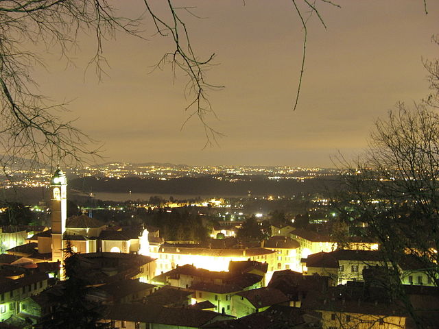
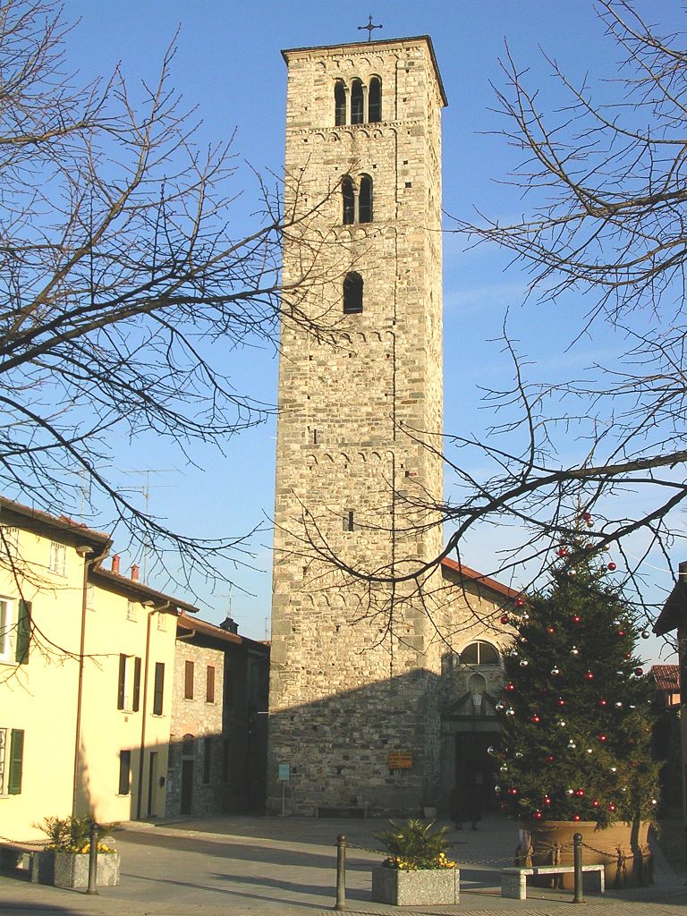
Монгуццо (Monguzzo, Monguzzo)
.svg)
- коммуна Италии
 Hiking in Монгуццо
Monguzzo, located in the Lombardy region of Italy, is a quaint town nestled in the Brianza area, which is known for its beautiful landscapes, rolling hills, and proximity to the larger city of Como and the stunning Lake Como. While Monguzzo itself is not a major hiking destination, it offers access to some lovely trails and natural scenery that are perfect for outdoor enthusiasts.
Hiking Opportunities:
-
Local Trails: There are various small trails around Monguzzo that you can explore. These often wind through wooded areas, meadows, and the charming countryside. These trails are generally suitable for walkers of all levels.
-
Surrounding Parks: Explore nearby parks such as Parco Regionale della Valle del Lambro. This regional park features a variety of trails and is home to diverse flora and fauna, making it a great spot for hiking and nature walks.
-
Views and Culture: While hiking in the area, you can also enjoy views of the surrounding hills and possibly spot historical sites or charming local architecture.
-
Lake Como Area: If you are willing to travel a bit, nearby Lake Como offers some stunning hiking opportunities. Trails in this area provide breathtaking views of the lake and surrounding mountains, such as the Greenway del Lago di Como or the Valsassina trails.
Tips for Hiking in Monguzzo:
- Weather: Check the weather conditions before heading out, as the region can experience sudden changes.
- Footwear: Wear comfortable, sturdy hiking shoes or boots to navigate the varied terrain.
- Map and Navigation: Have a map or GPS device to help you navigate the trails, especially if you’re venturing into less marked areas.
- Hydration and Snacks: Always carry water and some snacks, especially on longer hikes, to keep your energy up.
- Respect Nature: Follow local guidelines for wildlife and plant preservation. Leave no trace of your visit.
By exploring the trails around Monguzzo, you can enjoy a refreshing day in nature while soaking up the charm of this Italian region.
- Страна:

- Почтовый код: 22040
- Телефонный код: 031
- Код автомобильного номера: CO
- Координаты: 45° 47' 0" N, 9° 14' 0" E


- GPS треки (wikiloc): [Ссылка]
- Высота над уровнем моря: 320 м m
- Площадь: 3.73 кв.км
- Население: 2348
- Веб сайт: http://www.comune.monguzzo.co.it/
- Википедия русская: wiki(ru)
- Википедия английская: wiki(en)
- Википедия национальная: wiki(it)
- Хранилище Wikidata: Wikidata: Q47432
- Галерея изображений в википедии: [Ссылка]
- Катеория в википедии: [Ссылка]
- код Freebase: [/m/0gj0y4]
- код GeoNames: Альт: [6542540]
- ID отношения в OpenStreetMap: [24966]
- UN/LOCODE: [ITMG3]
- код ISTAT: 013153
- кадастровый код Италии: F372
Граничит с регионами:

Альбавилла
- коммуна Италии
Hiking in Альбавилла
Albabilla, located in the region of Lombardy in Italy, is a charming area near the foothills of the Alps. It offers various opportunities for hiking enthusiasts, featuring scenic trails that navigate through beautiful landscapes....
- Страна:
- Почтовый код: 22031
- Телефонный код: 031
- Код автомобильного номера: CO
- Координаты: 45° 48' 0" N, 9° 11' 0" E
- GPS треки (wikiloc): [Ссылка]
- Высота над уровнем моря: 427 м m
- Площадь: 10.38 кв.км
- Население: 6361
- Веб сайт: [Ссылка]


Альсерио
- коммуна Италии
Hiking in Альсерио
Alserio is a charming village located in the Como Province of northern Italy. It is nestled at the foot of the scenic hills surrounding Lake Como. While Alserio itself may not be widely known as a hiking destination, its proximity to the beautiful natural landscapes of the Lake Como area offers plenty of opportunities for outdoor enthusiasts....
- Страна:
- Почтовый код: 22040
- Телефонный код: 031
- Код автомобильного номера: CO
- Координаты: 45° 47' 0" N, 9° 12' 0" E
- GPS треки (wikiloc): [Ссылка]
- Высота над уровнем моря: 265 м m
- Площадь: 1.99 кв.км
- Население: 1257
- Веб сайт: [Ссылка]
Анцано-дель-Парко
- коммуна Италии
Hiking in Анцано-дель-Парко
Anzano del Parco, located in the province of Como in Italy, offers a delightful escape for hiking enthusiasts. This small village is situated in a picturesque landscape characterized by rolling hills, lush forests, and stunning views of the surrounding area, including Lake Como....
- Страна:
- Почтовый код: 22040
- Телефонный код: 031
- Код автомобильного номера: CO
- Координаты: 45° 46' 0" N, 9° 12' 0" E
- GPS треки (wikiloc): [Ссылка]
- Высота над уровнем моря: 329 м m
- Площадь: 3.25 кв.км
- Население: 1805
- Веб сайт: [Ссылка]
Лураго-д’Эрба
- коммуна Италии
Hiking in Лураго-д’Эрба
Lurago d'Erba is a charming town located in the province of Como in Italy, nestled in the foothills of the Alps. This area offers a variety of hiking opportunities that are suitable for different skill levels. Here are some key points to consider if you're planning a hiking trip in and around Lurago d'Erba:...
- Страна:
- Почтовый код: 22040
- Телефонный код: 031
- Код автомобильного номера: CO
- Координаты: 45° 45' 0" N, 9° 13' 0" E
- GPS треки (wikiloc): [Ссылка]
- Высота над уровнем моря: 351 м m
- Площадь: 4.7 кв.км
- Население: 5383
- Веб сайт: [Ссылка]

Эрба
- коммуна Италии
Hiking in Эрба
Erba, located in the province of Como in Lombardy, is an excellent destination for hiking enthusiasts. Surrounded by the picturesque landscapes of the Pre-Alps, the area offers a variety of trails suitable for all skill levels, from leisurely walks to more challenging hikes....
- Страна:
- Почтовый код: 22036
- Телефонный код: 031
- Код автомобильного номера: CO
- Координаты: 45° 49' 0" N, 9° 13' 0" E
- GPS треки (wikiloc): [Ссылка]
- Высота над уровнем моря: 320 м m
- Площадь: 17.80 кв.км
- Население: 16346
- Веб сайт: [Ссылка]
Мероне
- коммуна Италии
Hiking in Мероне
Merone, located in the province of Como in Italy, is a charming town that offers access to beautiful hiking trails, particularly in the surrounding areas of the Triangolo Lariano, which is part of the larger Lombardy region. Although Merone itself is not widely known for extensive hiking routes, its proximity to natural parks and the scenic landscape of Lake Como makes it a great starting point for outdoor enthusiasts....
- Страна:
- Почтовый код: 22046
- Телефонный код: 031
- Код автомобильного номера: CO
- Координаты: 45° 47' 0" N, 9° 15' 0" E
- GPS треки (wikiloc): [Ссылка]
- Высота над уровнем моря: 280 м m
- Площадь: 3.28 кв.км
- Население: 4101
- Веб сайт: [Ссылка]