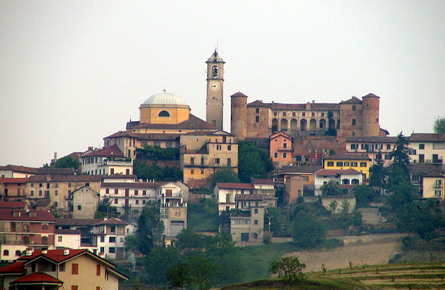
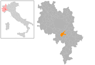
Монтальдо-Скарампи (Montaldo Scarampi, Montaldo Scarampi)

- коммуна Италии
 Hiking in Монтальдо-Скарампи
Montaldo Scarampi is a quaint village located in the Piedmont region of Italy, surrounded by picturesque landscapes that make it an attractive destination for hikers. The area offers a variety of trails that showcase the natural beauty and cultural heritage of the region.
Hiking Trails
-
Local Routes: There are several well-marked hiking trails around Montaldo Scarampi that vary in difficulty. Depending on your fitness level, you can find easier paths ideal for casual walkers, as well as more challenging routes for experienced hikers.
-
Nature Reserves: Nearby, you can explore nature reserves and protected areas, which provide an opportunity to observe local flora and fauna. The region is rich in biodiversity, and you may encounter various species of birds, mammals, and plants.
-
Wine and Vineyards: The Piedmont region is famous for its vineyards, so many hiking routes will lead you through beautiful vineyards. Some trails may even offer opportunities for wine tasting at local wineries, combining your love for hiking with culinary delights.
Recommendations
-
Preparation: As with any hike, it’s essential to wear proper hiking gear, including comfortable boots, and to bring water and snacks. Check the weather conditions prior to your hike.
-
Trail Maps: It's a good idea to have a detailed map of the trails or use a hiking app to ensure you stay on track.
-
Guided Tours: If you're not familiar with the area, consider joining a guided hiking tour. Local guides can enhance your experience by sharing insights about the history and ecology of the region.
-
Respect Nature: Always follow Leave No Trace principles to preserve the natural beauty of the area.
Cultural Context
While hiking in Montaldo Scarampi, you can also take the time to explore the village itself. The architecture and local culture, including traditional cuisine, are worth experiencing.
In summary, hiking in Montaldo Scarampi can be a rewarding experience, combining outdoor adventure with cultural exploration. Enjoy your hike!
- Страна:

- Почтовый код: 14048
- Телефонный код: 0141
- Код автомобильного номера: AT
- Координаты: 44° 49' 53" N, 8° 15' 36" E


- GPS треки (wikiloc): [Ссылка]
- Высота над уровнем моря: 258 м m
- Площадь: 6.63 кв.км
- Население: 754
- Веб сайт: http://www.comune.montaldoscarampi.at.it/
- Википедия русская: wiki(ru)
- Википедия английская: wiki(en)
- Википедия национальная: wiki(it)
- Хранилище Wikidata: Wikidata: Q17832
- код Freebase: [/m/0gbhn6]
- код GeoNames: Альт: [6542408]
- ID отношения в OpenStreetMap: [43712]
- UN/LOCODE: [ITMSM]
- код ISTAT: 005074
- кадастровый код Италии: F409
Граничит с регионами:
Момберчелли
- коммуна Италии
Hiking in Момберчелли
Mombercelli is a charming town located in the Piedmont region of Italy, surrounded by the beautiful rolling hills of the Asti province. This area is known for its stunning landscapes, vineyards, and rich cultural heritage. Hiking in and around Mombercelli offers a unique opportunity to explore the natural beauty and local attractions....
- Страна:
- Почтовый код: 14047
- Телефонный код: 0141
- Код автомобильного номера: AT
- Координаты: 44° 49' 1" N, 8° 17' 42" E
- GPS треки (wikiloc): [Ссылка]
- Высота над уровнем моря: 233 м m
- Площадь: 14.23 кв.км
- Население: 2208
- Веб сайт: [Ссылка]
Монтегроссо-д'Асти
- коммуна Италии
Hiking in Монтегроссо-д'Асти
Montegrosso d'Asti, located in the Piedmont region of Italy, is surrounded by beautiful landscapes and rolling hills, making it a great destination for hiking enthusiasts. The area is characterized by vineyards, forests, and panoramic views of the countryside, which provide a serene environment for outdoor activities....
- Страна:
- Почтовый код: 14048
- Телефонный код: 0141
- Код автомобильного номера: AT
- Координаты: 44° 49' 18" N, 8° 14' 19" E
- GPS треки (wikiloc): [Ссылка]
- Высота над уровнем моря: 244 м m
- Площадь: 15.42 кв.км
- Население: 2338
- Веб сайт: [Ссылка]
Рокка-д'Араццо
- коммуна Италии
Hiking in Рокка-д'Араццо
Rocca d'Arazzo is located in the Piedmont region of Italy, near the city of Asti. It offers a beautiful setting for hiking, with stunning views and a variety of terrains. Here are some key points to consider when planning a hike in this area:...
- Страна:
- Почтовый код: 14030
- Телефонный код: 0141
- Код автомобильного номера: AT
- Координаты: 44° 52' 23" N, 8° 17' 9" E
- GPS треки (wikiloc): [Ссылка]
- Высота над уровнем моря: 195 м m
- Площадь: 12.56 кв.км
- Население: 905
- Веб сайт: [Ссылка]