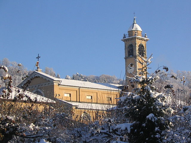
Монторфано (Montorfano, Montorfano)
.svg)
- коммуна Италии
 Hiking in Монторфано
Montorfano, located in the Lombardy region of Italy, is a small but beautiful area known for its natural scenery and outdoor activities, including hiking. Here’s what you need to know:
Trail Information
Montorfano offers a variety of hiking trails suitable for different skill levels. The landscape is characterized by lush greenery, rolling hills, and stunning views of the surrounding region. Some popular trails include:
-
The Montorfano Loop Trail: This is a moderate circular route that takes you around the hills, offering picturesque views and a chance to explore local flora and fauna.
-
Monte Croce: This trail leads to the summit of Monte Croce, providing rewarding panoramic views. The ascent can be challenging but is well worth the effort.
-
Connecting Trails: Montorfano is also part of a network of trails that connect to nearby areas, such as the neighboring towns of Erba and Cernobbio, allowing for longer hikes or loop routes.
Best Time to Hike
The ideal time for hiking in Montorfano is in spring (April to June) and early autumn (September to October) when the weather is generally mild, and the landscape is vibrant. Summers can be warm, while winter may present snow in some areas, making trails icy or inaccessible.
Gear and Preparation
- Footwear: Sturdy hiking boots are recommended, as some trails can be rocky or uneven.
- Navigation Tools: While many trails are well-marked, a map or GPS device is a good idea for exploring less familiar paths.
- Weather Awareness: Check local weather conditions before heading out, and be prepared for sudden changes in weather.
Safety Tips
- Always inform someone about your hiking plans.
- Stay on marked trails to avoid getting lost and to protect the local ecosystem.
- Bring sufficient water and snacks to stay hydrated and energized.
Local Culture
Montorfano has a rich cultural heritage, so don’t hesitate to explore local villages and enjoy regional cuisine after your hike. Sampling local dishes and interacting with residents can enhance your hiking experience.
Overall, Montorfano offers a wonderful escape into nature, with trails that cater to all levels and breathtaking views that will reward your efforts. Happy hiking!
- Страна:

- Почтовый код: 22030
- Телефонный код: 031
- Код автомобильного номера: CO
- Координаты: 45° 47' 11" N, 9° 8' 37" E


- GPS треки (wikiloc): [Ссылка]
- Высота над уровнем моря: 414 м m
- Площадь: 3.52 кв.км
- Население: 2567
- Веб сайт: http://www.comune.montorfano.co.it
- Википедия русская: wiki(ru)
- Википедия английская: wiki(en)
- Википедия национальная: wiki(it)
- Хранилище Wikidata: Wikidata: Q47599
- Катеория в википедии: [Ссылка]
- код Freebase: [/m/06fsc5]
- код GeoNames: Альт: [6542495]
- ID отношения в OpenStreetMap: [46108]
- UN/LOCODE: [ITM3O]
- код ISTAT: 013157
- кадастровый код Италии: F688
Граничит с регионами:
Альбезе-кон-Кассано
- коммуна Италии
Hiking in Альбезе-кон-Кассано
Albese con Cassano, located in the Lombardy region of Italy, is surrounded by beautiful landscapes that include hills, forests, and scenic views of the nearby mountains. While it may not be as famous for hiking as some other areas of Italy, there are still opportunities for outdoor enthusiasts to explore the local environment....
- Страна:
- Почтовый код: 22032
- Телефонный код: 031
- Код автомобильного номера: CO
- Координаты: 45° 48' 0" N, 9° 10' 0" E
- GPS треки (wikiloc): [Ссылка]
- Высота над уровнем моря: 402 м m
- Площадь: 7.95 кв.км
- Население: 4251
- Веб сайт: [Ссылка]
Альзате-Брианца
- коммуна Италии
Hiking in Альзате-Брианца
Alzate Brianza is a charming municipality located in the Lombardy region of Italy, nestled between the scenic hills and beautiful landscapes that characterize the area. The region offers a variety of outdoor activities, including hiking, making it a great destination for outdoor enthusiasts....
- Страна:
- Почтовый код: 22040
- Телефонный код: 031
- Код автомобильного номера: CO
- Координаты: 45° 46' 0" N, 9° 11' 0" E
- GPS треки (wikiloc): [Ссылка]
- Высота над уровнем моря: 341 м m
- Площадь: 7.58 кв.км
- Население: 5019
- Веб сайт: [Ссылка]

Капьаго-Интимьано
- коммуна Италии
Hiking in Капьаго-Интимьано
Capiago Intimiano is a charming municipality located in the province of Como, in the Lombardy region of Italy. While it may not be widely known as a major hiking destination compared to parts of the nearby Italian Alps or the lakes, it does offer some lovely walking and hiking opportunities, particularly for those who appreciate a mix of nature and quaint Italian towns....
- Страна:
- Почтовый код: 22070
- Телефонный код: 031
- Код автомобильного номера: CO
- Координаты: 45° 46' 0" N, 9° 7' 0" E
- GPS треки (wikiloc): [Ссылка]
- Высота над уровнем моря: 410 м m
- Площадь: 8.72 кв.км
- Население: 5516
- Веб сайт: [Ссылка]
Липомо
- коммуна Италии
Hiking in Липомо
Lipomo, located in the Lombardy region of Italy, is a great place for hiking enthusiasts to explore the natural beauty of the area. It is situated near Lake Como and offers stunning views of the surrounding mountains and landscape. Here are some highlights for hiking in and around Lipomo:...
- Страна:
- Почтовый код: 22030
- Телефонный код: 031
- Код автомобильного номера: CO
- Координаты: 45° 48' 0" N, 9° 7' 0" E
- GPS треки (wikiloc): [Ссылка]
- Высота над уровнем моря: 384 м m
- Площадь: 2.3 кв.км
- Население: 5946
- Веб сайт: [Ссылка]
Тавернерио
- коммуна Италии
Hiking in Тавернерио
Tavernerio is a charming municipality located near the city of Como in Italy, nestled in the foothills of the Alps. It offers a variety of hiking opportunities with stunning views of Lake Como and the surrounding mountains. Here are some key highlights for hikers interested in exploring the area:...
- Страна:
- Почтовый код: 22038
- Телефонный код: 031
- Код автомобильного номера: CO
- Координаты: 45° 48' 0" N, 9° 9' 0" E
- GPS треки (wikiloc): [Ссылка]
- Высота над уровнем моря: 460 м m
- Площадь: 11.91 кв.км
- Население: 5804
- Веб сайт: [Ссылка]
Орсениго
- коммуна Италии
Hiking in Орсениго
Orsenigo is a charming municipality located in the province of Como, in the Lombardy region of northern Italy. It is nestled in an area renowned for its natural beauty and offers a variety of outdoor activities, including hiking....
- Страна:
- Почтовый код: 22030
- Телефонный код: 031
- Код автомобильного номера: CO
- Координаты: 45° 47' 0" N, 9° 11' 0" E
- GPS треки (wikiloc): [Ссылка]
- Высота над уровнем моря: 390 м m
- Площадь: 4.46 кв.км
- Население: 2769
- Веб сайт: [Ссылка]