Мур-ам-Зе (Muhr am See, Muhr am See)

 Hiking in Мур-ам-Зе
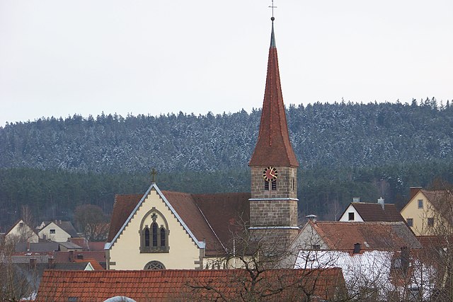
Muhr am See, located in Bavaria, Germany, is a picturesque destination that offers a variety of outdoor activities, including hiking. The area is characterized by its beautiful landscapes, tranquil lakes, and lush forests, making it an ideal place for nature enthusiasts.
Hiking Trails
-
Lake Trail: One of the most popular routes is the trail that circles around the scenic Muhr Lake. This relatively easy and flat trail allows hikers to enjoy the views of the water, as well as the surrounding greenery and wildlife.
-
Forest Hikes: There are several hiking paths that lead into the nearby forests. These trails are often shaded and provide a great escape, particularly during hot summer months. Look out for local flora and fauna along the way.
-
Gorges and Hills: If you're seeking more challenging hikes, some trails lead to the nearby hills that offer stunning vistas of the region. These hikes tend to be steeper and may be suited for more experienced hikers.
Tips for Hiking in Muhr am See
- Season: The best times to hike are typically spring and fall when the weather is mild and the scenery is particularly vibrant. Summer can be hot, while winter may bring snow and ice, making some trails difficult.
- Gear: Ensure you wear comfortable hiking boots and dress in layers. Depending on the time of year, it can be beneficial to have rain gear as weather can change quickly.
- Local Maps: Pick up a map or download a hiking app to help guide you along the trails. Signage may not always be clear.
- Hydration and Snacks: Carry enough water and some snacks to keep your energy levels up, especially on longer hikes.
- Respect Nature: Follow Leave No Trace principles and be respectful of the local wildlife.
Attractions Nearby
After a day of hiking, consider exploring the local culture. Muhr am See has charming village characteristics and may offer local eateries where you can try traditional Bavarian food.
Always check the local weather and trail conditions before heading out, and enjoy the breathtaking nature that Muhr am See has to offer!
- Страна:

- Почтовый код: 91735
- Телефонный код: 09831
- Код автомобильного номера: WUG
- Координаты: 49° 9' 16" N, 10° 43' 6" E


- GPS треки (wikiloc): [Ссылка]
- Высота над уровнем моря: 422 м m
- Площадь: 10.95 кв.км
- Население: 2223
- Веб сайт: http://www.muhr-am-see.de
- Википедия русская: wiki(ru)
- Википедия английская: wiki(en)
- Википедия национальная: wiki(de)
- Хранилище Wikidata: Wikidata: Q267993
- Катеория в википедии: [Ссылка]
- код Freebase: [/m/02q949l]
- код GeoNames: Альт: [3206926]
- код VIAF: Альт: [237832594]
- ID отношения в OpenStreetMap: [1015094]
- код GND: Альт: [4288006-3]
- код LCNAF: Альт: [no2016044105]
- код Historical Gazetteer: [MUHSEEJN59ID]
- Bavarikon ID: [ODB_A00000199]
- идентификатор муниципалитетов в Германии: 09577114
Включает регионы:
Altenmuhr
Hiking in Altenmuhr
Altenmuhr, a picturesque village in Germany, offers various hiking opportunities that showcase the natural beauty of the surrounding region. While specific trails may vary, here are some general points to consider when hiking in Altenmuhr:...
- Страна:
- Почтовый код: 91735
- Телефонный код: 09831
- Координаты: 49° 9' 13" N, 10° 42' 30" E
- GPS треки (wikiloc): [Ссылка]
Neuenmuhr
Hiking in Neuenmuhr
Neuenmuhr is a small village in Germany, located in the state of Bavaria. While it might not be widely recognized as a hiking destination, the surrounding areas do offer beautiful landscapes and opportunities for outdoor activities....
- Страна:
- Почтовый код: 91735
- Телефонный код: 09831
- Координаты: 49° 9' 4" N, 10° 43' 27" E
- GPS треки (wikiloc): [Ссылка]
- Высота над уровнем моря: 415 м m
Wehlenberg
Hiking in Wehlenberg
Wehlenberg is a great destination for hiking enthusiasts, especially if you enjoy scenic views and the tranquil beauty of nature. Located in Germany, specifically in the Saxony region, Wehlenberg boasts a variety of trails suited for different skill levels, from beginner-friendly walks to more challenging hikes....
- Страна:
- Почтовый код: 91735
- Телефонный код: 09831
- Координаты: 49° 9' 46" N, 10° 43' 44" E
- GPS треки (wikiloc): [Ссылка]
Forsthaus
Hiking in Forsthaus
Forsthaus in Muhr is an excellent destination for hiking enthusiasts. Nestled in Bavaria, Germany, the area is known for its stunning natural landscapes, diverse flora and fauna, and well-marked trails suitable for various skill levels. Here are some highlights and tips for hiking in Forsthaus:...
- Страна:
- Почтовый код: 91735
- Телефонный код: 09831
- Координаты: 49° 9' 48" N, 10° 42' 54" E
- GPS треки (wikiloc): [Ссылка]
- Высота над уровнем моря: 419 м m
Граничит с регионами:

Ансбах
Hiking in Ансбах
Ansbach district, located in the region of Bavaria, Germany, offers a variety of hiking opportunities suitable for different skill levels. The region is characterized by its picturesque landscapes, including rolling hills, forests, and historical sites, making it a great destination for outdoor enthusiasts....
- Страна:
- Столица: Ансбах
- Код автомобильного номера: ROT; FEU; DKB; AN
- Координаты: 49° 19' 48" N, 10° 30' 0" E
- GPS треки (wikiloc): [Ссылка]
- Высота над уровнем моря: 426 м m
- Площадь: 1972.00 кв.км
- Население: 157632
- Веб сайт: [Ссылка]

Миттелешенбах
Hiking in Миттелешенбах
Mitteleschenbach is a quaint village located in the Franconia region of Bavaria, Germany. It's surrounded by picturesque landscapes that offer plenty of opportunities for hiking and enjoying nature. Here are some key points to consider if you're planning a hiking trip in and around Mitteleschenbach:...
- Страна:
- Почтовый код: 91734
- Телефонный код: 09871
- Код автомобильного номера: AN
- Координаты: 49° 13' 0" N, 10° 46' 0" E
- GPS треки (wikiloc): [Ссылка]
- Высота над уровнем моря: 407 м m
- Площадь: 10.51 кв.км
- Население: 1356
- Веб сайт: [Ссылка]


Гунценхаузен
- город в Баварии
Hiking in Гунценхаузен
Gunzenhausen is a charming town located in Bavaria, Germany, and serves as a gateway to some beautiful hiking opportunities, particularly around the Franconian Lake District (Fränkisches Seenland). Here’s what you can expect when hiking in and around Gunzenhausen:...
- Страна:
- Почтовый код: 91710
- Телефонный код: 09836; 09831
- Координаты: 49° 6' 53" N, 10° 45' 15" E
- GPS треки (wikiloc): [Ссылка]
- Высота над уровнем моря: 416 м m
- Площадь: 82.72 кв.км
- Население: 16562
- Веб сайт: [Ссылка]


Арберг
Hiking in Арберг
Arberg is a small town located in the Franconia region of Bavaria, Germany. While it may not be as widely known for its hiking trails as larger national parks, it still offers opportunities for outdoor enthusiasts to explore the scenic beauty of the surrounding areas....
- Страна:
- Почтовый код: 91722
- Телефонный код: 09822
- Код автомобильного номера: AN
- Координаты: 49° 8' 0" N, 10° 37' 0" E
- GPS треки (wikiloc): [Ссылка]
- Высота над уровнем моря: 468 м m
- Площадь: 31.31 кв.км
- Население: 2007
- Веб сайт: [Ссылка]


Меркендорф
Hiking in Меркендорф
Merkendorf is a charming town located in Bavaria, Germany, known for its beautiful countryside and scenic trails. Here are some highlights and tips for hiking in and around Merkendorf:...
- Страна:
- Почтовый код: 91732
- Телефонный код: 09826
- Код автомобильного номера: AN
- Координаты: 49° 12' 0" N, 10° 41' 0" E
- GPS треки (wikiloc): [Ссылка]
- Высота над уровнем моря: 438 м m
- Площадь: 26.08 кв.км
- Население: 2174
- Веб сайт: [Ссылка]


Хаундорф
Hiking in Хаундорф
Haundorf, a quaint village located in the Bavarian region of Germany, offers a variety of hiking opportunities for outdoor enthusiasts. Here are some details to consider if you're planning a hike in the area:...
- Страна:
- Почтовый код: 91729
- Телефонный код: 09837
- Код автомобильного номера: WUG
- Координаты: 49° 11' 0" N, 10° 46' 0" E
- GPS треки (wikiloc): [Ссылка]
- Высота над уровнем моря: 445 м m
- Площадь: 51.34 кв.км
- Население: 1909
- Веб сайт: [Ссылка]


Орнбау
- община Германии
Hiking in Орнбау
Ornbau, a small town in Bavaria, Germany, may not be widely known as a hiking destination, but it can be a charming area for outdoor enthusiasts. The surrounding landscapes offer various trails and natural beauty typical of the Franconia region....
- Страна:
- Почтовый код: 91737
- Телефонный код: 09826
- Код автомобильного номера: AN
- Координаты: 49° 10' 40" N, 10° 39' 20" E
- GPS треки (wikiloc): [Ссылка]
- Высота над уровнем моря: 419 м m
- Площадь: 15.16 кв.км
- Население: 1457
- Веб сайт: [Ссылка]