Мури (Muri, Muri)

 Hiking in Мури
Muri, located in the Aargau region of Switzerland, is surrounded by beautiful landscapes that offer great opportunities for hiking enthusiasts. The area features a combination of rolling hills, forests, and scenic views that are characteristic of the Swiss countryside.
Hiking Trails
There are several well-marked trails around Muri catering to different skill levels. Here are a few options:
-
Muri to the Reuss River: This trail leads you through picturesque farmland and forests down to the banks of the Reuss River. Along the way, you can enjoy beautiful views and maybe spot some local wildlife.
-
Ruins of a Castle: One popular hike involves trekking to the nearby ruins of a medieval castle. This trail typically involves some elevation gain, but the views from the top are rewarding.
-
Forest Trails: There are various paths winding through the forests around Muri that are ideal for a more tranquil hiking experience. These trails are great for nature lovers and those looking to escape into nature.
-
Circular Route: A circular hiking route around Muri might include several natural landmarks and small villages, allowing hikers to experience local culture and scenery.
Tips for Hiking in Muri
- Weather Check: Always check the weather forecast before heading out, as conditions can change rapidly in the mountains.
- Gear: Wear appropriate hiking shoes and bring along essentials like water, snacks, a map, and sun protection.
- Trail Maps: It's helpful to have a map or a hiking app on your phone, as some trails might not be well-signed.
- Respect Nature: Always follow Leave No Trace principles to protect the natural environment.
Accessibility
Muri is well-connected by public transportation, making it an excellent starting point for various hiking adventures in the surrounding areas.
Nearby Attractions
If you have extra time, consider visiting local attractions such as historical sites, local farms, or other scenic areas within Aargau.
Overall, hiking in Muri offers a wonderful opportunity to experience Switzerland's natural beauty, history, and culture. Enjoy your hike!
- Страна:

- Почтовый код: 5630
- Телефонный код: 056
- Код автомобильного номера: AG
- Координаты: 47° 16' 29" N, 8° 20' 30" E


- GPS треки (wikiloc): [Ссылка]
- Высота над уровнем моря: 478 м m
- Площадь: 12.34 кв.км
- Население: 7769
- Веб сайт: http://www.muri.ch
- Википедия русская: wiki(ru)
- Википедия английская: wiki(en)
- Википедия национальная: wiki(de)
- Хранилище Wikidata: Wikidata: Q69011
- Катеория в википедии: [Ссылка]
- код Freebase: [/m/0cwc0j]
- код GeoNames: Альт: [7286599]
- ID отношения в OpenStreetMap: [1684371]
- код GND: Альт: [4101789-4]
- идентификатор местоположения ArchINFORM: [6510]
- место в MusicBrainz: [72f8eb14-588e-48b0-abf2-1ecf480ed16f]
- идентификатор HDS: [1791]
- код швейцарского муниципалитета: [4236]
Граничит с регионами:


Аристау
Hiking in Аристау
Aristau is a beautiful and less-traveled destination perfect for hiking enthusiasts. Located in the Swiss region, it offers scenic views, lush landscapes, and a variety of trails suitable for different skill levels. Here’s an overview of what you can expect when hiking in Aristau:...
- Страна:
- Почтовый код: 5628
- Телефонный код: 056
- Код автомобильного номера: AG
- Координаты: 47° 17' 29" N, 8° 21' 50" E
- GPS треки (wikiloc): [Ссылка]
- Высота над уровнем моря: 387 м m
- Площадь: 8.64 кв.км
- Население: 1436
- Веб сайт: [Ссылка]


Мереншванд
Hiking in Мереншванд
Merenschwand, a picturesque municipality located in the Canton of Aargau in Switzerland, offers a variety of hiking opportunities that cater to different skill levels. Nestled in a beautiful landscape characterized by rolling hills, forests, and stunning views of the surrounding countryside, it's an excellent destination for both casual walkers and more experienced hikers....
- Страна:
- Почтовый код: 5634
- Телефонный код: 056
- Код автомобильного номера: AG
- Координаты: 47° 15' 44" N, 8° 22' 39" E
- GPS треки (wikiloc): [Ссылка]
- Высота над уровнем моря: 381 м m
- Площадь: 13.51 кв.км
- Население: 3393
- Веб сайт: [Ссылка]


Буттвиль
Hiking in Буттвиль
Buttwil is a charming village located in the Canton of Aargau in Switzerland, surrounded by picturesque landscapes that are ideal for hiking enthusiasts. The region offers a variety of trails catering to different levels of hiking experience, from easy strolls to more challenging routes....
- Страна:
- Почтовый код: 5632
- Телефонный код: 056
- Код автомобильного номера: AG
- Координаты: 47° 16' 4" N, 8° 18' 39" E
- GPS треки (wikiloc): [Ссылка]
- Высота над уровнем моря: 644 м m
- Площадь: 4.61 кв.км
- Население: 1227
- Веб сайт: [Ссылка]
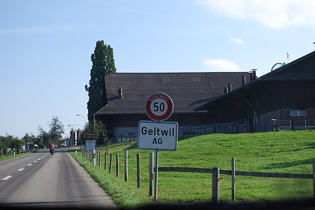

Гельтвиль
Hiking in Гельтвиль
Geltwil is a charming village located in the Canton of Aargau, Switzerland. Nestled in the scenic Swiss countryside, it offers beautiful landscapes, well-marked hiking trails, and a tranquil atmosphere perfect for outdoor enthusiasts....
- Страна:
- Почтовый код: 5637
- Телефонный код: 056
- Код автомобильного номера: AG
- Координаты: 47° 14' 57" N, 8° 19' 33" E
- GPS треки (wikiloc): [Ссылка]
- Высота над уровнем моря: 656 м m
- Площадь: 3.28 кв.км
- Население: 208
- Веб сайт: [Ссылка]

Босвиль
Hiking in Босвиль
Boswil, a charming village located in the Canton of Aargau, Switzerland, offers a variety of hiking opportunities suited for different skill levels amidst beautiful landscapes. Here are some key details about hiking in Boswil:...
- Страна:
- Почтовый код: 5623
- Телефонный код: 056
- Код автомобильного номера: AG
- Координаты: 47° 18' 4" N, 8° 18' 50" E
- GPS треки (wikiloc): [Ссылка]
- Высота над уровнем моря: 475 м m
- Площадь: 11.78 кв.км
- Население: 2783
- Веб сайт: [Ссылка]