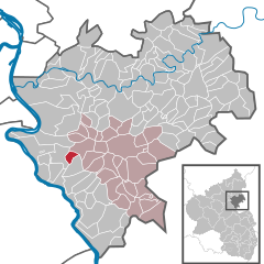
Объединённая община Наштеттен (Verbandsgemeinde Nastätten, Verbandsgemeinde Nastätten)

 Hiking in Объединённая община Наштеттен
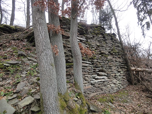
Nastätten, located in the Verbandsgemeinde of Nastätten in Rhineland-Palatinate, Germany, offers beautiful hiking opportunities characterized by scenic landscapes, lush forests, and quaint villages. Here are some highlights for hikers looking to explore the area:
Trails and Routes:
-
Local Hiking Trails: Nastätten has several well-marked hiking trails that range in difficulty from easy strolls to more challenging hikes. These trails often lead through picturesque countryside, offering views of the rolling hills and vineyards typical of the region.
-
Wanderwege: Look for trails featuring the local "Wanderwege" signs that guide you through various terrains including forests, meadows, and along rivers. The area is known for its extensive trail network.
-
Rheinsteig Trail: In proximity to Nastätten, the Rheinsteig hiking trail runs along the banks of the Rhine River. This long-distance trail offers hikers the chance to experience diverse landscapes, historical sites, and charming towns.
Natural Attractions:
- Forests: The surrounding forests are great for nature lovers, providing a habitat for various wildlife and a peaceful atmosphere for hiking.
- Vineyards: The hilly terrain is often covered in vineyards, presenting opportunities for wine enthusiasts to explore and perhaps stop by local wineries for tastings.
Accessibility:
Nastätten is accessible by car and public transport, making it convenient to reach for a day hike or longer excursions. The trailheads are usually well-signposted, and many local maps are available.
Equipment and Safety:
- Footwear: Wear sturdy hiking boots to handle various trail conditions.
- Hydration: Bring plenty of water, especially during warmer months.
- Maps: Carry a map or GPS device as some trails may not always be clearly marked.
Local Tips:
- Weather: Check the weather forecast before heading out, as conditions can change rapidly in the region.
- Seasonal Events: Look out for local festivals and events that might align with your visit, as they can offer unique experiences alongside your hiking adventure.
Whether you're a local or a visitor, Nastätten offers a captivating experience for hikers and a wonderful way to connect with the natural beauty of the area.
- Страна:

- Столица: Наштеттен
- Координаты: 50° 12' 0" N, 7° 52' 0" E


- GPS треки (wikiloc): [Ссылка]
- Веб сайт: http://www.vgnastaetten.de/
- Википедия русская: wiki(ru)
- Википедия английская: wiki(en)
- Википедия национальная: wiki(de)
- Хранилище Wikidata: Wikidata: Q562668
- код Freebase: [/m/02z42s6]
- код GND: Альт: [4629781-9]
- код региона Германии: 071415007
Включает регионы:
Лаутерт
Hiking in Лаутерт
Lauter is a beautiful destination for hiking, located in Germany, specifically in the state of Thuringia. The region is known for its picturesque landscapes, dense forests, and charming villages, making it an ideal spot for outdoor enthusiasts....
- Страна:
- Почтовый код: 56355
- Телефонный код: 06772
- Код автомобильного номера: EMS
- Координаты: 50° 10' 8" N, 7° 50' 27" E
- GPS треки (wikiloc): [Ссылка]
- Высота над уровнем моря: 390 м m
- Площадь: 3.56 кв.км
- Население: 270
- Веб сайт: [Ссылка]

Эшбах
- муниципалитет в Германии, Рейнланд-Пфальц, Рейн-Лан, Объединённая община Наштеттен
Hiking in Эшбах
Eschbach, located in the Rhein-Lahn district of Germany, offers a picturesque setting for hiking enthusiasts. The region is characterized by its rolling hills, lush forests, and scenic river valleys, especially along the Lahn River, making it a lovely area for outdoor activities....
- Страна:
- Почтовый код: 56357
- Телефонный код: 06771
- Код автомобильного номера: EMS
- Координаты: 50° 12' 50" N, 7° 43' 36" E
- GPS треки (wikiloc): [Ссылка]
- Высота над уровнем моря: 360 м m
- Площадь: 2.58 кв.км
- Население: 153
- Веб сайт: [Ссылка]
Руппертсхофен
Hiking in Руппертсхофен
Ruppertshofen, located in Rhineland-Palatinate, is a charming village surrounded by picturesque landscapes that are ideal for hiking enthusiasts. The region is part of the larger Palatinate Forest (Pfälzerwald), which offers a variety of hiking trails catering to different skill levels and preferences....
- Страна:
- Почтовый код: 56357
- Телефонный код: 06772
- Код автомобильного номера: EMS
- Координаты: 50° 12' 10" N, 7° 48' 28" E
- GPS треки (wikiloc): [Ссылка]
- Высота над уровнем моря: 310 м m
- Площадь: 4.78 кв.км
- Население: 332
- Веб сайт: [Ссылка]


Хольцхаузен-ан-дер-Хайде
Hiking in Хольцхаузен-ан-дер-Хайде
Holzhausen an der Haide is a quaint village located in the state of Hesse, Germany, known for its picturesque landscapes and serene environment, which makes it an appealing destination for hiking enthusiasts. Here are some key points to consider if you're planning to hike in this lovely area:...
- Страна:
- Почтовый код: 56357
- Телефонный код: 06772
- Код автомобильного номера: EMS
- Координаты: 50° 13' 15" N, 7° 54' 40" E
- GPS треки (wikiloc): [Ссылка]
- Высота над уровнем моря: 400 м m
- Площадь: 8.48 кв.км
- Население: 1174
- Веб сайт: [Ссылка]
Богель
Hiking in Богель
Bogel is a beautiful area for hiking, offering a range of trails suitable for various skill levels. While I don't have specific information about a place called "Bogel" as it could refer to multiple locations, I can provide some general advice and insights about hiking in any natural area....
- Страна:
- Почтовый код: 56357
- Телефонный код: 06772
- Код автомобильного номера: EMS
- Координаты: 50° 11' 26" N, 7° 47' 59" E
- GPS треки (wikiloc): [Ссылка]
- Высота над уровнем моря: 350 м m
- Площадь: 5.34 кв.км
- Население: 769
- Веб сайт: [Ссылка]


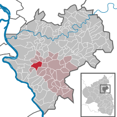
Наштеттен
Hiking in Наштеттен
Nastätten, a small town in the Rhineland-Palatinate region of Germany, is surrounded by picturesque landscapes and offers several hiking opportunities. Here are some highlights and tips for hiking in and around Nastätten:...
- Страна:
- Почтовый код: 56355
- Телефонный код: 06772
- Код автомобильного номера: EMS
- Координаты: 50° 11' 58" N, 7° 51' 30" E
- GPS треки (wikiloc): [Ссылка]
- Высота над уровнем моря: 280 м m
- Площадь: 13.02 кв.км
- Население: 4130
- Веб сайт: [Ссылка]
Реттерсхайн
Hiking in Реттерсхайн
Rettershain is a small village located in the picturesque Hunsrück region of Germany, known for its beautiful landscapes, rolling hills, and dense forests. Hiking in and around Rettershain offers a variety of trails that cater to different skill levels, making it a great destination for both novice and experienced hikers....
- Страна:
- Почтовый код: 56357
- Телефонный код: 06775
- Код автомобильного номера: EMS
- Координаты: 50° 8' 43" N, 7° 49' 59" E
- GPS треки (wikiloc): [Ссылка]
- Высота над уровнем моря: 420 м m
- Площадь: 4.81 кв.км
- Население: 339
- Веб сайт: [Ссылка]
Хунцель
Hiking in Хунцель
Hunsrück is a picturesque region in Germany known for its stunning landscapes, dense forests, and quaint villages. It's a fantastic destination for hiking enthusiasts looking to explore nature while enjoying the tranquility of the outdoors....
- Страна:
- Почтовый код: 56355
- Телефонный код: 06772
- Код автомобильного номера: EMS
- Координаты: 50° 14' 56" N, 7° 50' 18" E
- GPS треки (wikiloc): [Ссылка]
- Высота над уровнем моря: 300 м m
- Площадь: 4.02 кв.км
- Население: 256
- Веб сайт: [Ссылка]

Липпорн
Hiking in Липпорн
Lipporn isn't widely recognized as a hiking destination, and it's possible that you might be referring to a smaller, less-known location or a misspelling of a place. However, I can provide information on hiking areas generally found in various regions....
- Страна:
- Почтовый код: 56357
- Телефонный код: 06775
- Код автомобильного номера: EMS
- Координаты: 50° 8' 28" N, 7° 51' 50" E
- GPS треки (wikiloc): [Ссылка]
- Высота над уровнем моря: 415 м m
- Площадь: 4.80 кв.км
- Население: 273
- Веб сайт: [Ссылка]
Кельбах
Hiking in Кельбах
Kehlbach, a small municipality in Rhineland-Palatinate, Germany, is surrounded by beautiful natural landscapes that provide excellent opportunities for hiking enthusiasts. Here’s a general overview of what you can expect when hiking in this area:...
- Страна:
- Почтовый код: 56355
- Телефонный код: 06776
- Код автомобильного номера: EMS
- Координаты: 50° 15' 41" N, 7° 45' 31" E
- GPS треки (wikiloc): [Ссылка]
- Высота над уровнем моря: 295 м m
- Площадь: 2.14 кв.км
- Население: 163
- Веб сайт: [Ссылка]
Касдорф
Hiking in Касдорф
Kasdorf, nestled in the picturesque landscape, is an excellent destination for hikers seeking both adventure and tranquility. While it's a smaller location, it offers a variety of trails suitable for different skill levels....
- Страна:
- Почтовый код: 56357
- Телефонный код: 06772
- Код автомобильного номера: EMS
- Координаты: 50° 12' 28" N, 7° 47' 7" E
- GPS треки (wikiloc): [Ссылка]
- Высота над уровнем моря: 298 м m
- Площадь: 4.06 кв.км
- Население: 239
- Веб сайт: [Ссылка]
Хайнау
Hiking in Хайнау
Hainau, while not widely known as a hiking destination, is surrounded by beautiful landscapes typical of the German countryside, making it suitable for hiking and outdoor activities. Here are some key points to consider if you’re looking to hike in and around Hainau, Germany:...
- Страна:
- Почтовый код: 56357
- Телефонный код: 06772
- Код автомобильного номера: EMS
- Координаты: 50° 13' 21" N, 7° 46' 54" E
- GPS треки (wikiloc): [Ссылка]
- Высота над уровнем моря: 280 м m
- Площадь: 3.31 кв.км
- Население: 177
- Веб сайт: [Ссылка]
Вельтерод
Hiking in Вельтерод
Welterod is a small village located in the Westerwald region of Germany. This area is known for its beautiful landscapes, dense forests, and numerous hiking trails, making it a great destination for outdoor enthusiasts. Here are some highlights of hiking in and around Welterod:...
- Страна:
- Почтовый код: 56357
- Телефонный код: 06775
- Код автомобильного номера: EMS
- Координаты: 50° 8' 0" N, 7° 53' 0" E
- GPS треки (wikiloc): [Ссылка]
- Высота над уровнем моря: 420 м m
- Площадь: 9.94 кв.км
- Население: 458
- Веб сайт: [Ссылка]
Нидербахгайм
Hiking in Нидербахгайм
Niederbachheim, a village in Germany, is situated in a picturesque region that offers a number of hiking opportunities. While the specific trails in Niederbachheim may not be as well-known as those in more popular hiking destinations, the surrounding countryside provides beautiful landscapes perfect for exploration....
- Страна:
- Почтовый код: 56357
- Телефонный код: 06776
- Код автомобильного номера: EMS
- Координаты: 50° 14' 56" N, 7° 45' 53" E
- GPS треки (wikiloc): [Ссылка]
- Высота над уровнем моря: 270 м m
- Площадь: 2.93 кв.км
- Население: 259
- Веб сайт: [Ссылка]
Дитардт
Hiking in Дитардт
Diethardt is a relatively less-known hiking destination, and while specific information may not be readily available about it, I can provide you with some general guidance on hiking in lesser-known areas. If you're looking for a scenic and possibly challenging hike, here are a few tips you can follow that may apply to Diethardt or similar locations:...
- Страна:
- Почтовый код: 56355
- Телефонный код: 06772
- Код автомобильного номера: EMS
- Координаты: 50° 9' 50" N, 7° 52' 29" E
- GPS треки (wikiloc): [Ссылка]
- Высота над уровнем моря: 300 м m
- Площадь: 4.42 кв.км
- Население: 232
- Веб сайт: [Ссылка]
Беттендорф
Hiking in Беттендорф
Bettendorf is a small village located in the district of Lahn-Dill-Kreis in Hesse, Germany. While it may not be as famous as some of the larger cities or more popular hiking areas in Germany, it can still offer hikers some beautiful landscapes and trails....
- Страна:
- Почтовый код: 56355
- Телефонный код: 06772
- Код автомобильного номера: EMS
- Координаты: 50° 14' 0" N, 7° 52' 15" E
- GPS треки (wikiloc): [Ссылка]
- Высота над уровнем моря: 310 м m
- Площадь: 3.24 кв.км
- Население: 333
- Веб сайт: [Ссылка]
Винтерверб
Hiking in Винтерверб
It seems like there might be a small mix-up with the name "Winterwerb," as it isn't a widely recognized hiking destination. However, if you meant "Winterberg," which is a popular hiking and winter sports area in Germany, I can provide information about that....
- Страна:
- Почтовый код: 56355
- Телефонный код: 06776
- Код автомобильного номера: EMS
- Координаты: 50° 14' 17" N, 7° 44' 28" E
- GPS треки (wikiloc): [Ссылка]
- Высота над уровнем моря: 340 м m
- Площадь: 3.01 кв.км
- Население: 173
- Веб сайт: [Ссылка]
Химмигхофен
Hiking in Химмигхофен
Himmighofen, a small village in Germany, is not widely known as a hiking destination, but it can serve as a great base for exploring the surrounding natural beauty and hiking trails in the region. Typically, this area offers scenic walks, forested paths, and possibly some routes along rivers or through historical landscapes....
- Страна:
- Почтовый код: 56357
- Телефонный код: 06772
- Код автомобильного номера: EMS
- Координаты: 50° 12' 41" N, 7° 45' 57" E
- GPS треки (wikiloc): [Ссылка]
- Высота над уровнем моря: 325 м m
- Площадь: 5.03 кв.км
- Население: 317
- Веб сайт: [Ссылка]


Мариенфельс
Hiking in Мариенфельс
Marienfels is a beautiful area in Germany known for its scenic landscapes and outdoor activities, including hiking. Located in the state of Rhineland-Palatinate, it is close to the Rhine River and surrounded by picturesque hills, forests, and vineyards....
- Страна:
- Почтовый код: 56357
- Телефонный код: 06772
- Код автомобильного номера: EMS
- Координаты: 50° 14' 29" N, 7° 48' 50" E
- GPS треки (wikiloc): [Ссылка]
- Высота над уровнем моря: 210 м m
- Площадь: 3.84 кв.км
- Население: 301
- Веб сайт: [Ссылка]


Милен
Hiking in Милен
Miehlen is a charming village located in the Westerwald region of Germany, which offers some beautiful hiking opportunities. The surrounding area is characterized by lush woods, rolling hills, and a variety of trails suitable for different skill levels. Here are some points to consider for hiking in and around Miehlen:...
- Страна:
- Почтовый код: 56357
- Телефонный код: 06772
- Код автомобильного номера: EMS
- Координаты: 50° 13' 31" N, 7° 49' 53" E
- GPS треки (wikiloc): [Ссылка]
- Высота над уровнем моря: 217 м m
- Площадь: 15.01 кв.км
- Население: 1935
- Веб сайт: [Ссылка]

Геммерих
Hiking in Геммерих
Gemmerich is a charming area in Germany that offers beautiful landscapes and a variety of hiking trails suited for different skill levels. While not as widely known as other hiking destinations in Germany, it can provide a peaceful and scenic experience away from the crowds....
- Страна:
- Почтовый код: 56357
- Телефонный код: 06776
- Код автомобильного номера: EMS
- Координаты: 50° 13' 40" N, 7° 45' 28" E
- GPS треки (wikiloc): [Ссылка]
- Высота над уровнем моря: 340 м m
- Площадь: 6.79 кв.км
- Население: 528
- Веб сайт: [Ссылка]


Обертифенбах
Hiking in Обертифенбах
Obertiefenbach is a beautiful village located in the southern part of Germany, within the state of Hesse. While it may not be as well-known as some other hiking destinations, it offers charming landscapes and a tranquil environment for nature enthusiasts....
- Страна:
- Почтовый код: 56357
- Телефонный код: 06772
- Код автомобильного номера: EMS
- Координаты: 50° 14' 38" N, 7° 53' 25" E
- GPS треки (wikiloc): [Ссылка]
- Высота над уровнем моря: 350 м m
- Площадь: 5.77 кв.км
- Население: 396
- Веб сайт: [Ссылка]
Обервалльменах
Hiking in Обервалльменах
Oberwallmenach is a picturesque village located in the picturesque region of the Rhine-Lahn district in Germany, known for its beautiful landscapes and rich natural environment, making it an excellent destination for hiking enthusiasts. Here are some key points to consider if you are planning a hike in or around Oberwallmenach:...
- Страна:
- Почтовый код: 56357
- Телефонный код: 06772
- Код автомобильного номера: EMS
- Координаты: 50° 9' 51" N, 7° 49' 42" E
- GPS треки (wikiloc): [Ссылка]
- Высота над уровнем моря: 380 м m
- Площадь: 3.18 кв.км
- Население: 188
- Веб сайт: [Ссылка]
Обербахгайм
Hiking in Обербахгайм
Oberbachheim is a picturesque village located in scenic surroundings, making it a great destination for hiking enthusiasts. The area is characterized by its beautiful landscapes, rolling hills, and lush forests. Here are a few highlights to consider when planning a hike in Oberbachheim:...
- Страна:
- Почтовый код: 56355
- Телефонный код: 06776
- Код автомобильного номера: EMS
- Координаты: 50° 14' 49" N, 7° 44' 52" E
- GPS треки (wikiloc): [Ссылка]
- Высота над уровнем моря: 300 м m
- Площадь: 2.85 кв.км
- Население: 208
- Веб сайт: [Ссылка]
Нидервалльменах
Hiking in Нидервалльменах
Niederwallmenach is a charming village located in the Westerwald region of Germany, offering a variety of hiking opportunities through its picturesque landscapes, including forests, hills, and rivers. Here are some highlights and tips for hiking in Niederwallmenach:...
- Страна:
- Почтовый код: 56357
- Телефонный код: 06772
- Код автомобильного номера: EMS
- Координаты: 50° 9' 57" N, 7° 48' 47" E
- GPS треки (wikiloc): [Ссылка]
- Высота над уровнем моря: 332 м m
- Площадь: 6.88 кв.км
- Население: 412
- Веб сайт: [Ссылка]
Вайденбах
Hiking in Вайденбах
Weidenbach is a charming village located in the Rhein-Lahn district of Germany, known for its picturesque landscapes and hiking opportunities. The surrounding area features beautiful natural scenery, including forests, hills, and rivers. Here are some tips and highlights for hiking in Weidenbach:...
- Страна:
- Почтовый код: 56355
- Телефонный код: 06775
- Код автомобильного номера: EMS
- Координаты: 50° 9' 21" N, 7° 53' 0" E
- GPS треки (wikiloc): [Ссылка]
- Высота над уровнем моря: 380 м m
- Площадь: 2.24 кв.км
- Население: 114
- Веб сайт: [Ссылка]
Бух
- муниципалитет в Германии, Рейнланд-Пфальц, Рейн-Лан, Объединённая община Наштеттен
Hiking in Бух
Hiking in Buch, located in the Rhein-Lahn district of Germany, offers a variety of scenic trails that wind through beautiful landscapes characterized by rolling hills, dense forests, and picturesque riverside views. Here are some key points to consider when hiking in this region:...
- Страна:
- Почтовый код: 56357
- Телефонный код: 06772
- Код автомобильного номера: EMS
- Координаты: 50° 12' 21" N, 7° 52' 26" E
- GPS треки (wikiloc): [Ссылка]
- Высота над уровнем моря: 290 м m
- Площадь: 4.19 кв.км
- Население: 621
- Веб сайт: [Ссылка]
Берг
- муниципалитет в Германии, Рейнланд-Пфальц, Рейн-Лан, Объединённая община Наштеттен
Hiking in Берг
Hiking in Berg, located in the Rhein-Lahn district of Germany, offers beautiful scenery, rich nature, and a variety of trails suitable for different skill levels. Here are some key features and recommendations for hiking in this area:...
- Страна:
- Почтовый код: 56357
- Телефонный код: 06772
- Код автомобильного номера: EMS
- Координаты: 50° 15' 15" N, 7° 48' 46" E
- GPS треки (wikiloc): [Ссылка]
- Высота над уровнем моря: 290 м m
- Площадь: 3.30 кв.км
- Население: 247
- Веб сайт: [Ссылка]
Эльсберг
Hiking in Эльсберг
Oelsberg, located in the beautiful region of North Rhine-Westphalia, Germany, is an excellent destination for hiking enthusiasts. The area is characterized by its picturesque landscapes, rolling hills, dense forests, and charming villages, making it a perfect spot for both leisurely walks and more challenging hikes....
- Страна:
- Почтовый код: 56357
- Телефонный код: 06772
- Код автомобильного номера: EMS
- Координаты: 50° 11' 51" N, 7° 50' 15" E
- GPS треки (wikiloc): [Ссылка]
- Высота над уровнем моря: 280 м m
- Площадь: 4.02 кв.км
- Население: 505
- Веб сайт: [Ссылка]


Штрют
Hiking in Штрют
Strüth is a small village located in the picturesque landscapes of the Rheinland-Pfalz region in Germany. While it may not be as widely known as some larger hiking destinations, the area surrounding Strüth offers beautiful hiking opportunities for outdoor enthusiasts....
- Страна:
- Почтовый код: 56357
- Телефонный код: 06775
- Код автомобильного номера: EMS
- Координаты: 50° 8' 0" N, 7° 53' 0" E
- GPS треки (wikiloc): [Ссылка]
- Высота над уровнем моря: 380 м m
- Площадь: 4.66 кв.км
- Население: 294
- Веб сайт: [Ссылка]
Эр
Hiking in Эр
Ehr, a small municipality in the Rhineland-Palatinate region of Germany, is nestled in the picturesque landscape of the Eifel Mountains. Hiking in this area can be a delightful experience, thanks to its scenic trails, diverse flora and fauna, and tranquil surroundings. Here are a few highlights for hiking around Ehr:...
- Страна:
- Почтовый код: 56357
- Телефонный код: 06776
- Код автомобильного номера: EMS
- Координаты: 50° 14' 18" N, 7° 47' 3" E
- GPS треки (wikiloc): [Ссылка]
- Высота над уровнем моря: 260 м m
- Площадь: 1.22 кв.км
- Население: 71
- Веб сайт: [Ссылка]