
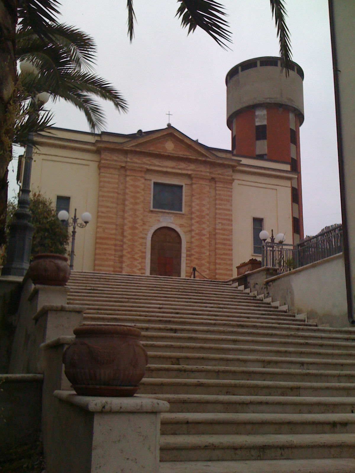
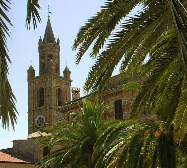
Нерето (Nereto, Nereto)
.svg)
- коммуна Италии
 Hiking in Нерето
Nereto, located in the Abruzzo region of Italy, is not just a picturesque town known for its historical buildings and beautiful landscapes; it also provides access to some wonderful hiking opportunities. The town is surrounded by the splendid Apennine mountains and offers various trails that cater to different skill levels, from casual walkers to experienced hikers.
Hiking Trails and Areas Near Nereto
-
Gran Sasso e Monti della Laga National Park: This nearby national park is a treasure trove of hiking trails. It features rugged mountain landscapes, rich biodiversity, and stunning views. Hikers can explore numerous paths, including those that lead to its highest peaks, such as Corno Grande.
-
The Path of the Waterfalls: This scenic route takes you through natural landscapes and along beautiful waterfalls. It's a fantastic trail for families and offers a gentle hike that's suitable for all ages.
-
Riviera delle Palme: While not directly a hiking trail, the coastline nearby provides opportunities for coastal walks with stunning views of the Adriatic Sea. You can combine beach activities with hiking efficiently in this area.
-
Local Vineyards and Olive Groves: Many trails wind through the picturesque vineyards and olive groves surrounding Nereto. These routes offer an opportunity to enjoy nature while sampling local wines and olive oil.
Preparation Tips
-
Best Time to Hike: The best hiking months in the Nereto area are typically spring (April to June) and early autumn (September to October) when the weather is mild and the scenery is vibrant.
-
Gear Up: Make sure to wear suitable hiking shoes, carry plenty of water, and bring snacks. A map or GPS device is also helpful to stay on track.
-
Local Guidance: If you're unfamiliar with the area, consider hiring a local guide or joining a hiking group to enhance your experience and ensure safety.
-
Check Weather Conditions: Always check the local weather forecast before setting out, as conditions can change quickly in mountainous regions.
Enjoy your hiking adventure in Nereto! The combination of nature, culture, and breathtaking views makes it a memorable experience. If you have a specific trail or area in mind, feel free to ask for more detailed information!
- Страна:

- Почтовый код: 64015
- Телефонный код: 0861
- Код автомобильного номера: TE
- Координаты: 42° 49' 12" N, 13° 49' 1" E


- GPS треки (wikiloc): [Ссылка]
- Высота над уровнем моря: 163 м m
- Площадь: 7.01 кв.км
- Население: 5342
- Веб сайт: http://www.comune.nereto.te.it
- Википедия русская: wiki(ru)
- Википедия английская: wiki(en)
- Википедия национальная: wiki(it)
- Хранилище Wikidata: Wikidata: Q51457
- Катеория в википедии: [Ссылка]
- код Freebase: [/m/0fs46q]
- код GeoNames: Альт: [6538858]
- код VIAF: Альт: [313298230]
- ID отношения в OpenStreetMap: [42179]
- код LCNAF: Альт: [no2015001592]
- место в MusicBrainz: [5b28d9ff-490c-406d-b7fe-fa4f436bfc0a]
- код Trismegistos: [32704]
- код ISTAT: 067031
- кадастровый код Италии: F870
Граничит с регионами:
Контрогуерра
- коммуна Италии
Hiking in Контрогуерра
Controguerra is a small town located in the Abruzzo region of Italy, nestled between the Apennine mountains and the Adriatic Sea. It offers a range of hiking opportunities, combining beautiful landscapes with cultural experiences....
- Страна:
- Почтовый код: 64010
- Телефонный код: 0861
- Код автомобильного номера: TE
- Координаты: 42° 51' 0" N, 13° 49' 0" E
- GPS треки (wikiloc): [Ссылка]
- Высота над уровнем моря: 267 м m
- Площадь: 22.82 кв.км
- Население: 2365
- Веб сайт: [Ссылка]
Коррополи
- коммуна Италии
Hiking in Коррополи
Corropoli is a charming town located in the Abruzzo region of Italy, known for its picturesque scenery, rich history, and access to beautiful hiking trails. Hiking in and around Corropoli offers a unique opportunity to explore the stunning landscapes of the Apennines and the coastal areas nearby....
- Страна:
- Почтовый код: 64013
- Телефонный код: 0861
- Код автомобильного номера: TE
- Координаты: 42° 50' 0" N, 13° 50' 0" E
- GPS треки (wikiloc): [Ссылка]
- Высота над уровнем моря: 132 м m
- Площадь: 22.11 кв.км
- Население: 5054
- Веб сайт: [Ссылка]

Сант'Омеро
- коммуна в Италии
Hiking in Сант'Омеро
Sant'Omero, located in the Abruzzo region of Italy, is a charming town known for its scenic beauty and proximity to the Monti della Laga National Park. Hiking in and around Sant'Omero offers a variety of trails that cater to different skill levels, giving you the opportunity to explore the stunning landscapes, rich biodiversity, and cultural heritage of the area....
- Страна:
- Почтовый код: 64027
- Телефонный код: 0861
- Код автомобильного номера: TE
- Координаты: 42° 47' 0" N, 13° 48' 0" E
- GPS треки (wikiloc): [Ссылка]
- Высота над уровнем моря: 209 м m
- Площадь: 34.2 кв.км
- Население: 5317
- Веб сайт: [Ссылка]

Торано-Нуово
- коммуна Италии
Hiking in Торано-Нуово
Torano Nuovo is a small town located in the Abruzzo region of Italy, known for its scenic landscapes and proximity to the Gran Sasso and Monti della Laga National Park. While it may not be as well-known as some larger hiking destinations, it offers a variety of trails that can cater to both casual walkers and more experienced hikers....
- Страна:
- Почтовый код: 64010
- Телефонный код: 0861
- Код автомобильного номера: TE
- Координаты: 42° 49' 0" N, 13° 47' 0" E
- GPS треки (wikiloc): [Ссылка]
- Высота над уровнем моря: 237 м m
- Площадь: 10.22 кв.км
- Население: 1584
- Веб сайт: [Ссылка]