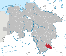
Нордхаузен (Nordhausen, Landkreis Nordhausen)

- район земли Тюрингия, Германия
 Hiking in Нордхаузен
Nordhausen district, located in the state of Thuringia, Germany, offers a variety of hiking opportunities that appeal to both casual walkers and experienced hikers. The region is characterized by its beautiful landscapes, historical sites, and diverse ecosystems, making it a great destination for outdoor enthusiasts.
Key Hiking Areas:
-
Harz Mountains:
- The northern part of Nordhausen borders the Harz mountain range. This area features numerous well-marked trails, from gentle walks to challenging hikes. Popular routes include the Brocken hike, which takes you to the highest peak in the Harz, offering stunning views.
- The scenery is a mix of dense forests, rocky outcrops, and picturesque villages.
-
National Park Harz:
- Established to protect the unique landscape and biodiversity, the park offers a range of established hiking trails, including circular walks that showcase its natural beauty. Some trails are suitable for families, while others are meant for more experienced hikers.
- Look for routes that take you past waterfalls, through heathlands, and up to vantage points.
-
Thuringian Forest:
- To the south of Nordhausen, this dense forest area has numerous trails that weave through its vast woodlands. You can explore small villages, ancient castles, and wildlife.
- Popular trails include segments of the Rennsteig, a historic long-distance hiking trail that runs through the entire Thuringian Forest.
Tips for Hiking in Nordhausen:
-
Trail Maps: Always carry a trail map or use a reliable hiking app to navigate. Many trails are well-marked, but it’s good to have a backup in case of detours.
-
Weather Prep: Weather in the Harz can change quickly. Dress in layers, and be prepared for rain or sudden temperature drops, especially in higher elevations.
-
Safety: Make sure to let someone know your hiking plans, especially if you're venturing into remote areas. Carry a first aid kit, enough water, and snacks.
-
Respect Nature: Stay on marked trails, dispose of waste properly, and respect wildlife. The ecosystem in this region is fragile and deserves protection.
-
Cultural Sites: Don’t miss the chance to explore historical sites along the way, such as old mining towns, castles, and museums that tell the story of the region's rich history.
With a mix of natural beauty, cultural heritage, and solid trail systems, hiking in Nordhausen district can be a rewarding experience for all levels of hikers. Enjoy the adventure!
- Страна:

- Код автомобильного номера: NDH
- Координаты: 51° 30' 0" N, 10° 43' 48" E


- GPS треки (wikiloc): [Ссылка]
- Высота над уровнем моря: 232 м m
- Площадь: 713.91 кв.км
- Население: 85355
- Веб сайт: http://www.landratsamt-nordhausen.de/
- Википедия русская: wiki(ru)
- Википедия английская: wiki(en)
- Википедия национальная: wiki(de)
- Хранилище Wikidata: Wikidata: Q7858
- Катеория в википедии: [Ссылка]
- Карты в википедии: [Ссылка]
- код Freebase: [/m/01yrdj]
- код GeoNames: Альт: [2861979]
- код VIAF: Альт: [152513663]
- ID отношения в OpenStreetMap: [62621]
- код GND: Альт: [4346028-8]
- идентификатор местоположения ArchINFORM: [11037]
- код LCNAF: Альт: [n85207987]
- код TGN: [7125727]
- код NUTS: [DEG07]
- код района Германии: 16062
Граничит с регионами:

Остероде
Hiking in Остероде
Osterode, located in the Lower Saxony region of Germany, offers a variety of hiking opportunities, particularly given its picturesque landscapes and proximity to the Harz Mountains. Here are some key points to consider for hiking in the Osterode district:...
- Страна:
- Код автомобильного номера: OHA
- Координаты: 51° 40' 12" N, 10° 19' 48" E
- GPS треки (wikiloc): [Ссылка]
- Высота над уровнем моря: 505 м m
- Площадь: 636.00 кв.км
- Население: 75245
- Веб сайт: [Ссылка]