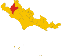
Норма (Norma, Norma)
.svg)
- коммуна Италии
 Hiking in Норма
Norma, a charming town in the Lazio region of Italy, offers beautiful hiking opportunities with its stunning landscapes, historical sites, and proximity to the Monti Lepini mountains. Here are some highlights for hiking in and around Norma:
Hiking Trails
-
Monte Cavo Trail:
- This trail takes you to Monte Cavo, which is a popular hiking destination with breathtaking views of the surrounding countryside and lakes. The trail is usually well-marked and ranges from moderate to challenging depending on the route taken.
-
The Lepini Mountains:
- The broader Monti Lepini area has various hiking trails that offer different levels of difficulty. Trails here can take you through lush forests, rocky landscapes, and past ancient ruins.
-
Historical Paths:
- Some trails can lead you to historical sites such as the ancient town of Norba, where you can explore old ruins and enjoy panoramic views.
-
Nature Reserves:
- The Regional Nature Reserve of Monte Lepini provides various trails that showcase the local flora and fauna, with opportunities for birdwatching and photography.
Tips for Hiking in Norma
- Prepare for Varying Weather: The weather can change quickly, so bring layers and rain gear, especially in spring and fall.
- Stay Hydrated: Carry enough water and snacks, as well as a first aid kit for emergencies.
- Respect Nature: Stay on marked trails to protect the local ecosystem and follow the “Leave No Trace” principles.
- Check Local Maps: Use local maps or hiking apps to ensure you are on the right path and to discover additional trails.
- Enjoy Local Culture: After your hike, explore the town of Norma for its cultural sites, try local cuisine, and perhaps visit nearby towns like Cisterna di Latina or Sermoneta.
Access and Logistics
- Getting There: Norma is accessible by car, and public transport options may include buses from larger nearby towns.
- Best Time to Hike: Spring (April to June) and fall (September to October) are ideal for hiking, with milder temperatures and beautiful scenery.
Hiking in Norma can be a rewarding experience that combines physical activity with cultural exploration. Be sure to plan ahead and enjoy the natural beauty of this picturesque area in Lazio!
- Страна:

- Почтовый код: 04010
- Телефонный код: 0773
- Код автомобильного номера: LT
- Координаты: 41° 35' 0" N, 12° 58' 0" E


- GPS треки (wikiloc): [Ссылка]
- Высота над уровнем моря: 410 м m
- Площадь: 31.22 кв.км
- Население: 4046
- Веб сайт: http://www.comune.norma.lt.it/
- Википедия русская: wiki(ru)
- Википедия английская: wiki(en)
- Википедия национальная: wiki(it)
- Хранилище Wikidata: Wikidata: Q128119
- Катеория в википедии: [Ссылка]
- код Freebase: [/m/0gm8wc]
- код GeoNames: Альт: [6538696]
- ID отношения в OpenStreetMap: [68913]
- код ISTAT: 059016
- кадастровый код Италии: F937
Граничит с регионами:


Бассиано
- коммуна Италии
Hiking in Бассиано
Bassiano is a charming town located in the province of Latina, in the Lazio region of Italy. Nestled in the Ausoni Mountain range, it offers beautiful landscapes, rich history, and a variety of hiking opportunities suitable for different skill levels....
- Страна:
- Почтовый код: 04010
- Телефонный код: 0773
- Код автомобильного номера: LT
- Координаты: 41° 33' 0" N, 13° 2' 0" E
- GPS треки (wikiloc): [Ссылка]
- Высота над уровнем моря: 562 м m
- Площадь: 32.4 кв.км
- Население: 1530
- Веб сайт: [Ссылка]

Чистерна-Ди-Латина
- коммуна Италии
Hiking in Чистерна-Ди-Латина
Cisterna di Latina, located in the Lazio region of Italy, offers a unique setting for hiking enthusiasts. This area is characterized by its picturesque landscapes, rolling hills, and proximity to both the Tyrrhenian Sea and the Apennine Mountains. If you're considering hiking in this area, here are some key points to consider:...
- Страна:
- Почтовый код: 04012
- Телефонный код: 06
- Код автомобильного номера: LT
- Координаты: 41° 36' 0" N, 12° 50' 0" E
- GPS треки (wikiloc): [Ссылка]
- Высота над уровнем моря: 77 м m
- Площадь: 144.16 кв.км
- Население: 36980
- Веб сайт: [Ссылка]


Кори
- коммуна Италии
Hiking in Кори
Cori, located in the region of Lazio, is known for its picturesque landscapes, rich history, and charming medieval architecture. Hiking in this area offers a blend of natural beauty and cultural exploration, making it a rewarding experience....
- Страна:
- Почтовый код: 04010
- Телефонный код: 06
- Код автомобильного номера: LT
- Координаты: 41° 39' 0" N, 12° 55' 0" E
- GPS треки (wikiloc): [Ссылка]
- Высота над уровнем моря: 384 м m
- Площадь: 85.31 кв.км
- Население: 10893
- Веб сайт: [Ссылка]


Сермонета
- коммуна Италии
Hiking in Сермонета
Sermoneta is a charming medieval town located in the province of Latina in the Lazio region of Italy. It is surrounded by beautiful natural landscapes, making it an excellent destination for hiking enthusiasts. Here are some key highlights and tips for hiking in and around Sermoneta:...
- Страна:
- Почтовый код: 04013
- Телефонный код: 0773
- Код автомобильного номера: LT
- Координаты: 41° 33' 0" N, 12° 59' 0" E
- GPS треки (wikiloc): [Ссылка]
- Высота над уровнем моря: 257 м m
- Площадь: 45 кв.км
- Население: 10077
- Веб сайт: [Ссылка]


Карпинето-Романо
- коммуна Италии
Hiking in Карпинето-Романо
Carpineto Romano, located in the Lazio region of Italy, is a wonderful destination for hiking enthusiasts. Nestled in the Monti Lepini mountain range, this charming town is surrounded by stunning natural landscapes, making it an ideal spot for various outdoor activities....
- Страна:
- Почтовый код: 00032
- Телефонный код: 06
- Код автомобильного номера: ROMA
- Координаты: 41° 36' 0" N, 13° 5' 0" E
- GPS треки (wikiloc): [Ссылка]
- Высота над уровнем моря: 550 м m
- Площадь: 86.29 кв.км
- Население: 4425
- Веб сайт: [Ссылка]
Монтеланико
- коммуна Италии
Hiking in Монтеланико
Montelanico is a charming town located in the Lazio region of central Italy, known for its beautiful landscapes and proximity to the Apennine mountains. Hiking in and around Montelanico offers a unique opportunity to explore stunning natural scenery, charming villages, and a rich array of local flora and fauna. Here are some key points to consider when hiking in this area:...
- Страна:
- Почтовый код: 00030
- Телефонный код: 06
- Код автомобильного номера: ROMA
- Координаты: 41° 39' 0" N, 13° 2' 23" E
- GPS треки (wikiloc): [Ссылка]
- Высота над уровнем моря: 297 м m
- Площадь: 35.14 кв.км
- Население: 2125
- Веб сайт: [Ссылка]