Обфельден (Obfelden, Obfelden)

 Hiking in Обфельден
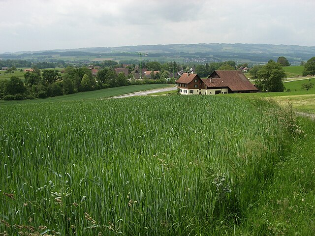
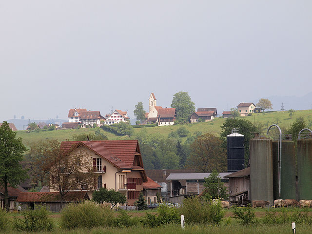
Obfelden, located in the Canton of Zurich, Switzerland, offers beautiful hiking opportunities amidst stunning natural landscapes. The region is characterized by rolling hills, lush forests, and picturesque views of the surrounding Alps, making it a great destination for hikers of all skill levels.
Hiking Trails:
-
Zurich Oberland Trail: This longer trail connects various villages in the Zurich Oberland and includes sections that pass through Obfelden. The trail offers breathtaking views, especially towards the mountains and Lake Zurich.
-
The Hasensprung Trail: A shorter, family-friendly trail that gives you a taste of the local flora and fauna. This hike is often enjoyed by beginners and is suitable for children.
-
Albis Ridge: The ridge offers panoramic views and a mix of nature and historical sites. You can walk along the ridge for a more challenging hike.
-
Forest Trails: There are numerous well-marked forest trails in the region, providing a serene hiking experience amidst tall trees and possibly some wildlife sightings.
Tips for Hiking in Obfelden:
- Weather Check: Always check the weather before heading out, as conditions can change rapidly in the mountains.
- Footwear: Wear proper hiking boots for comfort and support on varied terrain.
- Hydration and Snacks: Carry enough water and snacks, especially for longer hikes.
- Maps and Guides: Utilize local hiking maps, which are often available at tourist information centers, to ensure you stay on track.
- Respect Nature: Leave no trace and respect local wildlife and flora.
Accessibility:
Obfelden is easily accessible from Zurich by public transport, making it a convenient option for both locals and visitors. Buses and trains frequently connect to nearby trails and parking areas.
Whether you're looking for a leisurely stroll or a more challenging ascent, Obfelden has something to offer every hiker!
- Страна:

- Почтовый код: 8912
- Телефонный код: 044
- Код автомобильного номера: ZH
- Координаты: 47° 15' 42" N, 8° 25' 19" E


- GPS треки (wikiloc): [Ссылка]
- Высота над уровнем моря: 435 м m
- Площадь: 7.54 кв.км
- Население: 5340
- Веб сайт: http://www.obfelden.ch
- Википедия русская: wiki(ru)
- Википедия английская: wiki(en)
- Википедия национальная: wiki(de)
- Хранилище Wikidata: Wikidata: Q65942
- Катеория в википедии: [Ссылка]
- код Freebase: [/m/0gn_ny]
- код GeoNames: Альт: [7286724]
- код VIAF: Альт: [243182371]
- ID отношения в OpenStreetMap: [1682181]
- код темы Quora: [Obfelden]
- идентификатор HDS: [10]
- код швейцарского муниципалитета: [0010]
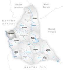
Граничит с регионами:


Мереншванд
Hiking in Мереншванд
Merenschwand, a picturesque municipality located in the Canton of Aargau in Switzerland, offers a variety of hiking opportunities that cater to different skill levels. Nestled in a beautiful landscape characterized by rolling hills, forests, and stunning views of the surrounding countryside, it's an excellent destination for both casual walkers and more experienced hikers....
- Страна:
- Почтовый код: 5634
- Телефонный код: 056
- Код автомобильного номера: AG
- Координаты: 47° 15' 44" N, 8° 22' 39" E
- GPS треки (wikiloc): [Ссылка]
- Высота над уровнем моря: 381 м m
- Площадь: 13.51 кв.км
- Население: 3393
- Веб сайт: [Ссылка]

Машванден
Hiking in Машванден
Maschwanden is a picturesque village located near Zug in Switzerland, surrounded by beautiful natural landscapes that are ideal for hiking. The area offers several trails suitable for various skill levels, making it a great destination for both novice and experienced hikers....
- Страна:
- Почтовый код: 8933
- Телефонный код: 044
- Код автомобильного номера: ZH
- Координаты: 47° 14' 5" N, 8° 25' 45" E
- GPS треки (wikiloc): [Ссылка]
- Высота над уровнем моря: 407 м m
- Площадь: 4.67 кв.км
- Население: 641
- Веб сайт: [Ссылка]


Метменштеттен
Hiking in Метменштеттен
Mettmenstetten is a charming village located in the Zurich Oberland region of Switzerland, offering a variety of hiking opportunities in a picturesque setting. The area is known for its beautiful landscapes, rolling hills, and well-marked trails that cater to hikers of all levels....
- Страна:
- Почтовый код: 8932
- Телефонный код: 044
- Код автомобильного номера: ZH
- Координаты: 47° 14' 41" N, 8° 27' 52" E
- GPS треки (wikiloc): [Ссылка]
- Высота над уровнем моря: 468 м m
- Площадь: 13.11 кв.км
- Население: 4865
- Веб сайт: [Ссылка]
Хюненберг
Hiking in Хюненберг
Hünenberg, located in the Canton of Zug in Switzerland, offers a blend of beautiful landscapes, scenic views, and various hiking opportunities. Here are some key points to consider if you’re planning a hike in this area:...
- Страна:
- Почтовый код: 6331
- Телефонный код: 041
- Код автомобильного номера: ZG
- Координаты: 47° 11' 29" N, 8° 25' 11" E
- GPS треки (wikiloc): [Ссылка]
- Высота над уровнем моря: 403 м m
- Площадь: 18.7 кв.км
- Население: 8824
- Веб сайт: [Ссылка]

Оттенбах
Hiking in Оттенбах
Ottenbach, a picturesque village located in the Canton of Aargau in Switzerland, offers a great setting for hiking enthusiasts. The surrounding landscapes provide a delightful mix of rolling hills, forested areas, and charming valleys, making it an excellent spot for both beginners and experienced hikers....
- Страна:
- Почтовый код: 8913
- Телефонный код: 044
- Код автомобильного номера: ZH
- Координаты: 47° 16' 53" N, 8° 24' 14" E
- GPS треки (wikiloc): [Ссылка]
- Высота над уровнем моря: 409 м m
- Площадь: 4.98 кв.км
- Население: 2556
- Веб сайт: [Ссылка]


Аффольтерн-на-Альбисе
Hiking in Аффольтерн-на-Альбисе
Affoltern am Albis is a picturesque town located in the Zurich Oberland region of Switzerland, nestled between the rolling hills and the beautiful natural landscapes of the area. It offers a variety of hiking opportunities suitable for different skill levels, ranging from leisurely walks to more challenging treks. Here’s what you can expect when hiking in and around Affoltern am Albis:...
- Страна:
- Почтовый код: 8910
- Код автомобильного номера: ZH
- Координаты: 47° 16' 29" N, 8° 26' 45" E
- GPS треки (wikiloc): [Ссылка]
- Высота над уровнем моря: 494 м m
- Площадь: 10.56 кв.км
- Население: 12080
- Веб сайт: [Ссылка]