Эттинген (Oettingen in Bayern, Oettingen in Bayern)

 Hiking in Эттинген
Oettingen in Bayern is a charming town located in the Swabian region of Bavaria, Germany. The area is characterized by its picturesque landscapes, rolling hills, and a rich historical backdrop, making it a great spot for hiking enthusiasts.
Hiking Trails
-
Nördlinger Ries:
- Just a short distance from Oettingen, the Nördlinger Ries is a unique geological feature, known for its circular form resulting from a meteor impact. There are several trails that lead through beautiful countryside, where you can enjoy the distinctive landscape and spot various wildlife.
-
Altmühl Valley Nature Park:
- This nature park is about 30 kilometers from Oettingen and offers multiple hiking routes. The Altmühl River flows through the park, providing scenic views and opportunities for birdwatching. The trails here vary in difficulty, catering to both casual walkers and more experienced hikers.
-
Local Trails:
- There are numerous local trails around Oettingen itself that provide stunning views of the surrounding countryside. Look for hiking maps available locally or visit the town’s tourism office for recommended trails that highlight the area's natural beauty.
Hiking Tips
- Season: Spring and autumn are ideal for hiking in this region due to pleasant temperatures and beautiful foliage.
- Gear: Wear sturdy hiking boots and dress in layers, as the weather can change quickly.
- Safety: Always carry enough water and snacks, and let someone know your hiking plans.
- Navigation: While many trails are marked, it's beneficial to have a map or a GPS device. Mobile reception can be patchy in remote areas.
Points of Interest
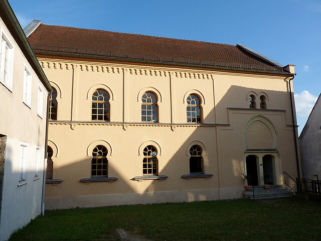
- Besides hiking, Oettingen is rich in history, with attractions such as the historic old town, the Gothic St. Jacob’s Church, and the beautiful Oettingen Palace.
- The region also features numerous quaint villages and farms where you can stop for local cuisine after a day of hiking.
Enjoy your hiking experience in Oettingen in Bayern, taking in the serene natural beauty and cultural richness of the area!
- Страна:

- Почтовый код: 86729–86732
- Телефонный код: 09082
- Код автомобильного номера: DON
- Координаты: 48° 57' 0" N, 10° 35' 0" E


- GPS треки (wikiloc): [Ссылка]
- Высота над уровнем моря: 418 м m
- Площадь: 34.21 кв.км
- Население: 4616
- Веб сайт: http://www.oettingen.de
- Википедия русская: wiki(ru)
- Википедия английская: wiki(en)
- Википедия национальная: wiki(de)
- Хранилище Wikidata: Wikidata: Q556312
- Катеория в википедии: [Ссылка]
- код Freebase: [/m/0d5tj0]
- код GeoNames: Альт: [2857847]
- код BNF: [11975488v]
- код VIAF: Альт: [247679638]
- ID отношения в OpenStreetMap: [962610]
- код GND: Альт: [4116730-2]
- код LCNAF: Альт: [n92007294]
- место в MusicBrainz: [f0a4c2a7-ded4-463f-8efb-cffc48a1fc01]
- Bavarikon ID: [ODB_A00000856]
- код Католической энциклопедии: [11215b]
- идентификатор муниципалитетов в Германии: 09779197
Граничит с регионами:


Пользинген
Hiking in Пользинген
Polsingen is a charming area located in the region of Bavaria, Germany. While it may not be one of the most popular hiking destinations compared to some of the larger national parks, it does offer a variety of scenic trails and opportunities for outdoor activities, making it suitable for hikers of different skill levels....
- Страна:
- Почтовый код: 91805
- Телефонный код: 09093
- Код автомобильного номера: WUG
- Координаты: 48° 56' 0" N, 10° 43' 0" E
- GPS треки (wikiloc): [Ссылка]
- Высота над уровнем моря: 443 м m
- Площадь: 33.87 кв.км
- Население: 1864
- Веб сайт: [Ссылка]
Хайнсфарт
Hiking in Хайнсфарт
Hainsfarth, located in Bavaria, Germany, offers a charming setting for hiking enthusiasts. The region features picturesque landscapes, lush forests, and rolling hills that make for a great hiking experience. Here are some highlights and tips for hiking in Hainsfarth:...
- Страна:
- Почтовый код: 86744
- Телефонный код: 09082
- Код автомобильного номера: DON
- Координаты: 48° 58' 0" N, 10° 37' 0" E
- GPS треки (wikiloc): [Ссылка]
- Высота над уровнем моря: 445 м m
- Площадь: 17.54 кв.км
- Население: 1443
- Веб сайт: [Ссылка]

Муннинген
Hiking in Муннинген
Munningen is a small area located in the Bavarian region of Germany, near the Danube River. While it may not be as widely known as some larger hiking destinations, it offers beautiful landscapes and opportunities for outdoor activities, particularly for those who enjoy tranquility away from more crowded trails....
- Страна:
- Почтовый код: 86754
- Телефонный код: 0 90 82
- Код автомобильного номера: DON
- Координаты: 48° 55' 0" N, 10° 35' 0" E
- GPS треки (wikiloc): [Ссылка]
- Высота над уровнем моря: 415 м m
- Площадь: 22.78 кв.км
- Население: 1659
- Веб сайт: [Ссылка]