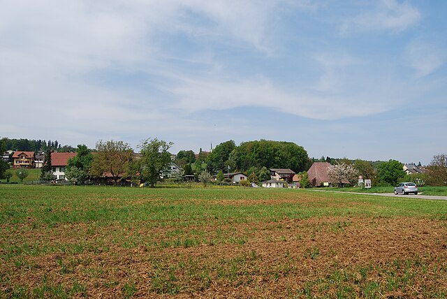
Ольтен (Olten District, Bezirk Olten)
- округ кантона Золотурн (Швейцария)
 Hiking in Ольтен
Olten District, located in the canton of Aargau in Switzerland, is known for its picturesque landscapes and diverse hiking trails. The region combines natural beauty with a variety of terrains, making it an excellent destination for both novice and experienced hikers. Here are some key highlights for hiking in the Olten District:
Scenic Trails
-
Aare River Path: This picturesque trail follows the Aare River, offering scenic views and a relatively flat terrain. It's particularly beautiful in the spring and summer when the surrounding nature is in full bloom.
-
Gipf Mountain: A hike up to Gipf offers panoramic views of the surrounding valleys and distant mountain ranges. The trail can be somewhat steep, so it's best suited for those looking for a moderate challenge.
-
Waldhügel: This area provides various forest trails that are ideal for a peaceful hike among trees, perfect for families or those looking for a relaxing outing.
Flora and Fauna
The Olten District is rich in biodiversity, featuring various plant species and wildlife. Hikers may encounter deer, birds, and an array of wildflowers along the trails, especially in spring and summer.
Accessibility
The hiking trails in Olten are generally well-marked and accessible to the public. Many trails can be reached easily from the town of Olten, which is well-serviced by public transport.
Best Time to Hike
The best time to hike in Olten is typically from late spring (May) to early autumn (October). During these months, the weather is generally mild, and the landscapes are lush and vibrant.
Local Tips
- Weather Check: Always check the weather forecast before heading out, as conditions can change quickly in the mountains.
- Pack Essentials: Bring plenty of water, snacks, and a map or GPS device to navigate the trails.
- Respect Nature: Follow the Leave No Trace principles to preserve the natural beauty of the area.
Conclusion
Whether you're looking for a leisurely walk along the river or a more challenging ascent through hilly terrain, Olten District offers a memorable hiking experience. Enjoy the stunning scenery, diverse trails, and the tranquility of nature as you explore this beautiful region of Switzerland.
- Страна:

- Столица: Ольтен
- Код автомобильного номера: SO
- Координаты: 47° 21' 12" N, 7° 54' 28" E


- GPS треки (wikiloc): [Ссылка]
- Высота над уровнем моря: 395 м m
- Площадь: 80.60 кв.км
- Википедия русская: wiki(ru)
- Википедия английская: wiki(en)
- Википедия национальная: wiki(de)
- Хранилище Wikidata: Wikidata: Q660133
- Катеория в википедии: [Ссылка]
- код Freebase: [/m/0g51ld]
- код GeoNames: Альт: [6458893]
- код BNF: [119755090]
- идентификатор местоположения ArchINFORM: [42762]
- идентификатор HDS: [7729]
Включает регионы:


Фуленбах
Hiking in Фуленбах
Fulenbach, located in the scenic region of Switzerland, offers a variety of hiking opportunities that cater to different skill levels. Nestled in the Jura mountains, the area boasts picturesque landscapes, lush forests, and diverse wildlife, making it ideal for nature enthusiasts....
- Страна:
- Почтовый код: 4629
- Телефонный код: 062
- Код автомобильного номера: SO
- Координаты: 47° 16' 51" N, 7° 49' 58" E
- GPS треки (wikiloc): [Ссылка]
- Высота над уровнем моря: 426 м m
- Площадь: 4.47 кв.км
- Население: 1776
- Веб сайт: [Ссылка]

Каппель
Hiking in Каппель
Kappel, a picturesque village in Switzerland, offers a range of hiking opportunities set against beautiful landscapes typical of the region. Here are some highlights for hikers considering exploring this area:...
- Страна:
- Почтовый код: 4616
- Телефонный код: 062
- Код автомобильного номера: SO
- Координаты: 47° 19' 30" N, 7° 51' 0" E
- GPS треки (wikiloc): [Ссылка]
- Высота над уровнем моря: 425 м m
- Площадь: 5.09 кв.км
- Население: 3189
- Веб сайт: [Ссылка]


Деникен
Hiking in Деникен
Däniken is a small municipality located in the Solothurn district of Switzerland, known for its picturesque landscapes and proximity to various hiking trails. The region provides several opportunities for outdoor enthusiasts to explore nature while enjoying beautiful views of the surrounding Jura mountains and valleys....
- Страна:
- Почтовый код: 4658
- Телефонный код: 062
- Код автомобильного номера: SO
- Координаты: 47° 21' 24" N, 7° 58' 55" E
- GPS треки (wikiloc): [Ссылка]
- Высота над уровнем моря: 382 м m
- Площадь: 5.43 кв.км
- Население: 2784
- Веб сайт: [Ссылка]
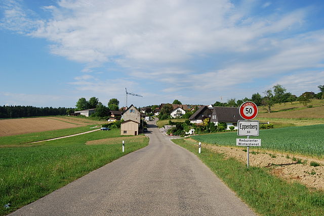

Эппенберг-Вёшнау
Hiking in Эппенберг-Вёшнау
Eppenberg-Wöschnau, located in Switzerland's Aargau region, offers a picturesque backdrop for hiking enthusiasts. This area presents a mix of well-maintained trails, scenic vistas, and rich natural surroundings, making it ideal for hikers of all skill levels....
- Страна:
- Почтовый код: 5012
- Телефонный код: 062
- Код автомобильного номера: SO
- Координаты: 47° 22' 36" N, 8° 1' 30" E
- GPS треки (wikiloc): [Ссылка]
- Высота над уровнем моря: 459 м m
- Площадь: 1.83 кв.км
- Население: 330
- Веб сайт: [Ссылка]


Бонинген
Hiking in Бонинген
Boningen is a small municipality in the canton of Aargau, Switzerland, and while it may not be as widely known as some of the larger hiking areas in the region, it offers beautiful landscapes and a variety of trails suitable for different skill levels. Here’s what you need to know about hiking in and around Boningen:...
- Страна:
- Почтовый код: 4618
- Телефонный код: 062
- Код автомобильного номера: SO
- Координаты: 47° 18' 34" N, 7° 51' 30" E
- GPS треки (wikiloc): [Ссылка]
- Высота над уровнем моря: 410 м m
- Площадь: 2.8 кв.км
- Население: 755
- Веб сайт: [Ссылка]


Гунцген
Hiking in Гунцген
Gunzgen, located in the canton of Aargau, Switzerland, is a charming area for hiking enthusiasts. The region is characterized by picturesque landscapes, including rolling hills, dense forests, and scenic views of the Swiss countryside....
- Страна:
- Почтовый код: 4617
- Телефонный код: 062
- Код автомобильного номера: SO
- Координаты: 47° 18' 46" N, 7° 50' 7" E
- GPS треки (wikiloc): [Ссылка]
- Высота над уровнем моря: 438 м m
- Площадь: 3.91 кв.км
- Население: 1651
- Веб сайт: [Ссылка]

Гретценбах
Hiking in Гретценбах
Gretzenbach is a small municipality located in the Swiss canton of Solothurn, nestled in a picturesque setting that offers some lovely hiking opportunities. The region is characterized by rolling hills, forests, and scenic views, making it a great spot for both casual and more experienced hikers....
- Страна:
- Почтовый код: 5014
- Телефонный код: 062
- Код автомобильного номера: SO
- Координаты: 47° 21' 29" N, 7° 59' 55" E
- GPS треки (wikiloc): [Ссылка]
- Высота над уровнем моря: 398 м m
- Площадь: 5.79 кв.км
- Население: 2733
- Веб сайт: [Ссылка]

Дулликен
Hiking in Дулликен
Dulliken is a small municipality located in the Canton of Aargau in Switzerland. While it may not be as well-known for hiking as some larger areas, it can still offer a few opportunities for outdoor exploration and enjoyment of nature....
- Страна:
- Почтовый код: 4657
- Телефонный код: 062
- Код автомобильного номера: SO
- Координаты: 47° 21' 9" N, 7° 56' 45" E
- GPS треки (wikiloc): [Ссылка]
- Высота над уровнем моря: 436 м m
- Площадь: 6.02 кв.км
- Население: 4964
- Веб сайт: [Ссылка]


Штарркирх-Виль
Hiking in Штарркирх-Виль
Starrkirch-Wil, located in the Canton of Aargau in Switzerland, offers a variety of beautiful hiking opportunities set against a backdrop of picturesque landscapes, rolling hills, and charming rural scenery. Here are some aspects to consider when hiking in this area:...
- Страна:
- Почтовый код: 4656
- Телефонный код: 062
- Код автомобильного номера: SO
- Координаты: 47° 20' 54" N, 7° 55' 35" E
- GPS треки (wikiloc): [Ссылка]
- Высота над уровнем моря: 419 м m
- Площадь: 1.85 кв.км
- Население: 1692
- Веб сайт: [Ссылка]

Вальтерсвиль
Hiking in Вальтерсвиль
Walterswil, located in the Solothurn region of Switzerland, offers a variety of hiking opportunities that cater to different skill levels. The picturesque landscapes of the area, combined with its charming rural character, make it an excellent destination for outdoor enthusiasts....
- Страна:
- Почтовый код: 5746
- Телефонный код: 062
- Код автомобильного номера: SO
- Координаты: 47° 19' 44" N, 7° 58' 2" E
- GPS треки (wikiloc): [Ссылка]
- Высота над уровнем моря: 574 м m
- Площадь: 4.53 кв.км
- Население: 701
- Веб сайт: [Ссылка]


Риккенбах
- община в Швейцарии, Золотурн
Hiking in Риккенбах
Rickenbach is a charming village in the Canton of Solothurn, Switzerland, surrounded by stunning landscapes and offers a variety of hiking opportunities. Here are some highlights and tips for hiking in the Rickenbach area:...
- Страна:
- Почтовый код: 4613
- Телефонный код: 062
- Код автомобильного номера: SO
- Координаты: 47° 20' 33" N, 7° 51' 19" E
- GPS треки (wikiloc): [Ссылка]
- Высота над уровнем моря: 454 м m
- Площадь: 2.69 кв.км
- Население: 964
- Веб сайт: [Ссылка]


Шёненверд
Hiking in Шёненверд
Schönenwerd, located in the canton of Aargau in Switzerland, is a charming town that offers various opportunities for hiking enthusiasts. The region is characterized by picturesque landscapes, rolling hills, and lush greenery, making it an excellent spot for outdoor activities....
- Страна:
- Почтовый код: 5012
- Телефонный код: 062
- Код автомобильного номера: SO
- Координаты: 47° 22' 19" N, 8° 0' 10" E
- GPS треки (wikiloc): [Ссылка]
- Высота над уровнем моря: 389 м m
- Площадь: 3.77 кв.км
- Население: 4902
- Веб сайт: [Ссылка]


Хегендорф
Hiking in Хегендорф
Hägendorf is a picturesque municipality located in the canton of Solothurn, Switzerland, surrounded by beautiful landscapes and natural scenery that are great for hiking. Here are some highlights and suggestions for hiking in the Hägendorf area:...
- Страна:
- Почтовый код: 4614
- Телефонный код: 062
- Код автомобильного номера: SO
- Координаты: 47° 20' 44" N, 7° 49' 28" E
- GPS треки (wikiloc): [Ссылка]
- Высота над уровнем моря: 691 м m
- Площадь: 13.87 кв.км
- Население: 5044
- Веб сайт: [Ссылка]


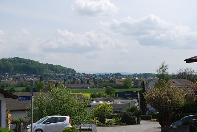
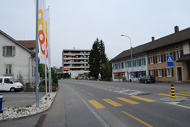
Ольтен
- город в Швейцарии
Hiking in Ольтен
Olten, located in the canton of Solothurn in Switzerland, is surrounded by beautiful landscapes and offers a range of hiking opportunities. Here are some highlights and tips for hiking in and around Olten:...
- Страна:
- Почтовый код: 4600
- Телефонный код: 062
- Код автомобильного номера: SO
- Координаты: 47° 21' 11" N, 7° 54' 28" E
- GPS треки (wikiloc): [Ссылка]
- Высота над уровнем моря: 396 м m
- Площадь: 11.5 кв.км
- Население: 17133
- Веб сайт: [Ссылка]

Ванген-Ольтен
Hiking in Ванген-Ольтен
Wangen bei Olten, located in the canton of Solothurn in Switzerland, offers a range of hiking opportunities that showcase the stunning natural beauty of the region. With its picturesque landscape, charming villages, and well-marked trails, Wangen bei Olten is an attractive destination for both casual walkers and seasoned hikers....
- Страна:
- Почтовый код: 4612
- Телефонный код: 062
- Код автомобильного номера: SO
- Координаты: 47° 20' 31" N, 7° 52' 18" E
- GPS треки (wikiloc): [Ссылка]
- Высота над уровнем моря: 412 м m
- Площадь: 6.94 кв.км
- Население: 5096
- Веб сайт: [Ссылка]
Граничит с регионами:

Гой
Hiking in Гой
The Gäu District, located in the heart of southern Germany, offers various hiking opportunities with diverse landscapes, rich cultural heritage, and picturesque views. Here are some highlights and tips for hiking in this beautiful region:...
- Страна:
- Столица: Энзинген
- Код автомобильного номера: SO
- Координаты: 47° 17' 20" N, 7° 42' 50" E
- GPS треки (wikiloc): [Ссылка]
- Высота над уровнем моря: 442 м m
- Площадь: 62.02 кв.км

Гёсген
Hiking in Гёсген
Hiking in the Gösgen District, located in the canton of Aargau, Switzerland, offers a wonderful experience for nature lovers and outdoor enthusiasts. This region features a mix of scenic landscapes, rich history, and a variety of trails suitable for different skill levels. Here are some key points to consider:...
- Страна:
- Столица: Нидергёсген
- Код автомобильного номера: SO
- Координаты: 47° 22' 25" N, 7° 59' 35" E
- GPS треки (wikiloc): [Ссылка]
- Высота над уровнем моря: 492 м m
- Площадь: 68.81 кв.км