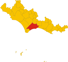
Понтиния (Pontinia, Pontinia)
.svg)
- коммуна Италии
 Hiking in Понтиния
Pontinia, located in the Lazio region of Italy, is not typically known as a major hiking destination, but it offers some interesting walking opportunities amidst its beautiful scenery. The area features characteristic flatlands, as it is situated near the Tyrrhenian Sea and surrounded by agricultural landscapes. Here are some aspects you might find appealing when considering hiking around Pontinia:
-
Natural Beauty: The region is known for its beautiful countryside, with fields of crops, vast plains, and occasional views of hills and mountains in the background. Hiking here provides a chance to enjoy the tranquility of rural Italy.
-
Proximity to Nature Reserves: Close to Pontinia, you can explore natural reserves such as the Circeo National Park or the Rive di Traiano. The park offers various trails and opportunities to experience the local flora and fauna, including coastal landscapes.
-
Historical and Cultural Sites: While hiking, you might stumble upon small, charming villages, historical sites, and remnants of ancient Roman architecture—adding a cultural depth to your outdoor experience.
-
Easy Trails: The hiking trails in and around Pontinia are generally suitable for all skill levels, making it a great place for families or beginners looking to enjoy leisurely walks in nature.
-
Local Cuisine: After a day of hiking, you can enjoy the local cuisine, which includes delicious regional dishes made from fresh, local ingredients.
-
Accessibility: Pontinia is accessible from larger cities like Rome, which can serve as a convenient base for day trips into the countryside.
-
Wildlife Observation: The area around Pontinia has a diverse ecosystem, so if you're interested in birdwatching or seeing other wildlife, be on the lookout as you hike.
Overall, while Pontinia may not offer hardcore hiking adventures, it certainly provides opportunities for leisurely walks and enjoying the peaceful Italian countryside. Always check local maps and guides for the best trails and points of interest, and ensure you're equipped with adequate supplies for your hike.
- Страна:

- Почтовый код: 04014
- Телефонный код: 0773
- Код автомобильного номера: LT
- Координаты: 41° 24' 30" N, 13° 2' 40" E


- GPS треки (wikiloc): [Ссылка]
- Высота над уровнем моря: 4 м m
- Площадь: 112.1 кв.км
- Население: 14915
- Веб сайт: http://www.comune.ponza.lt.it/
- Википедия русская: wiki(ru)
- Википедия английская: wiki(en)
- Википедия национальная: wiki(it)
- Хранилище Wikidata: Wikidata: Q128130
- Катеория в википедии: [Ссылка]
- код Freebase: [/m/0gm8wr]
- код GeoNames: Альт: [6541618]
- код VIAF: Альт: [132721809]
- ID отношения в OpenStreetMap: [41262]
- UN/LOCODE: [ITPTA]
- код в Большой каталанской энциклопедии: [0266603]
- код Цифрового атласа Римской империи: [22183]
- код ISTAT: 059017
- кадастровый код Италии: G865
Граничит с регионами:


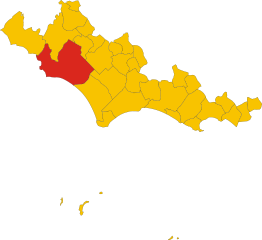
Приверно
- коммуна Италии
Hiking in Приверно
Priverno, a charming town located in the Province of Latina in Italy's Lazio region, offers various hiking opportunities that cater to outdoor enthusiasts of all levels. The surrounding landscapes are characterized by rolling hills, ancient ruins, and the picturesque scenery of the nearby Lepini Mountains. Here are some key points about hiking in the Priverno area:...
- Страна:
- Почтовый код: 04015
- Телефонный код: 0773
- Код автомобильного номера: LT
- Координаты: 41° 28' 0" N, 13° 11' 0" E
- GPS треки (wikiloc): [Ссылка]
- Высота над уровнем моря: 151 м m
- Площадь: 56.98 кв.км
- Население: 14365
- Веб сайт: [Ссылка]


Сабаудия
- коммуна Италии
Hiking in Сабаудия
Sabaudia, located in the Lazio region of Italy, is an excellent destination for hiking, thanks to its stunning landscapes and diverse natural environments. Nestled between the Circeo National Park and the Tyrrhenian Sea, Sabaudia offers a range of hiking trails that cater to all experience levels....
- Страна:
- Почтовый код: 04016
- Телефонный код: 0773
- Код автомобильного номера: LT
- Координаты: 41° 18' 0" N, 13° 1' 0" E
- GPS треки (wikiloc): [Ссылка]
- Высота над уровнем моря: 17 м m
- Площадь: 145.37 кв.км
- Население: 20536
- Веб сайт: [Ссылка]


Сецце
- коммуна Италии
Hiking in Сецце
Sezze is a charming town located in the province of Latina in Italy, situated on the foothills of the Monti Lepini. The area is known for its scenic landscapes, rich history, and diverse hiking opportunities. Here’s what you need to know about hiking in and around Sezze:...
- Страна:
- Почтовый код: 04018; 04010
- Телефонный код: 0773
- Код автомобильного номера: LT
- Координаты: 41° 30' 0" N, 13° 4' 0" E
- GPS треки (wikiloc): [Ссылка]
- Высота над уровнем моря: 319 м m
- Площадь: 100.47 кв.км
- Население: 24954
- Веб сайт: [Ссылка]
Соннино
- коммуна Италии
Hiking in Соннино
Sonnino, located in the province of Latina in the Lazio region of Italy, offers a unique hiking experience with its rich history, natural beauty, and panoramic views of the surrounding landscape. Here are some key points about hiking in and around Sonnino:...
- Страна:
- Почтовый код: 04010
- Телефонный код: 0773
- Код автомобильного номера: LT
- Координаты: 41° 25' 0" N, 13° 14' 0" E
- GPS треки (wikiloc): [Ссылка]
- Высота над уровнем моря: 430 м m
- Площадь: 63.82 кв.км
- Население: 7560
- Веб сайт: [Ссылка]

Террачина
- коммуна Италии
Hiking in Террачина
Terracina, located on the Italian coast of the Tyrrhenian Sea, is not only known for its beautiful beaches and ancient history but also offers excellent hiking opportunities. Here’s an insight into hiking in the area:...
- Страна:
- Почтовый код: 04019
- Телефонный код: 0773
- Код автомобильного номера: LT
- Координаты: 41° 17' 0" N, 13° 15' 0" E
- GPS треки (wikiloc): [Ссылка]
- Высота над уровнем моря: 22 м m
- Площадь: 136.59 кв.км
- Население: 46323
- Веб сайт: [Ссылка]

Латина
- коммуна Италии
Hiking in Латина
Latina is a beautiful province in the Lazio region of Italy, known for its diverse landscapes including mountains, hills, and coastal areas. Here are some key points and popular hiking options in Latina:...
- Страна:
- Почтовый код: 04010; 04013; 04100
- Телефонный код: 0773
- Код автомобильного номера: LT
- Координаты: 41° 28' 3" N, 12° 54' 13" E
- GPS треки (wikiloc): [Ссылка]
- Высота над уровнем моря: 21 м m
- Площадь: 277.62 кв.км
- Население: 126181
- Веб сайт: [Ссылка]