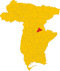
Поволетто (Povoletto, Povoletto)
.svg)
- коммуна Италии
 Hiking in Поволетто
Povoletto is a picturesque municipality located in the Friuli Venezia Giulia region of northeastern Italy. The area offers a variety of hiking opportunities, showcasing its beautiful landscapes, rich natural diversity, and cultural heritage. Here are some highlights for hiking in Povoletto:
-
Scenic Trails: Povoletto and its surrounding areas are home to numerous trails suitable for all levels of hikers: from easy walks for families to more challenging routes for experienced trekkers. Many trails provide stunning views of the Julian Alps and the surrounding countryside.
-
Nature and Wildlife: The region's diverse ecosystems boast a variety of flora and fauna. As you hike, you might encounter local wildlife, including birds, deer, and various plant species native to the area.
-
Cultural Sites: While hiking, you can explore historical and cultural landmarks. There are several small churches and traditional villages that reflect the local architecture and history, adding an enriching element to your hike.
-
Gastronomy: After hiking, don’t miss out on the local cuisine. Friuli is known for its hearty dishes, local wines, and cheese. Many restaurants and agriturismos (farm stays) offer local food and wine, making for a perfect way to wind down after a day on the trails.
-
Access and Safety: The area is generally accessible by car or public transportation, making it convenient for day hikes. However, always check local conditions before heading out, as well-maintained pathways and marked trails can vary in difficulty. Be sure to carry plenty of water, wear appropriate footwear, and inform someone about your hiking plan, especially if you’re heading into more remote areas.
-
Local Hiking Clubs and Guides: Consider joining a hiking group or hiring a local guide to enhance your experience. They can provide valuable insights into the trails, nature, and hidden gems in the surrounding area.
Whether you’re looking for a leisurely stroll or a challenging hike, Povoletto offers a delightful blend of nature, culture, and adventure. Happy hiking!
- Страна:

- Почтовый код: 33040
- Телефонный код: 0432
- Код автомобильного номера: UD
- Координаты: 46° 7' 0" N, 13° 17' 0" E


- GPS треки (wikiloc): [Ссылка]
- Высота над уровнем моря: 116 м m
- Площадь: 38.41 кв.км
- Население: 5425
- Веб сайт: http://www.comune.povoletto.ud.it
- Википедия русская: wiki(ru)
- Википедия английская: wiki(en)
- Википедия национальная: wiki(it)
- Хранилище Wikidata: Wikidata: Q53313
- Галерея изображений в википедии: [Ссылка]
- Катеория в википедии: [Ссылка]
- код Freebase: [/m/0gk9n6]
- код GeoNames: Альт: [6536316]
- код VIAF: Альт: [249402650]
- ID отношения в OpenStreetMap: [79105]
- UN/LOCODE: [ITZRF]
- код ISTAT: 030078
- кадастровый код Италии: G949
Граничит с регионами:


Удине
- коммуна Италии
Hiking in Удине
Udine, located in the northeastern part of Italy, offers a variety of hiking opportunities that showcase its natural beauty and stunning landscapes. Here are some highlights about hiking in the Udine area:...
- Страна:
- Почтовый код: 33100
- Телефонный код: 0432
- Код автомобильного номера: UD
- Координаты: 46° 4' 0" N, 13° 14' 0" E
- GPS треки (wikiloc): [Ссылка]
- Высота над уровнем моря: 113 м m
- Площадь: 57.17 кв.км
- Население: 99341
- Веб сайт: [Ссылка]


Аттимис
- коммуна Италии
Hiking in Аттимис
Attimis is a charming village located in the Friuli Venezia Giulia region of northeastern Italy. It is known for its beautiful natural landscapes, lush hills, and vineyards, which provide a stunning backdrop for hiking enthusiasts. Here are some points to consider if you are planning a hiking trip in and around Attimis:...
- Страна:
- Почтовый код: 33040
- Телефонный код: 0432
- Код автомобильного номера: UD
- Координаты: 46° 11' 0" N, 13° 18' 0" E
- GPS треки (wikiloc): [Ссылка]
- Высота над уровнем моря: 133 м m
- Площадь: 33.24 кв.км
- Население: 1744
- Веб сайт: [Ссылка]


Фаедис
- коммуна Италии
Hiking in Фаедис
Faedis, a picturesque village located in the Friuli Venezia Giulia region of northeastern Italy, offers a variety of hiking opportunities amidst stunning landscapes. Here are some highlights of hiking in and around Faedis:...
- Страна:
- Почтовый код: 33040
- Телефонный код: 0432
- Код автомобильного номера: UD
- Координаты: 46° 9' 0" N, 13° 21' 0" E
- GPS треки (wikiloc): [Ссылка]
- Высота над уровнем моря: 176 м m
- Площадь: 46.78 кв.км
- Население: 2871
- Веб сайт: [Ссылка]

Нимис
- коммуна Италии
Hiking in Нимис
Nimis is an intriguing area located in the Hälsingland region of Sweden, known for its striking natural beauty and unique landscapes. The area is primarily known for the Nimis structure, an art installation made from driftwood, which attracts visitors and hikers alike. While Nimis is not a traditional hiking destination, it provides opportunities for outdoor enthusiasts to explore the surrounding areas....
- Страна:
- Почтовый код: 33045
- Телефонный код: 0432
- Код автомобильного номера: UD
- Координаты: 46° 12' 0" N, 13° 16' 0" E
- GPS треки (wikiloc): [Ссылка]
- Высота над уровнем моря: 207 м m
- Площадь: 33.9 кв.км
- Население: 2711
- Веб сайт: [Ссылка]


Реана-дель-Рояле
- коммуна Италии
Hiking in Реана-дель-Рояле
Reana del Rojale is a charming village located in the Friuli Venezia Giulia region of northern Italy. It offers a beautiful natural landscape and is an excellent destination for hiking enthusiasts. Here are some key points about hiking in Reana del Rojale:...
- Страна:
- Почтовый код: 33010
- Телефонный код: 0432
- Код автомобильного номера: UD
- Координаты: 46° 9' 0" N, 13° 14' 0" E
- GPS треки (wikiloc): [Ссылка]
- Высота над уровнем моря: 168 м m
- Площадь: 20.33 кв.км
- Население: 4905
- Веб сайт: [Ссылка]


Реманцакко
- коммуна Италии
Hiking in Реманцакко
Remanzacco, located in the Friuli-Venezia Giulia region of Italy, is an area rich in natural beauty, making it a fantastic destination for hiking enthusiasts. Here are some highlights and tips for hiking in this region:...
- Страна:
- Почтовый код: 33047
- Телефонный код: 0432
- Код автомобильного номера: UD
- Координаты: 46° 5' 0" N, 13° 19' 0" E
- GPS треки (wikiloc): [Ссылка]
- Высота над уровнем моря: 110 м m
- Площадь: 30.99 кв.км
- Население: 6134
- Веб сайт: [Ссылка]