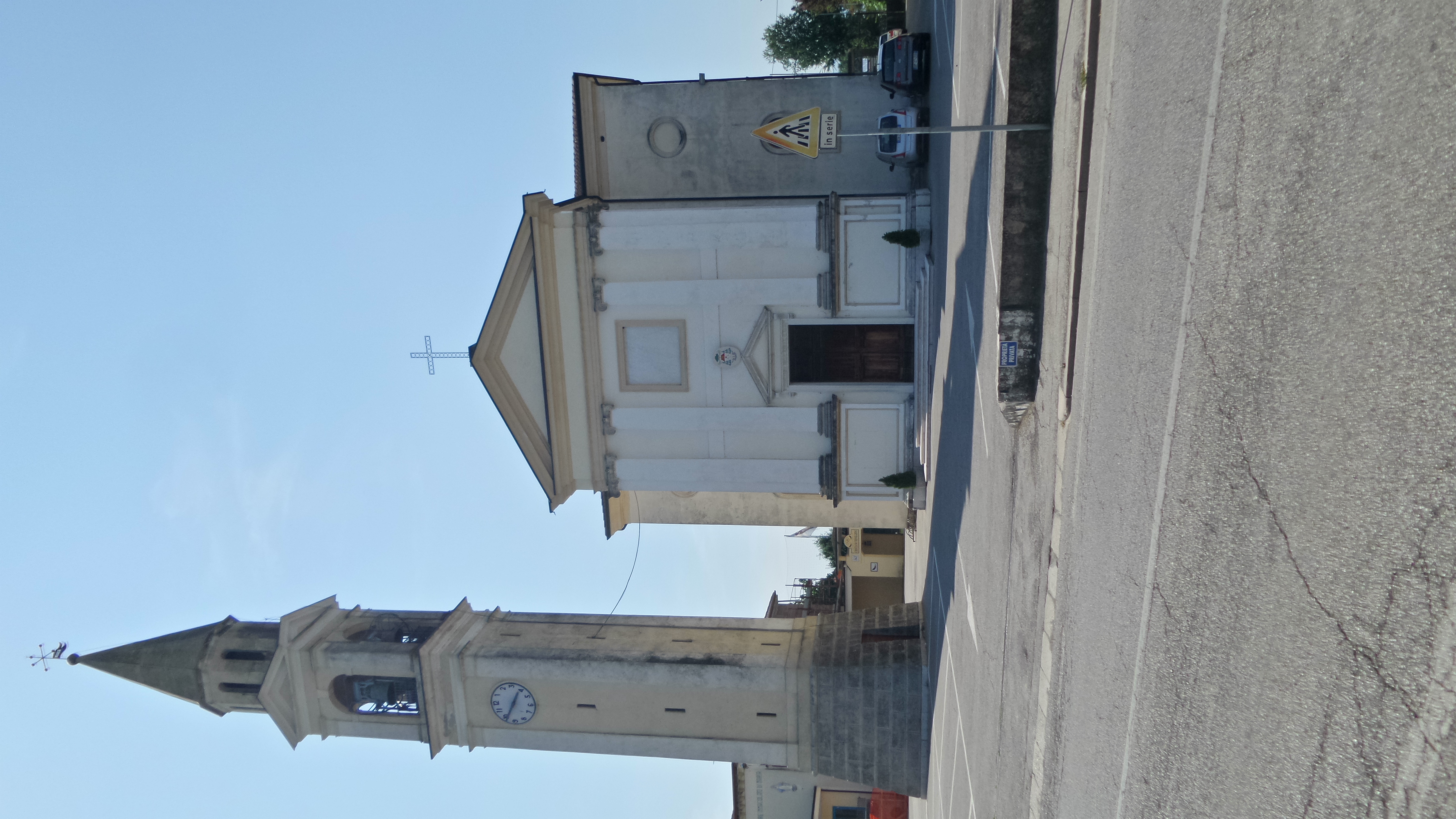
Поццолеоне (Pozzoleone, Pozzoleone)
.svg)
- коммуна Италии
 Hiking in Поццолеоне
Pozzoleone is a small town located in the Veneto region of Italy, not far from the larger cities of Vicenza and Verona. While it may not be as widely recognized as a primary hiking destination, it offers various opportunities for outdoor enthusiasts looking to explore the natural beauty of the surrounding areas.
Hiking Around Pozzoleone
-
Local Trails: The area around Pozzoleone has a network of local trails that can be suitable for both casual and more experienced hikers. These paths often wind through the rural countryside, offering views of vineyards, farmlands, and small forests typical of the Veneto region.
-
Nearby Natural Parks: If you are willing to travel a little further, you can explore nearby natural parks such as the Colli Euganei Regional Park or the Berici Hills. Both locations offer a range of trails with varying difficulty levels, stunning landscapes, and opportunities to see local flora and fauna.
-
Cultural Routes: Hikes around Pozzoleone can also incorporate cultural elements, with trails leading to historical sites, traditional villages, and local monuments. You might explore old churches, farms, and scenic viewpoints that offer insights into the region's history.
-
Seasonal Hiking: Spring and fall are particularly great times for hiking in this region, as the weather is mild, and the landscapes are vibrant. Summer can be hot, while winter hiking might bring a beautiful but different experience with occasional snow.
-
Preparation: As with any hike, make sure to wear appropriate footwear, carry plenty of water, and pack snacks. It's also a good idea to check local maps or trail guides for the latest trail conditions and recommended routes.
Tips for Hikers
- Know Your Limits: Choose trails that match your fitness level and experience.
- Respect Nature: Follow the Leave No Trace principles to help preserve the natural beauty of the area.
- Local Guidance: Consider checking with local hiking clubs or guides for recommendations on trails and safety tips.
Whether you’re a local or a traveler, Pozzoleone and its surroundings can provide a quaint and enjoyable hiking experience perfect for those looking to escape urban environments and reconnect with nature.
- Страна:

- Почтовый код: 36050
- Телефонный код: 0444
- Код автомобильного номера: VI
- Координаты: 45° 38' 58" N, 11° 40' 28" E


- GPS треки (wikiloc): [Ссылка]
- Высота над уровнем моря: 56 м m
- Площадь: 11.26 кв.км
- Население: 2780
- Веб сайт: http://www.pozzoleone.org
- Википедия русская: wiki(ru)
- Википедия английская: wiki(en)
- Википедия национальная: wiki(it)
- Хранилище Wikidata: Wikidata: Q46451
- Катеория в википедии: [Ссылка]
- код Freebase: [/m/0g999g]
- код GeoNames: Альт: [6536625]
- код VIAF: Альт: [238170119]
- ID отношения в OpenStreetMap: [45593]
- UN/LOCODE: [ITZVZ]
- код ISTAT: 024082
- кадастровый код Италии: G957
Граничит с регионами:
Сан-Пьетро-ин-Гу
- коммуна Италии
Hiking in Сан-Пьетро-ин-Гу
San Pietro in Gu is a quaint village located in the Veneto region of Italy, nestled among the rolling hills and picturesque countryside. While it may not be a well-known hiking destination, the surrounding area offers various opportunities for outdoor enthusiasts....
- Страна:
- Почтовый код: 35010
- Телефонный код: 049
- Код автомобильного номера: PD
- Координаты: 45° 36' 37" N, 11° 40' 40" E
- GPS треки (wikiloc): [Ссылка]
- Высота над уровнем моря: 44 м m
- Площадь: 17.9 кв.км
- Население: 4435
- Веб сайт: [Ссылка]
Карминьано-ди-Брента
- коммуна Италии
Hiking in Карминьано-ди-Брента
Carmignano di Brenta is a charming town located in the province of Padua in the Veneto region of Italy. It is known for its beautiful natural landscapes and historical sites. Hiking in and around Carmignano di Brenta offers a variety of trails that cater to different skill levels, allowing hikers to explore the stunning countryside, forests, and hills....
- Страна:
- Почтовый код: 35010
- Телефонный код: 049
- Код автомобильного номера: PD
- Координаты: 45° 38' 0" N, 11° 42' 0" E
- GPS треки (wikiloc): [Ссылка]
- Высота над уровнем моря: 46 м m
- Площадь: 14.68 кв.км
- Население: 7576
- Веб сайт: [Ссылка]
Картильяно
- коммуна Италии
Hiking in Картильяно
Cartigliano, a charming town located in the province of Vicenza in northern Italy, is surrounded by beautiful landscapes that are suitable for hiking enthusiasts. Here are some notable aspects of hiking in and around Cartigliano:...
- Страна:
- Почтовый код: 36050
- Телефонный код: 0424
- Код автомобильного номера: VI
- Координаты: 45° 43' 0" N, 11° 42' 0" E
- GPS треки (wikiloc): [Ссылка]
- Высота над уровнем моря: 86 м m
- Площадь: 7.38 кв.км
- Население: 3788
- Веб сайт: [Ссылка]

Брессанвидо
- коммуна Италии
Hiking in Брессанвидо
Bressanvido, located in the province of Vicenza in Northern Italy, is not widely known as a major hiking destination, but it does offer access to beautiful landscapes and trails that can cater to both casual walkers and more serious hikers....
- Страна:
- Почтовый код: 36050
- Телефонный код: 0444
- Код автомобильного номера: VI
- Координаты: 45° 39' 0" N, 11° 38' 0" E
- GPS треки (wikiloc): [Ссылка]
- Высота над уровнем моря: 57 м m
- Площадь: 8.44 кв.км
- Население: 3164
- Веб сайт: [Ссылка]


Тецце-суль-Брента
- коммуна Италии
Hiking in Тецце-суль-Брента
Tezze sul Brenta is a beautiful town located in the Veneto region of northeastern Italy, nestled near the Brenta River and surrounded by the scenic foothills of the Alps. It's a lesser-known gem for hikers but offers several opportunities to explore the natural beauty and history of the area....
- Страна:
- Почтовый код: 36056
- Телефонный код: 0424
- Код автомобильного номера: VI
- Координаты: 45° 41' 24" N, 11° 42' 24" E
- GPS треки (wikiloc): [Ссылка]
- Высота над уровнем моря: 69 м m
- Площадь: 17.93 кв.км
- Население: 12817
- Веб сайт: [Ссылка]
Сандриго
- коммуна Италии
Hiking in Сандриго
Sandrigo is a charming town located in the Veneto region of Italy, surrounded by beautiful landscapes that offer plenty of opportunities for hiking enthusiasts. While Sandrigo itself may not be a major hiking destination, it is situated near various natural parks and trails that can provide a rich hiking experience....
- Страна:
- Почтовый код: 36066
- Телефонный код: 0444
- Код автомобильного номера: VI
- Координаты: 45° 40' 0" N, 11° 36' 0" E
- GPS треки (wikiloc): [Ссылка]
- Высота над уровнем моря: 64 м m
- Площадь: 27.99 кв.км
- Население: 8457
- Веб сайт: [Ссылка]


Скьявон
- коммуна Италии
Hiking in Скьявон
Schiavon, located in the Veneto region of Italy, is a charming area that offers numerous hiking opportunities, particularly through the beautiful rolling hills, vineyards, and picturesque landscapes that characterize this part of the country. While Schiavon itself may not be as famous as some other hiking destinations in Italy, it provides a serene setting for outdoor enthusiasts who enjoy exploring off-the-beaten-path locations....
- Страна:
- Почтовый код: 36060
- Телефонный код: 0444
- Код автомобильного номера: VI
- Координаты: 45° 42' 0" N, 11° 39' 0" E
- GPS треки (wikiloc): [Ссылка]
- Высота над уровнем моря: 74 м m
- Площадь: 12 кв.км
- Население: 2629
- Веб сайт: [Ссылка]
Нове
- коммуна Италии
Hiking in Нове
Nove is a charming area in Italy, known for its beautiful landscapes and rich cultural heritage. While there may not be as many established hiking trails as in more mountainous regions, the surrounding areas offer stunning nature and outdoor activities. Here are a few key points to consider when hiking in and around Nove:...
- Страна:
- Почтовый код: 36055
- Телефонный код: 0424
- Код автомобильного номера: VI
- Координаты: 45° 44' 0" N, 11° 41' 0" E
- GPS треки (wikiloc): [Ссылка]
- Высота над уровнем моря: 84 м m
- Площадь: 8.15 кв.км
- Население: 4966
- Веб сайт: [Ссылка]

Читтаделла
- коммуна Италии
Hiking in Читтаделла
Cittadella, located in the Veneto region of Italy, is known for its well-preserved medieval walls and rich history. While the town itself is small and doesn't offer extensive hiking trails, the surrounding area does present some opportunities for outdoor enthusiasts looking to enjoy nature and explore on foot....
- Страна:
- Почтовый код: 35013
- Телефонный код: 049
- Код автомобильного номера: PD
- Координаты: 45° 38' 55" N, 11° 47' 1" E
- GPS треки (wikiloc): [Ссылка]
- Высота над уровнем моря: 48 м m
- Площадь: 36.68 кв.км
- Население: 20145
- Веб сайт: [Ссылка]