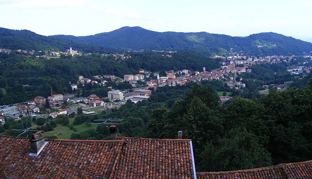
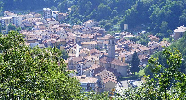
Пралунго (Pralungo, Pralungo)
- коммуна Италии
 Hiking in Пралунго
Pralungo, located in the Piedmont region of Italy, is often celebrated for its stunning natural scenery and a variety of hiking opportunities. Nestled in the Susa Valley, it offers access to beautiful landscapes, mountains, and cultural sites, which makes it a great destination for outdoor enthusiasts.
Hiking Trails
-
Sentiero dei Duchi: This trail runs through the woods and offers picturesque views of the surrounding mountains. It’s suitable for various skill levels and showcases the natural beauty of the region.
-
Lago di Malciaussia: A popular hike that leads to a scenic lake, ideal for relaxation and enjoying nature. The hike is moderate and often attracts families and casual hikers.
-
Monte Rocciamelone: For more experienced hikers, this trail leads to the summit of Monte Rocciamelone, which offers breathtaking panoramic views. It’s a challenging hike that typically requires a good level of fitness and preparation.
-
Val di Susa Pathways: The area is interconnected with several paths that can be combined for longer hikes. These pathways traverse through forests, meadows, and alongside streams.
Tips for Hiking in Pralungo
-
Gear: Ensure you have proper hiking gear, including sturdy footwear, weather-appropriate clothing, and a good backpack with water and snacks.
-
Weather: The weather can change rapidly in the mountains, so check the forecast before heading out and be prepared for varying conditions.
-
Maps and Navigation: While many trails are well-marked, having a map or a GPS device can help you stay oriented, especially in more remote areas.
-
Wildlife: Respect the local wildlife and practice Leave No Trace principles to maintain the area’s natural beauty.
-
Local Culture: Consider exploring nearby villages and enjoying local cuisine as many hiking trails lead through traditional areas where you can experience the local culture.
Overall, hiking in Pralungo is a rewarding experience that combines outdoor adventure with the charm of the Italian Alps. Whether you’re looking for a leisurely walk or a challenging trek, Pralungo offers something for every type of hiker.
- Страна:

- Почтовый код: 13899
- Телефонный код: 015
- Код автомобильного номера: BI
- Координаты: 45° 35' 24" N, 8° 2' 23" E


- GPS треки (wikiloc): [Ссылка]
- Высота над уровнем моря: 554 м m
- Площадь: 7.25 кв.км
- Население: 2406
- Веб сайт: http://www.comunedipralungo.it/
- Википедия русская: wiki(ru)
- Википедия английская: wiki(en)
- Википедия национальная: wiki(it)
- Хранилище Wikidata: Wikidata: Q18149
- Катеория в википедии: [Ссылка]
- код Freebase: [/m/0gr2dz]
- код GeoNames: Альт: [6539392]
- код VIAF: Альт: [236181226]
- ID отношения в OpenStreetMap: [45533]
- код ISTAT: 096049
- кадастровый код Италии: G980
Граничит с регионами:

Биелла
- коммуна Италии
Hiking in Биелла
Biella, located in the Piedmont region of northern Italy, is a fantastic destination for hiking enthusiasts. The area is characterized by its stunning landscapes, rolling hills, and the backdrop of the surrounding Alps. Here are some highlights and key information regarding hiking in Biella:...
- Страна:
- Почтовый код: 13900
- Телефонный код: 015
- Код автомобильного номера: BI
- Координаты: 45° 33' 59" N, 8° 3' 12" E
- GPS треки (wikiloc): [Ссылка]
- Высота над уровнем моря: 420 м m
- Площадь: 46.69 кв.км
- Население: 44616
- Веб сайт: [Ссылка]
Сальяно-Микка
- коммуна Италии
Hiking in Сальяно-Микка
Sagliano Micca is a charming municipality located in the Biella region of Piedmont, Italy. It is nestled in the beautiful foothills of the Alps, making it an excellent destination for hiking enthusiasts. Here are some highlights and tips regarding hiking in and around Sagliano Micca:...
- Страна:
- Почтовый код: 13816
- Телефонный код: 015
- Код автомобильного номера: BI
- Координаты: 45° 37' 0" N, 8° 3' 0" E
- GPS треки (wikiloc): [Ссылка]
- Высота над уровнем моря: 589 м m
- Площадь: 14.61 кв.км
- Население: 1610
- Веб сайт: [Ссылка]
Толленьо
- коммуна Италии
Hiking in Толленьо
Tollegno is a charming village located in the Piedmont region of northern Italy, nestled in the foothills of the Biella Alps. Hiking in this area offers a fantastic opportunity to explore beautiful landscapes, rich biodiversity, and cultural heritage....
- Страна:
- Почтовый код: 13818
- Телефонный код: 015
- Код автомобильного номера: BI
- Координаты: 45° 35' 0" N, 8° 3' 0" E
- GPS треки (wikiloc): [Ссылка]
- Высота над уровнем моря: 495 м m
- Площадь: 3.31 кв.км
- Население: 2469
- Веб сайт: [Ссылка]