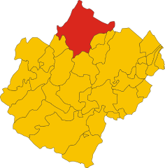
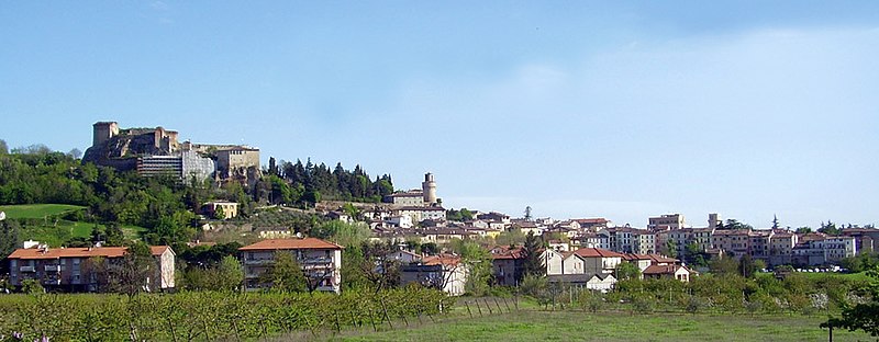
Предаппио (Predappio, Predappio)
.svg)
- коммуна Италии
 Hiking in Предаппио
Predappio, located in the Emilia-Romagna region of Italy, is surrounded by beautiful countryside and offers various hiking opportunities. The area is characterized by rolling hills, wooded areas, and stunning views, making it a great destination for outdoor activities.
Hiking Trails
-
Sentiero dei Parchi: This trail is part of a network that connects different parks in the region, offering scenic views and a chance to explore the local flora and fauna.
-
Monte Amandola: For those looking for a more challenging hike, the paths leading to Monte Amandola provide a rewarding trek, with panoramic vistas at the summit.
-
Foreste Casentinesi: A short distance from Predappio, this forest area offers numerous trails through ancient woods, with opportunities for wildlife spotting and enjoying nature's tranquility.
Difficulty Levels
Hiking trails around Predappio vary in difficulty from easy walks suitable for families to more challenging hikes that require a good level of fitness. Always check trail information and difficulty levels before starting your hike.
Preparation and Tips
- Maps and Guides: Having a trail map or a GPS app is helpful for navigation.
- Footwear: Wear sturdy hiking boots to ensure comfort and safety on various terrains.
- Weather: Check the weather forecast before your hike, as conditions can change rapidly in the hills.
- Hydration and Snacks: Bring enough water and snacks to stay energized throughout your hike.
Safety Considerations
Always let someone know your hiking plans and estimated return time. It’s also important to respect wildlife and the environment while hiking.
Conclusion
Hiking in and around Predappio provides a wonderful opportunity to enjoy the natural beauty of the Emilia-Romagna region. Whether you’re a beginner or an experienced hiker, you can find trails that suit your preferences and enjoy the stunning landscapes.
- Страна:

- Почтовый код: 47016
- Телефонный код: 0543
- Код автомобильного номера: FC
- Координаты: 44° 6' 15" N, 11° 59' 6" E


- GPS треки (wikiloc): [Ссылка]
- Высота над уровнем моря: 133 м m
- Площадь: 91.39 кв.км
- Население: 6287
- Веб сайт: http://www.comune.predappio.fc.it/
- Википедия русская: wiki(ru)
- Википедия английская: wiki(en)
- Википедия национальная: wiki(it)
- Хранилище Wikidata: Wikidata: Q99950
- Галерея изображений в википедии: [Ссылка]
- Катеория в википедии: [Ссылка]
- код Freebase: [/m/0f7c53]
- код GeoNames: Альт: [3169879]
- код VIAF: Альт: [168381395]
- ID отношения в OpenStreetMap: [42825]
- идентификатор местоположения ArchINFORM: [16459]
- код LCNAF: Альт: [n85178006]
- место в MusicBrainz: [cba9b516-b54c-4536-87e2-d78610d3875a]
- код TGN: [1046192]
- UN/LOCODE: [ITPRP]
- код ISTAT: 040032
- кадастровый код Италии: H017
Граничит с регионами:

Форли
- коммуна Италии
Hiking in Форли
Forlì, located in the Emilia-Romagna region of northern Italy, is surrounded by beautiful landscapes that are perfect for hiking enthusiasts. The area offers a mix of rolling hills, historical towns, and natural parks, making it an excellent destination for outdoor activities....
- Страна:
- Почтовый код: 47121–47122
- Телефонный код: 0543
- Код автомобильного номера: FC; FO
- Координаты: 44° 13' 21" N, 12° 2' 27" E
- GPS треки (wikiloc): [Ссылка]
- Высота над уровнем моря: 34 м m
- Площадь: 228.2 кв.км
- Население: 117859
- Веб сайт: [Ссылка]

Кастрокаро-Терме-е-Терра-дель-Соле
- коммуна регионе Эмилия-Романья, Италия
Hiking in Кастрокаро-Терме-е-Терра-дель-Соле
Castrocaro Terme e Terra del Sole, located in the Emilia-Romagna region of Italy, offers a unique blend of natural beauty, historical significance, and wellness. Here are some highlights of hiking in this beautiful area:...
- Страна:
- Почтовый код: 47011
- Телефонный код: 0543
- Код автомобильного номера: FC
- Координаты: 44° 11' 3" N, 11° 56' 38" E
- GPS треки (wikiloc): [Ссылка]
- Высота над уровнем моря: 68 м m
- Площадь: 38.95 кв.км
- Население: 6350
- Веб сайт: [Ссылка]
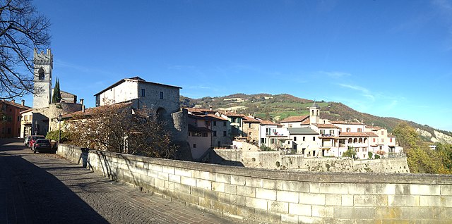

Чивителла-Ди-Романья
- коммуна Италии
Hiking in Чивителла-Ди-Романья
Civitella di Romagna is a charming village located in the Emilia-Romagna region of Italy, nestled in the heart of the Apennine mountains. The area offers stunning landscapes, beautiful trails, and a rich history, making it an excellent destination for hiking enthusiasts....
- Страна:
- Почтовый код: 47012
- Телефонный код: 0543
- Код автомобильного номера: FC
- Координаты: 44° 0' 0" N, 11° 56' 0" E
- GPS треки (wikiloc): [Ссылка]
- Высота над уровнем моря: 219 м m
- Площадь: 117.93 кв.км
- Население: 3758
- Веб сайт: [Ссылка]


Довадола
- коммуна регионе Эмилия-Романья, Италия
Hiking in Довадола
Dovadola is a charming village in the Emilia-Romagna region of Italy, nestled in the picturesque Apennine Mountains. It offers a wonderful experience for hikers looking to explore the beauty of the Italian countryside....
- Страна:
- Почтовый код: 47013
- Телефонный код: 0543
- Код автомобильного номера: FC
- Координаты: 44° 7' 0" N, 11° 53' 0" E
- GPS треки (wikiloc): [Ссылка]
- Высота над уровнем моря: 143 м m
- Площадь: 38.97 кв.км
- Население: 1581
- Веб сайт: [Ссылка]

Галеата
- коммуна регионе Эмилия-Романья, Италия
Hiking in Галеата
Galeata is a charming rural area located in the Emilia-Romagna region of Italy, known for its picturesque landscapes and rich natural heritage. Here are some insights into hiking in and around Galeata:...
- Страна:
- Почтовый код: 47010
- Телефонный код: 0543
- Код автомобильного номера: FC
- Координаты: 44° 0' 0" N, 11° 55' 0" E
- GPS треки (wikiloc): [Ссылка]
- Высота над уровнем моря: 237 м m
- Площадь: 63.13 кв.км
- Население: 2511
- Веб сайт: [Ссылка]


Мельдола
- коммуна Италии
Hiking in Мельдола
Meldola, located in the Emilia-Romagna region of Italy, is surrounded by beautiful landscapes and offers some great opportunities for hiking enthusiasts. The area features rolling hills, vineyards, and picturesque countryside, which make for scenic trails....
- Страна:
- Почтовый код: 47014
- Телефонный код: 0543
- Код автомобильного номера: FC
- Координаты: 44° 8' 0" N, 12° 4' 0" E
- GPS треки (wikiloc): [Ссылка]
- Высота над уровнем моря: 58 м m
- Площадь: 79.08 кв.км
- Население: 9978
- Веб сайт: [Ссылка]


Рокка-Сан-Кашано
- коммуна Италии
Hiking in Рокка-Сан-Кашано
Rocca San Casciano, located in the Emilia-Romagna region of Italy, is a charming village with beautiful landscapes perfect for hiking enthusiasts. The area is characterized by rolling hills, lush forests, and scenic views, making it an ideal destination for those looking to explore the outdoors....
- Страна:
- Почтовый код: 47017
- Телефонный код: 0543
- Код автомобильного номера: FC
- Координаты: 44° 4' 0" N, 11° 51' 0" E
- GPS треки (wikiloc): [Ссылка]
- Высота над уровнем моря: 210 м m
- Площадь: 50.56 кв.км
- Население: 1874
- Веб сайт: [Ссылка]