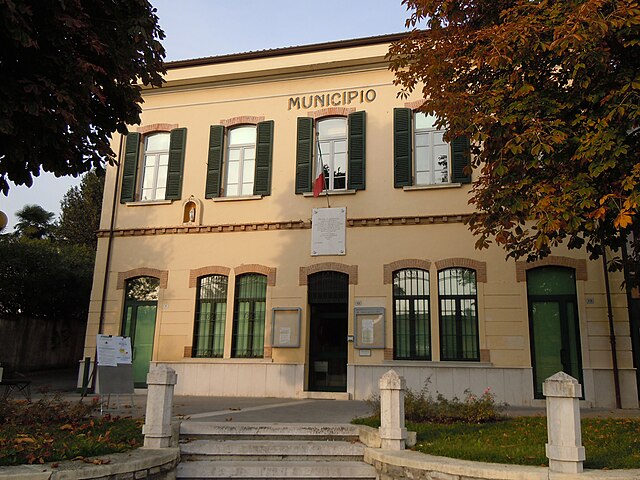
Превалле (Prevalle, Prevalle)
.svg)
- коммуна Италии
 Hiking in Превалле
Prevalle, a quaint village located in the province of Brescia, Italy, offers a number of hiking opportunities that showcase the beautiful landscapes of the region. Here are some highlights and tips for hiking in Prevalle:
Trails and Routes
-
Local Trails: Prevalle is surrounded by lush fields and rolling hills, with several local trails that cater to different skill levels. Popular routes often lead you through vineyards, olive groves, and scenic viewpoints overlooking the countryside.
-
Monte Netto: One notable hike is to Monte Netto, which provides stunning panoramas of the surrounding area. The trail to the summit involves moderate elevation gain and rewards climbers with breathtaking views of Lake Iseo and the surrounding mountains.
-
Nature Reserves: The nearby natural reserves offer diverse flora and fauna. Look for trails through forested areas and areas rich in biodiversity, perfect for nature enthusiasts.
Tips for Hiking in Prevalle
-
Season: The best time to hike in Prevalle is during spring and autumn when the weather is mild and the landscape is vibrant. Summers can be warm, and winters may see snow at higher elevations, so plan accordingly.
-
Gear: Comfortable hiking shoes are essential due to some rocky and uneven terrain. Additionally, carry adequate water, snacks, sun protection, and weather-appropriate clothing.
-
Map and Navigation: While many trails are marked, it’s advisable to have a physical map or a hiking app on your phone, as GPS signals can sometimes be unreliable in mountainous areas.
-
Local Regulations: Respect local guidelines regarding trails, wildlife, and conservation efforts. Trails may be subject to seasonal closures or restrictions, especially during hunting season.
-
Group Hikes: If you’re new to the area or hiking in general, consider joining a local hiking group or tour for a guided experience.
Cultural Aspects
Hiking in Prevalle also offers the opportunity to explore local culture, including quaint villages, historical sites, and traditional cuisine. Don’t miss the chance to enjoy local food and wine at nearby restaurants or vineyards after your hike.
Overall, Prevalle is a hidden gem for hikers seeking scenic trails and an authentic Italian experience amidst nature. Enjoy your hiking adventure!
- Страна:

- Почтовый код: 25080
- Телефонный код: 030
- Код автомобильного номера: BS
- Координаты: 45° 33' 0" N, 10° 25' 0" E


- GPS треки (wikiloc): [Ссылка]
- Высота над уровнем моря: 180 м m
- Площадь: 9.99 кв.км
- Население: 6943
- Веб сайт: http://www.comune.prevalle.bs.it/
- Википедия русская: wiki(ru)
- Википедия английская: wiki(en)
- Википедия национальная: wiki(it)
- Хранилище Wikidata: Wikidata: Q111528
- Катеория в википедии: [Ссылка]
- код Freebase: [/m/047dh8]
- код GeoNames: Альт: [6542611]
- код VIAF: Альт: [236180412]
- ID отношения в OpenStreetMap: [45239]
- UN/LOCODE: [ITPVA]
- код ISTAT: 017155
- кадастровый код Италии: H055
Граничит с регионами:

Бедиццоле
- коммуна Италии
Hiking in Бедиццоле
Bedizzole is a charming town located in northern Italy, near Lake Garda, and surrounded by beautiful landscapes that are ideal for hiking enthusiasts. The area offers a range of trails that cater to different skill levels, from gentle walks suitable for families to more challenging hikes for experienced adventurers....
- Страна:
- Почтовый код: 25081
- Телефонный код: 030
- Код автомобильного номера: BS
- Координаты: 45° 31' 0" N, 10° 25' 0" E
- GPS треки (wikiloc): [Ссылка]
- Высота над уровнем моря: 184 м m
- Площадь: 26.44 кв.км
- Население: 12299
- Веб сайт: [Ссылка]
Кальваджезе-делла-Ривьера
- коммуна Италии
Hiking in Кальваджезе-делла-Ривьера
Calvagese della Riviera, located in the province of Brescia in Northern Italy, offers various hiking opportunities that allow you to explore its picturesque landscapes and natural beauty. Here are some key points to consider when hiking in this area:...
- Страна:
- Почтовый код: 25080
- Телефонный код: 030
- Код автомобильного номера: BS
- Координаты: 45° 32' 3" N, 10° 26' 33" E
- GPS треки (wikiloc): [Ссылка]
- Высота над уровнем моря: 225 м m
- Площадь: 11.74 кв.км
- Население: 3566
- Веб сайт: [Ссылка]

Гавардо
- коммуна Италии
Hiking in Гавардо
Gavardo, located in the Lombardy region of Italy, offers a range of hiking opportunities amidst its beautiful natural landscapes. The area is characterized by rolling hills, picturesque vineyards, and nearby access to the larger mountain ranges such as the Alps and the Prealps....
- Страна:
- Почтовый код: 25085
- Телефонный код: 0365
- Код автомобильного номера: BS
- Координаты: 45° 35' 15" N, 10° 26' 20" E
- GPS треки (wikiloc): [Ссылка]
- Высота над уровнем моря: 199 м m
- Площадь: 29.8 кв.км
- Население: 12197
- Веб сайт: [Ссылка]
Мусколине
- коммуна Италии
Hiking in Мусколине
Muscoline, located in Northern Italy, is a delightful destination for hiking enthusiasts who appreciate natural beauty and stunning landscapes. The region is characterized by rolling hills, lush forests, and scenic views of the surrounding countryside....
- Страна:
- Почтовый код: 25080
- Телефонный код: 0365
- Код автомобильного номера: BS
- Координаты: 45° 34' 0" N, 10° 28' 0" E
- GPS треки (wikiloc): [Ссылка]
- Высота над уровнем моря: 272 м m
- Площадь: 10.08 кв.км
- Население: 2654
- Веб сайт: [Ссылка]
Нуволенто
- коммуна Италии
Hiking in Нуволенто
Nuvolento is a charming village located in the Lombardy region of Italy, nestled in the hills of the Val Sabbia area. While it may not be as famous as some other hiking destinations, it offers a range of scenic trails and beautiful landscapes perfect for outdoor enthusiasts....
- Страна:
- Почтовый код: 25080
- Телефонный код: 030
- Код автомобильного номера: BS
- Координаты: 45° 32' 40" N, 10° 23' 6" E
- GPS треки (wikiloc): [Ссылка]
- Высота над уровнем моря: 176 м m
- Площадь: 7.46 кв.км
- Население: 3957
- Веб сайт: [Ссылка]
Пайтоне
- коммуна Италии
Hiking in Пайтоне
Paitone isn't well-known in the broader hiking community, but if you're referring to a specific location or region, please provide more details. However, I can give general advice about hiking in lesser-known areas....
- Страна:
- Почтовый код: 25080
- Телефонный код: 030
- Код автомобильного номера: BS
- Координаты: 45° 33' 0" N, 10° 24' 0" E
- GPS треки (wikiloc): [Ссылка]
- Высота над уровнем моря: 177 м m
- Площадь: 8 кв.км
- Население: 2153
- Веб сайт: [Ссылка]