Рюеггисберг (Rüeggisberg, Rüeggisberg)

 Hiking in Рюеггисберг
Rüeggisberg, located in the Bernese Oberland region of Switzerland, offers a superb hiking experience with its picturesque landscapes, rolling hills, and stunning views of the Alps. Here are some highlights and tips for hiking in Rüeggisberg:
Trails:
- Rüeggisberg to Gantrisch: A popular hike that takes you through forests and scenic meadows with panoramic views. The trail is well-marked and suitable for intermediate hikers.
- Rüeggisberg to Gurnigel: This trail provides an opportunity to explore the Gantrisch Nature Park. It features diverse landscapes and is known for its beautiful wildlife and flora.
- Historical Trails: Rüeggisberg is also known for its historical significance. Some trails take you past historic sites, including old farms and a beautiful church.
Difficulty Levels:
- Beginner: There are easier trails that are suitable for families and those new to hiking.
- Intermediate: Moderate trails with some elevation gain, ideal for those with a bit of hiking experience.
- Advanced: More challenging routes that may require good fitness levels and experience.
Tips for Hiking:
- Season: The best time for hiking in Rüeggisberg is during the spring to autumn months (May to October) when the weather is generally mild, and the trails are accessible.
- Weather: Always check the weather forecast before heading out, as conditions can change rapidly in the mountains.
- Gear: Wear appropriate hiking boots and clothing. Consider layering your clothing to adapt to changing temperatures.
- Safety: Carry a map or GPS device, adequate water, snacks, and a first-aid kit. Inform someone about your planned route and estimated return time.
- Respect Nature: Stick to marked paths, and take your trash with you to help preserve the natural beauty.
Additional Attractions:
- Local Cuisine: After a hike, try local Swiss dishes in Rüeggisberg’s quaint restaurants.
- Cultural Sites: Visit historical sites in Rüeggisberg, including churches and charming traditional Swiss architecture.
With its stunning scenery, diverse trails, and rich cultural heritage, hiking in Rüeggisberg is an enriching experience for hikers of all skill levels. Enjoy your adventure!
- Страна:

- Почтовый код: 3088, 3089, 3155
- Телефонный код: 031
- Код автомобильного номера: BE
- Координаты: 46° 49' 18" N, 7° 26' 22" E


- GPS треки (wikiloc): [Ссылка]
- Высота над уровнем моря: 775 м m
- Площадь: 37.76 кв.км
- Население: 1789
- Веб сайт: http://www.rueggisberg.ch
- Википедия русская: wiki(ru)
- Википедия английская: wiki(en)
- Википедия национальная: wiki(de)
- Хранилище Wikidata: Wikidata: Q66387
- Катеория в википедии: [Ссылка]
- код Freebase: [/m/0fthty]
- код GeoNames: Альт: [7286974]
- код VIAF: Альт: [149782177]
- ID отношения в OpenStreetMap: [1682634]
- идентификатор местоположения ArchINFORM: [15720]
- идентификатор HDS: [503]
- код швейцарского муниципалитета: [0880]
Граничит с регионами:

Рюшег
Hiking in Рюшег
Rüschegg is a picturesque area located in the Bernese Oberland region of Switzerland, known for its stunning landscapes, rich flora and fauna, and a variety of hiking trails suitable for different skill levels. Here are some key points to consider when hiking in Rüschegg:...
- Страна:
- Почтовый код: 3153, 3154
- Телефонный код: 031
- Код автомобильного номера: BE
- Координаты: 46° 44' 44" N, 7° 24' 21" E
- GPS треки (wikiloc): [Ссылка]
- Высота над уровнем моря: 1313 м m
- Площадь: 57.40 кв.км
- Население: 1630
- Веб сайт: [Ссылка]

Риггисберг
Hiking in Риггисберг
Riggisberg, located in the Bernese Oberland region of Switzerland, offers beautiful hiking opportunities with stunning views of the Swiss Alps and the surrounding countryside. Here are some highlights about hiking in Riggisberg:...
- Страна:
- Почтовый код: 3132
- Телефонный код: 031
- Код автомобильного номера: BE
- Координаты: 46° 48' 34" N, 7° 28' 41" E
- GPS треки (wikiloc): [Ссылка]
- Высота над уровнем моря: 762 м m
- Площадь: 29.9 кв.км
- Население: 2491
- Веб сайт: [Ссылка]


Дерштеттен
Hiking in Дерштеттен
Därstetten, a picturesque village in the Bernese Oberland region of Switzerland, offers excellent opportunities for hiking enthusiasts. Surrounded by stunning alpine scenery, the area provides a variety of trails suitable for different skill levels, from leisurely walks to more challenging hikes....
- Страна:
- Почтовый код: 3763
- Телефонный код: 033
- Код автомобильного номера: BE
- Координаты: 46° 40' 19" N, 7° 29' 18" E
- GPS треки (wikiloc): [Ссылка]
- Высота над уровнем моря: 1329 м m
- Площадь: 32.8 кв.км
- Население: 862
- Веб сайт: [Ссылка]

Обербальм
Hiking in Обербальм
Oberbalm is a beautiful area located in Switzerland, known for its stunning landscapes and outdoor activities, including hiking. Nestled near the city of Bern, Oberbalm offers impressive views of the surrounding mountains and countryside, making it a great destination for hikers of all levels....
- Страна:
- Почтовый код: 3096
- Телефонный код: 031
- Код автомобильного номера: BE
- Координаты: 46° 51' 56" N, 7° 24' 33" E
- GPS треки (wikiloc): [Ссылка]
- Высота над уровнем моря: 776 м m
- Площадь: 12.40 кв.км
- Население: 869
- Веб сайт: [Ссылка]


Блуменштайн
Hiking in Блуменштайн
Blumenstein is a picturesque area that offers a variety of hiking opportunities, perfect for nature lovers and outdoor enthusiasts. Located in Switzerland, it’s known for its stunning landscapes, rich biodiversity, and peaceful environment. Here are some key highlights and tips for hiking in Blumenstein:...
- Страна:
- Почтовый код: 3638
- Телефонный код: 033
- Код автомобильного номера: BE
- Координаты: 46° 43' 59" N, 7° 30' 59" E
- GPS треки (wikiloc): [Ссылка]
- Высота над уровнем моря: 659 м m
- Площадь: 15.52 кв.км
- Население: 1227
- Веб сайт: [Ссылка]

Нидермулерн
Hiking in Нидермулерн
Niedermühlen is a picturesque area in Switzerland known for its beautiful landscapes and hiking opportunities. Nestled in the Emmental region, it offers diverse trails that cater to various skill levels, making it suitable for both beginners and experienced hikers....
- Страна:
- Почтовый код: 3087
- Телефонный код: 031
- Код автомобильного номера: BE
- Координаты: 46° 51' 41" N, 7° 27' 56" E
- GPS треки (wikiloc): [Ссылка]
- Высота над уровнем моря: 829 м m
- Площадь: 7.25 кв.км
- Население: 499
- Веб сайт: [Ссылка]

Кауфдорф
Hiking in Кауфдорф
Kaufdorf, a small municipality in Switzerland, is surrounded by beautiful nature and offers various hiking opportunities suitable for different skill levels. The area is characterized by rolling hills, picturesque landscapes, and scenic views of the nearby Alps....
- Страна:
- Почтовый код: 3126
- Телефонный код: 031
- Код автомобильного номера: BE
- Координаты: 46° 49' 59" N, 7° 28' 59" E
- GPS треки (wikiloc): [Ссылка]
- Высота над уровнем моря: 560 м m
- Площадь: 2.1 кв.км
- Население: 1085
- Веб сайт: [Ссылка]

Рюмлиген
Hiking in Рюмлиген
Rümligen is a small municipality in the canton of Bern, Switzerland, known for its beautiful natural landscapes and access to hiking trails. The area is characterized by rolling hills, forests, and scenic views of the surrounding Bernese Alps, making it a great destination for hikers of all levels....
- Страна:
- Почтовый код: 3128
- Телефонный код: 031
- Код автомобильного номера: BE
- Координаты: 46° 49' 51" N, 7° 29' 54" E
- GPS треки (wikiloc): [Ссылка]
- Высота над уровнем моря: 606 м m
- Площадь: 4.65 кв.км
- Население: 440
- Веб сайт: [Ссылка]
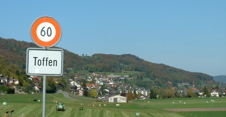
Тоффен
Hiking in Тоффен
Toffen, located in the Canton of Bern in Switzerland, is a charming village surrounded by stunning natural scenery, making it an excellent place for hiking enthusiasts. The region offers a variety of trails suitable for all levels of hikers, from leisurely walks to more challenging routes....
- Страна:
- Почтовый код: 3125
- Телефонный код: 031
- Код автомобильного номера: BE
- Координаты: 46° 51' 32" N, 7° 29' 33" E
- GPS треки (wikiloc): [Ссылка]
- Высота над уровнем моря: 530 м m
- Площадь: 4.88 кв.км
- Население: 2557
- Веб сайт: [Ссылка]

Schwarzenburg
Hiking in Schwarzenburg
Schwarzenburg is a charming village located in the canton of Bern, Switzerland, surrounded by stunning natural landscapes that make it an excellent destination for hiking enthusiasts. The region is characterized by rolling hills, lush forests, and breathtaking views of the surrounding mountains....
- Страна:
- Почтовый код: 3183; 3157; 3152; 3150; 3148
- Код автомобильного номера: BE
- Координаты: 46° 49' 0" N, 7° 20' 0" E
- GPS треки (wikiloc): [Ссылка]
- Высота над уровнем моря: 792 м m
- Площадь: 44.88 кв.км
- Население: 6827
- Веб сайт: [Ссылка]