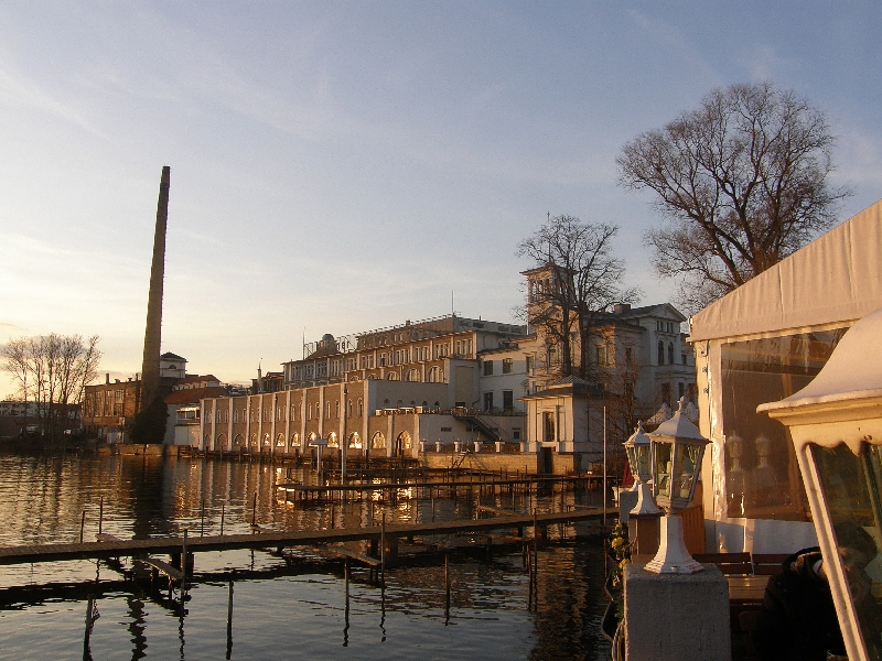
Рансдорф (Rahnsdorf, Rahnsdorf)

- район в Берлине
 Hiking in Рансдорф
Rahnsdorf, a picturesque neighborhood located in the eastern part of Berlin, Germany, offers some charming hiking opportunities, particularly for those looking to escape the hustle and bustle of city life and enjoy some natural landscapes. While not as mountainous as some other hiking destinations, Rahnsdorf is surrounded by beautiful areas that provide lovely trails.
Local Attractions and Trails
-
Müggelsee Lake: This large lake is located nearby and offers several trails around its perimeter. You can enjoy scenic walks, with opportunities to see local wildlife and beautiful views of the water.
-
Klein Venedig: This delightful area at the edge of the Dahme River features picturesque canals and wooden houses that resemble a small Venice. It’s a great place for a leisurely stroll, making it perfect for a relaxing hike.
-
Schwanenlied Park: If you prefer shorter, easier walks, this park in Rahnsdorf provides charming paths through natural settings, ideal for families or those looking for a peaceful hike.
-
Dahme River Trails: Trails along the Dahme River can lead you on longer hikes connecting to various natural reserves and parks. These paths are often well-marked and provide great opportunities for bird watching and enjoying the flora and fauna of the area.
-
Nature Reserves: Nearby areas like the "Nature Reserve Müggelspree" offer more extensive hiking paths through diverse landscapes, including forests, wetlands, and meadows.
Hiking Tips
-
Best Time to Visit: The best time for hiking in Rahnsdorf is during the spring and autumn months, when the weather is typically mild, and the landscapes are particularly beautiful.
-
Trail Maps: Before heading out, it’s a good idea to check for trail maps or apps that can provide you with up-to-date information and navigation assistance.
-
Wildlife: Keep an eye out for local wildlife, including various bird species and other animals endemic to the region.
-
Gear: While the trails are generally easy to moderate, wearing appropriate hiking shoes, bringing water, and wearing sun protection is advisable.
-
Local Cuisine: After your hike, consider stopping at one of the local eateries to enjoy some traditional German cuisine.
Whether you’re looking for a leisurely walk or a longer hike, Rahnsdorf provides an excellent blend of nature and tranquility close to Berlin. Happy hiking!
- Страна:

- Координаты: 52° 26' 0" N, 13° 42' 0" E


- GPS треки (wikiloc): [Ссылка]
- Высота над уровнем моря: 36 м m
- Площадь: 21.5 кв.км
- Википедия английская: wiki(en)
- Википедия национальная: wiki(de)
- Хранилище Wikidata: Wikidata: Q563583
- Галерея изображений в википедии: [Ссылка]
- Катеория в википедии: [Ссылка]
- Карты в википедии: [Ссылка]
- код Freebase: [/m/0bs1mmx]
- код GeoNames: Альт: [2850850]
- код VIAF: Альт: [234759412]
- код GND: Альт: [4398646-8]
- идентификатор местоположения ArchINFORM: [43324]
- код темы Quora: [Rahnsdorf]
Граничит с регионами:


Кёпеник
- район в Берлине
Hiking in Кёпеник
Köpenick is a district in the southeast of Berlin, Germany, and is known for its beautiful natural landscapes, historic architecture, and proximity to water. While Köpenick itself is more urban than rural, there are several opportunities for hiking and outdoor activities in and around the area. Here are some highlights for hiking in Köpenick:...
- Страна:
- Почтовый код: 12587; 12559; 12557; 12555; 12459
- Координаты: 52° 26' 45" N, 13° 34' 38" E
- GPS треки (wikiloc): [Ссылка]
- Высота над уровнем моря: 32 м m
- Площадь: 34.9 кв.км
- Население: 62569

Фридрихсхаген
- район в Берлине
Hiking in Фридрихсхаген
Friedrichshagen is a charming district located in the eastern part of Berlin, Germany. It’s situated along the shores of the Müggelsee, which is the largest lake in Berlin, and surrounded by beautiful natural landscapes, making it a great spot for hiking and outdoor activities....
- Страна:
- Координаты: 52° 27' 0" N, 13° 37' 0" E
- GPS треки (wikiloc): [Ссылка]
- Высота над уровнем моря: 38 м m
- Площадь: 14 кв.км
- Население: 18793


Мюггельхайм
- район в Берлине
Hiking in Мюггельхайм
Müggelheim, located in the district of Treptow-Köpenick in Berlin, Germany, is a great destination for hiking enthusiasts seeking a blend of nature, tranquility, and scenic views. This area is known for its lush forests, serene lakes, and extensive walking trails. Here are some highlights and tips for hiking in Müggelheim:...
- Страна:
- Координаты: 52° 24' 0" N, 13° 39' 0" E
- GPS треки (wikiloc): [Ссылка]
- Высота над уровнем моря: 36 м m
- Площадь: 22.2 кв.км
- Население: 6463