Рамлинсбург (Ramlinsburg, Ramlinsburg)

 Hiking in Рамлинсбург
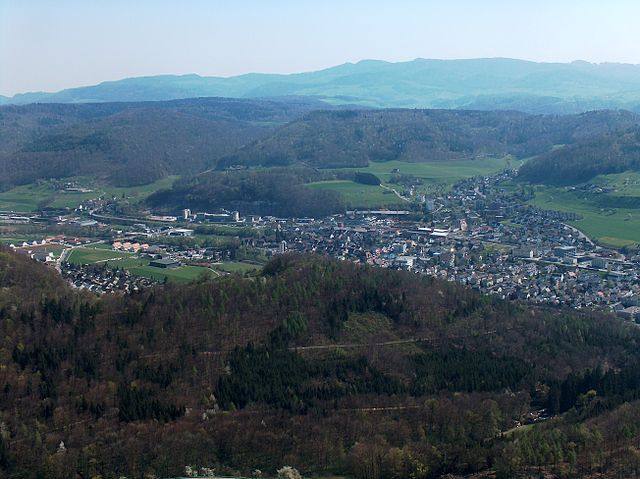
Ramlinsburg is a serene area known for its picturesque landscapes and hiking opportunities. While I don't have specific trails to mention directly from Ramlinsburg, I can provide general guidance that you might find useful for hiking in such regions.
Hiking in Ramlinsburg - General Guidelines:
-
Trail Selection: Check local hiking resources or maps for trails that match your skill level. Many regions offer easy, moderate, and challenging trails.
-
Preparation: Ensure you're well-prepared. Wear appropriate footwear, carry enough water, snacks, and maybe even a first-aid kit.
-
Weather Awareness: Always check the local weather conditions beforehand and be prepared for changes in weather.
-
Leave No Trace: Follow the principles of Leave No Trace. This means disposing of waste properly, respecting wildlife, and sticking to trails to preserve the natural environment.
-
Safety First: Inform someone about your hiking plans and expected return time. Carry a map and/or GPS for navigation.
-
Wildlife: Be aware of the local wildlife. It’s important to know how to behave when encountering animals, as well as understanding which species are common in the area.
-
Local Regulations: Be familiar with any local regulations regarding hiking, camping, and other outdoor activities. Some areas may have restrictions to protect wildlife and natural habitats.
-
Explore Local Features: Ramlinsburg may have unique geological features, historical landmarks, or viewpoints that are worth checking out.
Before heading out, consider visiting local outdoor shops or visitor centers for more specific details on trails and conditions in Ramlinsburg, as they can provide the most up-to-date information. Happy hiking!
- Страна:

- Почтовый код: 4433
- Телефонный код: 061
- Код автомобильного номера: BL
- Координаты: 47° 27' 1" N, 7° 46' 6" E


- GPS треки (wikiloc): [Ссылка]
- Высота над уровнем моря: 520 м m
- Площадь: 2.24 кв.км
- Население: 746
- Веб сайт: http://www.ramlinsburg.ch
- Википедия русская: wiki(ru)
- Википедия английская: wiki(en)
- Википедия национальная: wiki(de)
- Хранилище Wikidata: Wikidata: Q66529
- Катеория в википедии: [Ссылка]
- код Freebase: [/m/0g6fb8]
- код GeoNames: Альт: [7286850]
- код VIAF: Альт: [236596018]
- ID отношения в OpenStreetMap: [1683691]
- идентификатор HDS: [1214]
- код швейцарского муниципалитета: [2832]
Граничит с регионами:


Бубендорф
Hiking in Бубендорф
Bubendorf is a small municipality located in the canton of Basel-Landschaft in Switzerland. Although it may not be as widely known as some of the larger hiking destinations in the region, it offers a variety of scenic trails and opportunities for outdoor activities....
- Страна:
- Почтовый код: 4416
- Телефонный код: 061
- Код автомобильного номера: BL
- Координаты: 47° 26' 45" N, 7° 44' 13" E
- GPS треки (wikiloc): [Ссылка]
- Высота над уровнем моря: 376 м m
- Площадь: 10.81 кв.км
- Население: 4339
- Веб сайт: [Ссылка]

Лаузен
Hiking in Лаузен
Lausen, located in the region of Basel-Landschaft in Switzerland, is surrounded by beautiful landscapes that offer various hiking opportunities. While Lausen itself may not be a highly renowned hiking destination, its proximity to the Jura mountains and the Basel region means there are plenty of trails to explore nearby....
- Страна:
- Почтовый код: 4415
- Телефонный код: 061
- Код автомобильного номера: BL
- Координаты: 47° 28' 21" N, 7° 45' 35" E
- GPS треки (wikiloc): [Ссылка]
- Высота над уровнем моря: 338 м m
- Площадь: 5.56 кв.км
- Население: 5148
- Веб сайт: [Ссылка]