Расто (Rasteau, Rasteau)

- коммуна во Франции
 Hiking in Расто
Rasteau, a charming village located in the Vaucluse department of Provence, France, is not only known for its picturesque landscapes and rich wines but also offers several excellent hiking opportunities. Here are some aspects of hiking in and around Rasteau:
Scenic Trails
-
Vineyard Walks: The region surrounding Rasteau is characterized by its lush vineyards. You can find trails that take you through these stunning fields while enjoying views of the Dentelles de Montmirail mountains.
-
Local Trails: There are various marked trails in the area, suitable for different skill levels. These trails can take you through olive groves, lavender fields, and offer panoramic views of the surrounding landscape.
Nature Reserves
- The nearby Dentelles de Montmirail offers more challenging hikes with rocky terrains and breathtaking vistas. These trails are often more rugged and suited for experienced hikers. Look out for the unique limestone formations and rich biodiversity.
Cultural Hiking
- Hiking in Rasteau also provides a chance to explore the village itself, its historical sites, and the local wine culture. You can combine hiking with vineyard tours or wine tastings to make the most of your experience.
Hiking Seasons
- While hiking is enjoyable year-round, the best times to hike in Rasteau are during the spring (April to June) and fall (September to October). The weather is typically mild, and the landscapes are vibrant with blooming flowers and autumnal colors.
Preparation
- Ensure you're well-equipped with appropriate hiking boots, a map or GPS device (as some trails can be less marked), water, and snacks. It’s also wise to check the weather forecast and trail conditions before you set out.
Local Tips
- Consider visiting the local tourist office in Rasteau for updated trail maps and information about guided hikes or group tours.
Overall, Rasteau is a fantastic base for outdoor enthusiasts, combining the beauty of nature with cultural exploits in one of France's stunning regions. Happy hiking!
- Страна:

- Почтовый код: 84110
- Координаты: 44° 13' 49" N, 4° 59' 13" E


- GPS треки (wikiloc): [Ссылка]
- Площадь: 18.81 кв.км
- Население: 851
- Веб сайт: http://www.rasteau.fr
- Википедия русская: wiki(ru)
- Википедия английская: wiki(en)
- Википедия национальная: wiki(fr)
- Хранилище Wikidata: Wikidata: Q139613
- Катеория в википедии: [Ссылка]
- код Freebase: [/m/02vmp52]
- код GeoNames: Альт: [2984386]
- номер SIREN: [218400968]
- код BNF: [15278076t]
- код темы Quora: [Rasteau]
- код муниципалитета INSEE: 84096
Граничит с регионами:

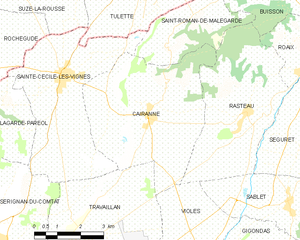
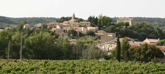
Керанн
- коммуна во Франции
Hiking in Керанн
Cairanne, located in the Provence region of France, is a charming village known for its beautiful landscapes and vineyards. While Cairanne itself is relatively small, it serves as a great base for exploring the surrounding countryside and enjoying hiking opportunities in the Vaucluse area. Here are some aspects to consider when hiking in and around Cairanne:...
- Страна:
- Почтовый код: 84290
- Координаты: 44° 13' 59" N, 4° 56' 1" E
- GPS треки (wikiloc): [Ссылка]
- Площадь: 22.51 кв.км
- Население: 1062
- Веб сайт: [Ссылка]
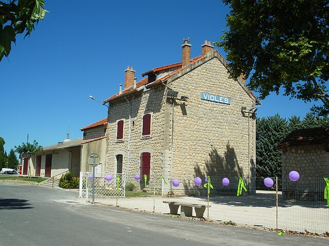

Вьоле
- коммуна во Франции
Hiking in Вьоле
Violès is a charming commune located in the Vaucluse department in the southeastern part of France. The area is known for its picturesque landscapes, vineyards, and proximity to the stunning natural beauty of the Provence region, making it an excellent destination for hiking enthusiasts....
- Страна:
- Почтовый код: 84150
- Координаты: 44° 9' 43" N, 4° 57' 17" E
- GPS треки (wikiloc): [Ссылка]
- Площадь: 14.79 кв.км
- Население: 1640
- Веб сайт: [Ссылка]


Сен-Ромен-де-Мальгард
- коммуна во Франции
Hiking in Сен-Ромен-де-Мальгард
Saint-Roman-de-Malegarde is a charming commune located in the Provence-Alpes-Côte d'Azur region of France, nestled at the foothills of the Dentelles de Montmirail mountains. This area provides a fantastic opportunity for hiking enthusiasts. Here are some key points to consider when exploring the hiking options in and around Saint-Roman-de-Malegarde:...
- Страна:
- Почтовый код: 84290
- Координаты: 44° 16' 12" N, 4° 57' 48" E
- GPS треки (wikiloc): [Ссылка]
- Площадь: 8.21 кв.км
- Население: 331

Роэ
- коммуна во Франции
Hiking in Роэ
Roaix, a charming village in the Vaucluse department of France, offers a variety of hiking opportunities that allow visitors to explore its beautiful landscapes and enjoy the rich natural and cultural heritage of the region. Here are some highlights of hiking in and around Roaix:...
- Страна:
- Почтовый код: 84110
- Координаты: 44° 14' 40" N, 5° 0' 50" E
- GPS треки (wikiloc): [Ссылка]
- Площадь: 5.83 кв.км
- Население: 655


Бюиссон
- коммуна во Франции
Hiking in Бюиссон
Buisson, located in the Vaucluse department of the Provence-Alpes-Côte d'Azur region in southeastern France, is known for its beautiful landscapes and scenic hiking opportunities. The area offers a mix of natural beauty, historical sites, and charming villages, making it an attractive destination for hikers of all levels....
- Страна:
- Почтовый код: 84110
- Координаты: 44° 16' 49" N, 4° 59' 52" E
- GPS треки (wikiloc): [Ссылка]
- Площадь: 9.49 кв.км
- Население: 294


Сабле
- коммуна во Франции
Hiking in Сабле
Sablet is a charming village located in the Vaucluse department in the Provence-Alpes-Côte d'Azur region of France. It’s known for its picturesque countryside, vineyards, and historical architecture. The area surrounding Sablet offers a variety of hiking opportunities that showcase the natural beauty and cultural heritage of the region....
- Страна:
- Почтовый код: 84110
- Координаты: 44° 11' 33" N, 5° 0' 20" E
- GPS треки (wikiloc): [Ссылка]
- Площадь: 11.1 кв.км
- Население: 1249


Сегюре
- коммуна во Франции
Hiking in Сегюре
Séguret is a charming village located in the Provence region of southeastern France, known for its picturesque landscapes, rich history, and beautiful vineyards. Hiking in and around Séguret offers an opportunity to explore the stunning natural scenery, including rolling hills, terraced vineyards, and scenic views of the nearby Dentelles de Montmirail mountains....
- Страна:
- Почтовый код: 84110
- Координаты: 44° 12' 22" N, 5° 1' 22" E
- GPS треки (wikiloc): [Ссылка]
- Площадь: 21.04 кв.км
- Население: 847