Риньяно-Гарганико (Rignano Garganico, Rignano Garganico)
.svg)
- коммуна Италии
 Hiking in Риньяно-Гарганико
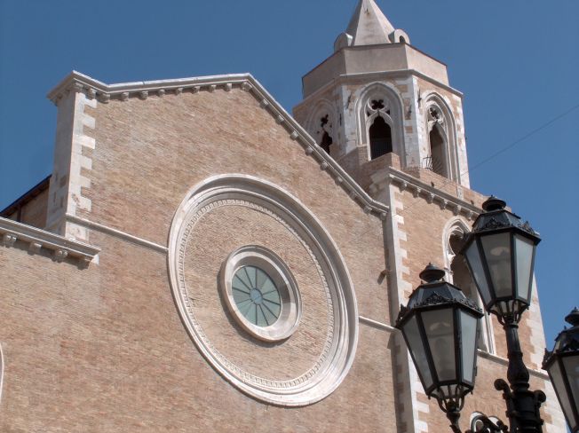
Rignano Garganico is a charming village located in the Apulia region of Italy, nestled in the Gargano National Park. This area is known for its stunning natural landscapes, diverse ecosystems, and rich cultural heritage, making it an excellent destination for hiking enthusiasts.
Hiking Trails in Rignano Garganico:
-
Sentiero degli Ulivi (Olive Tree Path):
- A picturesque path that winds through olive groves, offering both beautiful views and a glimpse into traditional agriculture. This trail is relatively easy and suitable for hikers of all levels.
-
Monte Calvo:
- This hike leads to one of the highest peaks in the Gargano area. The trek is more challenging and rewards hikers with panoramic views of the surrounding landscape and the Adriatic Sea in the distance.
-
Foresta Umbra:
- A short drive from Rignano, this ancient forest is a UNESCO Biosphere Reserve. The trails here vary in difficulty, and the shaded paths are perfect for warm days. You can explore diverse flora and fauna while enjoying serene nature.
-
Cascate del Marmo:
- This trail takes you to stunning waterfalls. The hike involves some elevation and rugged terrain, making it a more adventurous option. The sound of rushing water and the beauty of the falls provide a rewarding experience.
Tips for Hiking in Rignano Garganico:
-
Prepare for Varying Terrain: The trails can range from easy to challenging, so choose routes based on your fitness level. Good hiking shoes are essential.
-
Stay Hydrated: Always carry enough water, especially during the warmer months, as some trails may not have water sources.
-
Check the Weather: The weather can change quickly in mountainous areas, so plan your hikes accordingly and dress in layers.
-
Respect Nature: Stay on marked trails, and carry out any trash you bring in. This helps preserve the natural beauty for future hikers.
-
Local Guides: Consider hiring a local guide for more challenging hikes or to learn about the area's history and flora.
Cultural Aspects:
While hiking, you might encounter local traditions, historic sites, and breathtaking viewpoints. Rignano Garganico’s proximity to other towns in the Gargano region allows for an enriching experience combining outdoor activities with cultural exploration.
Conclusion:
Rignano Garganico is a fantastic destination for hiking, offering a mix of natural beauty and cultural heritage. Whether you're a novice or an experienced hiker, you'll find trails that suit your ability and interests. Enjoy your hike and take in the breathtaking landscapes!
- Страна:

- Почтовый код: 71010
- Телефонный код: 0882
- Код автомобильного номера: FG
- Координаты: 41° 41' 0" N, 15° 35' 0" E


- GPS треки (wikiloc): [Ссылка]
- Высота над уровнем моря: 590 м m
- Площадь: 89.4 кв.км
- Население: 2017
- Веб сайт: http://www.comune.rignanogarganico.fg.it
- Википедия русская: wiki(ru)
- Википедия английская: wiki(en)
- Википедия национальная: wiki(it)
- Хранилище Wikidata: Wikidata: Q51947
- Катеория в википедии: [Ссылка]
- код Freebase: [/m/0fz6fz]
- код GeoNames: Альт: [6540743]
- ID отношения в OpenStreetMap: [41423]
- WOEID: [721667]
- код TGN: [1046283]
- код ISTAT: 071041
- кадастровый код Италии: H287
Граничит с регионами:


Фоджа
- коммуна Италии
Hiking in Фоджа
Foggia, located in the Apulia region of southeastern Italy, offers a diverse range of hiking opportunities that cater to various skill levels and preferences. The surrounding areas are known for their rich natural beauty, historical significance, and unique landscapes....
- Страна:
- Почтовый код: 71121–71122
- Телефонный код: 0881
- Код автомобильного номера: FG
- Координаты: 41° 28' 0" N, 15° 34' 0" E
- GPS треки (wikiloc): [Ссылка]
- Высота над уровнем моря: 76 м m
- Площадь: 509.26 кв.км
- Население: 151975
- Веб сайт: [Ссылка]


Сан-Северо
- коммуна Италии
Hiking in Сан-Северо
San Severo, located in the Apulia region of Italy, is known for its rich history, picturesque landscapes, and agricultural fields. While it may not be as famous as other Italian hiking destinations, it offers some charming opportunities for outdoor enthusiasts. Here are some aspects to consider for hiking in this area:...
- Страна:
- Почтовый код: 71016
- Телефонный код: 0882
- Код автомобильного номера: FG
- Координаты: 41° 41' 42" N, 15° 22' 45" E
- GPS треки (wikiloc): [Ссылка]
- Высота над уровнем моря: 90 м m
- Площадь: 333 кв.км
- Население: 53015
- Веб сайт: [Ссылка]


Апричена
- коммуна Италии
Hiking in Апричена
Apricena is a charming town located in the Apulia region of Italy, near the Adriatic coast and known for its beautiful limestone cliffs, olive groves, and scenic landscapes. Hiking in this region can offer a mix of coastal views, nature, and cultural experiences....
- Страна:
- Почтовый код: 71011
- Телефонный код: 0882
- Код автомобильного номера: FG
- Координаты: 41° 47' 5" N, 15° 26' 37" E
- GPS треки (wikiloc): [Ссылка]
- Высота над уровнем моря: 73 м m
- Площадь: 172.51 кв.км
- Население: 13174
- Веб сайт: [Ссылка]

Лучера
- коммуна Италии
Hiking in Лучера
Lucera, located in the Apulia region of southern Italy, offers a variety of hiking opportunities that allow you to experience the beautiful landscapes, historical sites, and unique flora and fauna of the area. Here are some key points to consider for hiking in and around Lucera:...
- Страна:
- Почтовый код: 71036
- Телефонный код: 0881
- Код автомобильного номера: FG
- Координаты: 41° 30' 0" N, 15° 20' 0" E
- GPS треки (wikiloc): [Ссылка]
- Высота над уровнем моря: 50 м m
- Площадь: 339.79 кв.км
- Население: 33085
- Веб сайт: [Ссылка]


Сан-Джованни-Ротондо
- коммуна в Италии
Hiking in Сан-Джованни-Ротондо
San Giovanni Rotondo, located in the Apulia region of Italy, is not only famous for being the home of Padre Pio but also offers beautiful landscapes and hiking opportunities for outdoor enthusiasts. The area surrounding the town boasts picturesque scenery, with rolling hills, limestone cliffs, and a mix of Mediterranean vegetation....
- Страна:
- Почтовый код: 71013
- Телефонный код: 0882
- Код автомобильного номера: FG
- Координаты: 41° 42' 0" N, 15° 44' 0" E
- GPS треки (wikiloc): [Ссылка]
- Высота над уровнем моря: 565 м m
- Площадь: 261.88 кв.км
- Население: 27172
- Веб сайт: [Ссылка]


Сан-Марко-ин-Ламис
- коммуна Италии
Hiking in Сан-Марко-ин-Ламис
San Marco in Lamis, located in the Apulia region of Italy, offers a variety of hiking opportunities amidst beautiful natural landscapes and historical sites. Here are some key points about hiking in this area:...
- Страна:
- Почтовый код: 71014
- Телефонный код: 0882
- Код автомобильного номера: FG
- Координаты: 41° 42' 42" N, 15° 38' 6" E
- GPS треки (wikiloc): [Ссылка]
- Высота над уровнем моря: 550 м m
- Площадь: 234.2 кв.км
- Население: 13583
- Веб сайт: [Ссылка]