
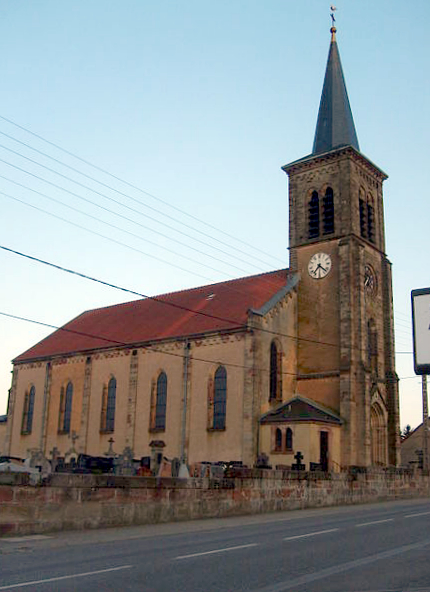
Саарбрюккен (Saarbrücken, Saarbrücken)
.png)

- столица земли Саар, Германия
 Hiking in Саарбрюккен
Saarbrücken, the capital city of the German state of Saarland, offers a variety of hiking opportunities that cater to different preferences and experience levels. The region is characterized by its lush forests, rolling hills, and scenic views, making it a great destination for outdoor enthusiasts. Here are some highlights for hiking in and around Saarbrücken:
Hiking Trails
-
Saarland Hiking Trail (Saar-Hunsrück-Steig): This long-distance trail runs through the Saarland region and offers stunning views of the Saar River and the surrounding countryside. Sections of the trail can be accessed from Saarbrücken.
-
Dillingen Loop: A popular circular hike that takes you through picturesque landscapes, vineyards, and quaint villages. It’s suitable for families and can be completed in a few hours.
-
Völklinger Hütte Loop: This scenic route is rich in cultural heritage, leading you past the UNESCO World Heritage Site of Völklinger Hütte, an old ironworks. The hike combines industrial history with natural beauty.
-
Kaiserstraße to Saargemünd: This trail takes you along the banks of the Saar River, providing a lovely walk to the French border town of Saargemünd. The path is relatively flat and great for an easy day hike.
Nature and Scenery
-
The Saarland Forest (Saarlandwald) is nearby, where you can enjoy vast woodlands and a diverse range of flora and fauna. It’s perfect for longer hikes or leisurely walks.
-
The Vilstal Valley offers stunning sandstone cliffs, dense forests, and the serene vibe of nature that makes for memorable hiking experiences.
Practical Tips
-
Trail Markings: Most trails are well-marked with signs and trail markers, making navigation straightforward.
-
Seasonal Hiking: Spring and autumn provide the best hiking weather with mild temperatures and beautiful scenery due to blooming flowers and fall foliage, respectively.
-
Local Amenities: Saarbrücken has various facilities and services such as restaurants, cafes, and shops, where you can refuel after your hikes.
Guided Hiking
If you're new to hiking or want more insight into the local scenery, consider joining a guided hiking tour. Local instructors can provide valuable information about the region's ecology and history while ensuring a safe and enjoyable experience.
Overall, Saarbrücken offers a variety of hiking experiences that can suit both casual walkers and more experienced hikers, all while showcasing the beautiful natural landscapes and rich cultural heritage of the region.
- Страна:

- Почтовый код: 66001–66133
- Телефонный код: 06898; 0681; 06805; 06897; 06893
- Код автомобильного номера: SB
- Координаты: 49° 14' 0" N, 7° 0' 0" E


- GPS треки (wikiloc): [Ссылка]
- Высота над уровнем моря: 190 м m
- Площадь: 167.52 кв.км
- Население: 179709
- Веб сайт: http://www.saarbruecken.de
- Википедия русская: wiki(ru)
- Википедия английская: wiki(en)
- Википедия национальная: wiki(de)
- Хранилище Wikidata: Wikidata: Q1724
- Галерея изображений в википедии: [Ссылка]
- Катеория в википедии: [Ссылка]
- код Freebase: [/m/011hrk]
- код GeoNames: Альт: [2842647]
- код BNF: [11939331r]
- код VIAF: Альт: [143062944]
- ID отношения в OpenStreetMap: [1187159]
- код GND: Альт: [4076912-4]
- идентификатор местоположения ArchINFORM: [440]
- код LCNAF: Альт: [n80046474]
- код тезауруса PACTOLS: [pcrtzWyFi5YFAx]
- место в MusicBrainz: [40475c77-63ee-4296-95c6-ed2a1c84e311]
- код в энциклопедии «Британника онлайн»: [place/Saarbrucken]
- EMLO location ID: [d089c0bc-391b-406e-a22e-789e67426820]
- код места в Facebook: [108203775870691]
- код в Большой российской энциклопедии онлайн: [3526360]
- код NKC: [ge134465]
- dmoz: Альт: [Regional/Europe/Germany/States/Saarland/Localities/Saarbrücken/]
- код NLI: [000979122]
- код статьи Klexikon: [Saarbrücken]
- FAST ID: [1208403]
- идентификатор муниципалитетов в Германии: 10041100
- код региона Германии: 100410100100
Граничит с регионами:
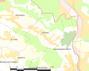
Альстен
- коммуна во Франции
- Страна:

- Почтовый код: 57515
- Координаты: 49° 10' 45" N, 6° 59' 54" E
- GPS треки (wikiloc): [Ссылка]
- Площадь: 5.73 кв.км
- Население: 2572