
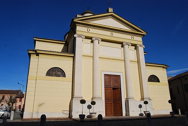
Саббьонета (Sabbioneta, Sabbioneta)
.svg)
- коммуна Италии
 Hiking in Саббьонета
Sabbioneta is a charming town located in the Lombardy region of Italy, known for its Renaissance architecture and historical significance as a UNESCO World Heritage site. While Sabbioneta itself is not primarily recognized as a hiking destination, there are some nearby areas and activities that can make for an enjoyable hiking experience.
Hiking Opportunities near Sabbioneta:
-
The Po River: The banks of the Po River offer some scenic walking paths. You can enjoy leisurely hikes while taking in the natural beauty of the river and the surrounding countryside.
-
Parco Regionale Oglio Sud: This regional park is located a short drive from Sabbioneta. It's ideal for hiking, with trails that wind through forests, along riverbanks, and across agricultural landscapes. The park is home to diverse flora and fauna, and you can enjoy a variety of routes suitable for different skill levels.
-
Montferrat Hills: If you’re willing to travel a bit further, the Montferrat area features rolling hills and scenic trails. This region is known for its beautiful vineyards, and you can combine hiking with wine tasting!
-
Bernardino's Path: A notable trail in the area dedicated to exploring the landscapes that influenced the historical figures of Sabbioneta. This path leads through various terrains and offers an insight into the region’s history.
Tips for Hiking in Sabbioneta:
-
Maps & Navigation: Always bring a good map or use a reliable navigation app to track your route. The local tourist office can provide information about marked trails in the area.
-
Local Guides: Consider hiring a local hiking guide to enhance your experience. They will provide insights about the historical areas and natural beauty of the region.
-
Weather: Check the weather before setting out. The best times for hiking in this region are spring and fall when temperatures are mild.
-
Hydration and Snacks: Bring plenty of water and snacks, especially if you plan on hiking longer trails.
-
Historic Exploration: After your hike, take time to explore Sabbioneta’s historical sites, such as the Palazzo Ducale, Teatro all’Antica, and the city walls.
While Sabbioneta might not have extensive hiking routes within the town itself, surrounding areas provide a beautiful backdrop for hiking adventures. Enjoy your exploration of both the natural and historical landscapes!
- Страна:

- Почтовый код: 46018
- Телефонный код: 0375
- Код автомобильного номера: MN
- Координаты: 44° 59' 57" N, 10° 29' 23" E


- GPS треки (wikiloc): [Ссылка]
- Высота над уровнем моря: 18 м m
- Площадь: 37.27 кв.км
- Население: 4216
- Веб сайт: http://www.comune.sabbioneta.mn.it
- Википедия русская: wiki(ru)
- Википедия английская: wiki(en)
- Википедия национальная: wiki(it)
- Хранилище Wikidata: Wikidata: Q43014
- Галерея изображений в википедии: [Ссылка]
- Катеория в википедии: [Ссылка]
- код Freebase: [/m/086bj7]
- код GeoNames: Альт: [6543229]
- код VIAF: Альт: [142432557]
- ID отношения в OpenStreetMap: [44001]
- идентификатор местоположения ArchINFORM: [3707]
- место в MusicBrainz: [c5efc569-405c-4e39-9d90-31d0ca0a03cc]
- UN/LOCODE: [ITSAB]
- код NKC: [ge886459]
- код ISTAT: 020054
- кадастровый код Италии: H652
Граничит с регионами:


Казальмаджоре
- коммуна Италии
Hiking in Казальмаджоре
Casalmaggiore is a charming town located in the province of Cremona in Lombardy, Italy. While it's not primarily known as a hiking destination, there are several outdoor activities and scenic areas in and around the town that can be enjoyable for hiking enthusiasts. Here are some insights into hiking and exploring the region:...
- Страна:
- Почтовый код: 26041
- Телефонный код: 0375
- Код автомобильного номера: CR
- Координаты: 44° 59' 23" N, 10° 25' 14" E
- GPS треки (wikiloc): [Ссылка]
- Высота над уровнем моря: 26 м m
- Площадь: 64.53 кв.км
- Население: 15376
- Веб сайт: [Ссылка]


Виадана
- коммуна Италии
Hiking in Виадана
Viadana is a town in the Lombardy region of Italy, located along the banks of the Po River. While it may not be as mountainous as other areas in Lombardy, it offers several opportunities for outdoor activities, including hiking, especially along the river and in the surrounding countryside....
- Страна:
- Почтовый код: 46019
- Телефонный код: 0375
- Код автомобильного номера: MN
- Координаты: 44° 55' 36" N, 10° 31' 12" E
- GPS треки (wikiloc): [Ссылка]
- Высота над уровнем моря: 26 м m
- Площадь: 103.84 кв.км
- Население: 20044
- Веб сайт: [Ссылка]


Коммессаджо
- коммуна Италии
Hiking in Коммессаджо
Commessaggio, located in the province of Mantua in Lombardy, Italy, is a lesser-known but charming area for hiking enthusiasts. While it may not be as famed as the Dolomites or the Apennines, it offers a unique landscape characterized by flat terrain, picturesque countryside, and historical sites....
- Страна:
- Почтовый код: 46010
- Телефонный код: 0376
- Код автомобильного номера: MN
- Координаты: 45° 2' 0" N, 10° 33' 0" E
- GPS треки (wikiloc): [Ссылка]
- Высота над уровнем моря: 22 м m
- Площадь: 11.65 кв.км
- Население: 1108
- Веб сайт: [Ссылка]


Ривароло-дель-Ре-эд-Унити
- коммуна Италии
Hiking in Ривароло-дель-Ре-эд-Унити
Rivarolo del Re ed Uniti is a small municipality located in the Lombardy region of Italy, near the Po River. While it might not be as well-known for hiking as some of Italy’s more mountainous areas, there are still opportunities for outdoor activities, including hiking, especially for those who appreciate flat terrain and picturesque landscapes....
- Страна:
- Почтовый код: 26036
- Телефонный код: 0375
- Код автомобильного номера: CR
- Координаты: 45° 1' 52" N, 10° 28' 21" E
- GPS треки (wikiloc): [Ссылка]
- Высота над уровнем моря: 22 м m
- Площадь: 27.33 кв.км
- Население: 1967
- Веб сайт: [Ссылка]

Спинеда
- коммуна Италии
Hiking in Спинеда
I'm sorry, but I couldn't find any specific information on a place called "Spineda" related to hiking. It's possible that it could be a lesser-known location, perhaps a local trail, or it may be a misspelling....
- Страна:
- Почтовый код: 26030
- Телефонный код: 0376
- Код автомобильного номера: CR
- Координаты: 45° 3' 41" N, 10° 30' 42" E
- GPS треки (wikiloc): [Ссылка]
- Высота над уровнем моря: 23 м m
- Площадь: 10.11 кв.км
- Население: 608
- Веб сайт: [Ссылка]