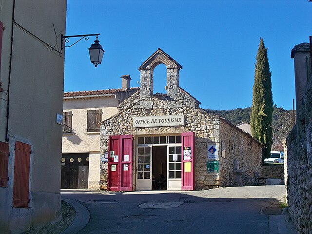
Сен-Жюльен (Saint-Julien, Saint-Julien)

- коммуна департамента Вар, Франция
 Hiking in Сен-Жюльен
Saint-Julien, located in the Var department of the Provence-Alpes-Côte d'Azur region in southeastern France, offers a variety of hiking opportunities that highlight the stunning natural beauty of the region. The area is characterized by its picturesque landscapes, rolling hills, and Mediterranean vegetation.
Hiking Trails
-
Local Trails:
- The region is dotted with numerous local trails that can be explored, ranging from easy to more challenging routes. Many of these trails provide a glimpse into the local flora and fauna, as well as breathtaking views of the surrounding countryside.
-
GR (Grande Randonnée) Trails:
- The GR99 is one such long-distance path that passes near Saint-Julien. This trail stretches across beautiful parts of Provence and is suitable for experienced hikers. It typically features well-marked paths and offers a mix of terrain, including forests, vineyards, and scenic overlooks.
-
Exploring Nearby Natural Parks:
- The nearby Verdon Regional Natural Park is famous for its dramatic gorges and offers a variety of trails for all skill levels. Although it requires a drive, the park is well worth the visit for those looking for more extensive hiking options.
Hiking Considerations
-
Weather: The weather in Provence is generally warm, especially in the summer months, so it’s essential to stay hydrated and apply sunscreen. Spring and fall offer more temperate conditions, making them ideal for hiking.
-
Equipment: Good hiking shoes are recommended, as some paths can be rocky or uneven. Depending on the length of the hike, consider bringing along water, snacks, a map, and possibly trekking poles for stability.
-
Local Guidance: If you're unfamiliar with the area, consider joining a guided hike or using local resources for maps and information about trails. The local tourism office can provide valuable information on trail conditions and recommendations.
Cultural Points
- While hiking, you may come across charming villages, historical sites, and local vineyards. Take the opportunity to enjoy the region's rich culture and perhaps sample some regional wines.
Conclusion
Hiking in Saint-Julien can be a rewarding experience, providing both physical activity and a chance to appreciate the natural and cultural beauty of the Var region. Be sure to check any local regulations or requirements before heading out, and enjoy your adventure!
- Страна:

- Почтовый код: 83560
- Координаты: 43° 41' 38" N, 5° 54' 55" E


- GPS треки (wikiloc): [Ссылка]
- Высота над уровнем моря: 578 м m
- Площадь: 75.88 кв.км
- Население: 2367
- Веб сайт: http://www.ville-saint-julien-le-montagnier.fr
- Википедия русская: wiki(ru)
- Википедия английская: wiki(en)
- Википедия национальная: wiki(fr)
- Хранилище Wikidata: Wikidata: Q840199
- Катеория в википедии: [Ссылка]
- код Freebase: [/m/03qhfgn]
- код GeoNames: Альт: [6617827]
- номер SIREN: [218301133]
- код BNF: [152779402]
- код муниципалитета INSEE: 83113
Граничит с регионами:

Сен-Мартен-де-Бром
- коммуна во Франции
Hiking in Сен-Мартен-де-Бром
Saint-Martin-de-Brômes is a charming village located in the Alpes-de-Haute-Provence region of southeastern France. Surrounded by stunning natural landscapes, it offers a variety of hiking opportunities for both beginners and experienced hikers....
- Страна:
- Почтовый код: 04800
- Координаты: 43° 46' 12" N, 5° 56' 44" E
- GPS треки (wikiloc): [Ссылка]
- Площадь: 21.09 кв.км
- Население: 577
Кенсон
- коммуна во Франции
Hiking in Кенсон
Quinson, a charming village located in the Provence-Alpes-Côte d'Azur region of France, offers an array of hiking opportunities that showcase the stunning natural beauty of the area. Here are some key points to consider when planning a hiking trip in Quinson:...
- Страна:
- Почтовый код: 04500
- Координаты: 43° 42' 8" N, 6° 2' 23" E
- GPS треки (wikiloc): [Ссылка]
- Площадь: 28.11 кв.км
- Население: 437
- Веб сайт: [Ссылка]


Жинасервис
- коммуна во Франции
Hiking in Жинасервис
Ginasservis is a charming village located in the Var department of the Provence-Alpes-Côte d'Azur region in France. Nestled in the beautiful countryside, it offers several hiking opportunities that showcase the stunning natural landscape of the area....
- Страна:
- Почтовый код: 83560
- Координаты: 43° 40' 15" N, 5° 50' 57" E
- GPS треки (wikiloc): [Ссылка]
- Площадь: 37.47 кв.км
- Население: 1709


Ла-Вердьер
- коммуна во Франции
Hiking in Ла-Вердьер
La Verdière is a picturesque village located in the Var department of the Provence-Alpes-Côte d'Azur region in southern France. This area is known for its beautiful landscapes, charming rural settings, and a network of trails that are perfect for hiking enthusiasts....
- Страна:
- Почтовый код: 83560
- Координаты: 43° 38' 19" N, 5° 56' 9" E
- GPS треки (wikiloc): [Ссылка]
- Площадь: 68.16 кв.км
- Население: 1622

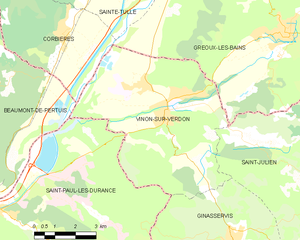
Винон-сюр-Вердон
- коммуна во Франции
Hiking in Винон-сюр-Вердон
Vinon-sur-Verdon is a charming commune located in the Var department of the Provence-Alpes-Côte d'Azur region in southeastern France. Known for its scenic landscapes and proximity to the Verdon River, this area offers a variety of hiking opportunities suitable for different skill levels....
- Страна:
- Почтовый код: 83560
- Координаты: 43° 43' 29" N, 5° 48' 43" E
- GPS треки (wikiloc): [Ссылка]
- Площадь: 36 кв.км
- Население: 4196

Эспаррон-де-Вердон
- коммуна во Франции
Hiking in Эспаррон-де-Вердон
Esparron-de-Verdon is a picturesque village located near the Verdon Gorge in the Provence-Alpes-Côte d’Azur region of France. It’s an excellent destination for hiking enthusiasts, thanks to its stunning landscapes, diverse terrain, and beautiful views of the Verdon River....
- Страна:
- Почтовый код: 04800
- Координаты: 43° 44' 20" N, 5° 58' 19" E
- GPS треки (wikiloc): [Ссылка]
- Площадь: 34.2 кв.км
- Население: 414
- Веб сайт: [Ссылка]

Греу-ле-Бен
- коммуна во Франции
Hiking in Греу-ле-Бен
Gréoux-les-Bains is a charming village located in the Provence-Alpes-Côte d'Azur region of southeastern France. Known primarily for its thermal springs, it also offers a variety of hiking opportunities that allow you to explore the beautiful surrounding landscapes, including the stunning Verdon Gorge and the lush countryside....
- Страна:
- Почтовый код: 04800
- Координаты: 43° 45' 30" N, 5° 53' 1" E
- GPS треки (wikiloc): [Ссылка]
- Площадь: 69.46 кв.км
- Население: 2628