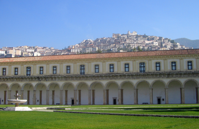
Сала-Консилина (Sala Consilina, Sala Consilina)

- коммуна Италии
 Hiking in Сала-Консилина
Sala Consilina, located in the Campania region of southern Italy, offers a range of hiking opportunities amid its beautiful landscapes. Nestled in the heart of the Vallo di Diano National Park, this area is characterized by lush forests, rolling hills, and stunning views of the surrounding mountains.
Best Hiking Trails
-
Sentiero Cai 101 (Cai Trail 101): This popular trail begins in Sala Consilina and leads hikers through dense forests and mountainous terrain, eventually reaching scenic viewpoints that showcase the beauty of the surrounding area.
-
Monte San Giacomo: This trail takes you up to Monte San Giacomo, where you can enjoy panoramic views of the Vallo di Diano and the nearby peaks. The hike can be challenging, but it rewards you with breathtaking scenery at the summit.
-
Valle delle Ferriere: This route meanders through a picturesque valley, featuring waterfalls, ancient ruins, and diverse flora and fauna. It’s a moderate trail suitable for families and those looking for a more leisurely hike.
Tips for Hiking in Sala Consilina
-
Check Weather Conditions: The weather can be unpredictable, especially in spring and autumn. Always check the forecast before heading out.
-
Wear Appropriate Gear: Good hiking shoes, weather-appropriate clothing, and a backpack with water and snacks are essential.
-
Stay on Marked Trails: To preserve the natural environment and ensure your safety, stick to designated trails.
-
Respect Wildlife: Keep a safe distance from animals, and do not disturb their habitats.
Local Attractions
-
Historical Town Center: After your hike, explore the charming town of Sala Consilina, with its historic buildings, local cuisine, and vibrant culture.
-
Cilento and Vallo di Diano National Park: Use Sala Consilina as a base to explore the broader national park, which includes a variety of ecosystems, historical sites, and additional hiking opportunities.
Safety Considerations
- Hydration: Always carry enough water, especially on longer hikes.
- Companionship: Hike with a partner or group, particularly on less-traveled trails.
- Navigation: Consider bringing a map or a GPS device, especially in areas where trail markers may be sparse.
Hiking in Sala Consilina offers a fantastic way to enjoy nature while experiencing the rich cultural landscape of the region. Whether you're an experienced hiker or just starting, the area has something to offer everyone.
- Страна:

- Почтовый код: 84036
- Телефонный код: 0975
- Код автомобильного номера: SA
- Координаты: 40° 24' 0" N, 15° 36' 0" E


- GPS треки (wikiloc): [Ссылка]
- Высота над уровнем моря: 614 м m
- Площадь: 59.7 кв.км
- Население: 12636
- Веб сайт: http://www.comune.sala-consilina.salerno.it
- Википедия русская: wiki(ru)
- Википедия английская: wiki(en)
- Википедия национальная: wiki(it)
- Хранилище Wikidata: Wikidata: Q81474
- Галерея изображений в википедии: [Ссылка]
- Катеория в википедии: [Ссылка]
- код Freebase: [/m/0frgmf]
- код GeoNames: Альт: [6538829]
- код BNF: [124573193]
- код VIAF: Альт: [135017701]
- ID отношения в OpenStreetMap: [40471]
- код GND: Альт: [4105211-0]
- код LCNAF: Альт: [n93026139]
- код темы Quora: [Sala-Consilina]
- код TGN: [7006918]
- UN/LOCODE: [ITZSW]
- код ISTAT: 065114
- кадастровый код Италии: H683
Граничит с регионами:


Бриенца
- коммуна Италии
Hiking in Бриенца
Brienza, located in the province of Potenza in the Basilicata region of Italy, is surrounded by beautiful landscapes, making it an excellent destination for hiking enthusiasts. The area features a mix of forested areas, rolling hills, and stunning views of the surrounding mountains....
- Страна:
- Почтовый код: 85050
- Телефонный код: 0975
- Код автомобильного номера: PZ
- Координаты: 40° 28' 43" N, 15° 37' 48" E
- GPS треки (wikiloc): [Ссылка]
- Высота над уровнем моря: 706 м m
- Площадь: 82.94 кв.км
- Население: 4030
- Веб сайт: [Ссылка]


Марсико-Нуово
- коммуна Италии
Hiking in Марсико-Нуово
Marsico Nuovo is a charming town located in the Basilicata region of southern Italy. Surrounded by the scenic beauty of the Appennino Lucano National Park, it offers excellent opportunities for hiking and outdoor activities. Here are some highlights and tips for hiking in the Marsico Nuovo area:...
- Страна:
- Почтовый код: 85052
- Телефонный код: 80052
- Код автомобильного номера: PZ
- Координаты: 40° 25' 0" N, 15° 44' 0" E
- GPS треки (wikiloc): [Ссылка]
- Высота над уровнем моря: 850 м m
- Площадь: 100.97 кв.км
- Население: 4014
- Веб сайт: [Ссылка]


Атена-Лукана
- коммуна Италии
Hiking in Атена-Лукана
Atena Lucana is a charming town located in the province of Salerno, in the Campania region of southern Italy. It is surrounded by the beautiful natural landscape of the Lucanian Apennines and is near the breathtaking Cilento and Vallo di Diano National Park, making it an excellent destination for hiking enthusiasts....
- Страна:
- Почтовый код: 84030
- Телефонный код: 0975
- Код автомобильного номера: SA
- Координаты: 40° 27' 0" N, 15° 33' 0" E
- GPS треки (wikiloc): [Ссылка]
- Высота над уровнем моря: 642 м m
- Площадь: 26.01 кв.км
- Население: 2402
- Веб сайт: [Ссылка]

Падула
- коммуна Италии
Hiking in Падула
Padula, located in the province of Salerno in the Campania region of Italy, is famous not only for its rich history and culture but also for its stunning natural landscape that offers excellent hiking opportunities. Here are some key points about hiking in and around Padula:...
- Страна:
- Почтовый код: 84030; 84034
- Телефонный код: 0975
- Код автомобильного номера: SA
- Координаты: 40° 20' 20" N, 15° 39' 23" E
- GPS треки (wikiloc): [Ссылка]
- Высота над уровнем моря: 699 м m
- Площадь: 67.12 кв.км
- Население: 5377
- Веб сайт: [Ссылка]
Сассано
- коммуна Италии
Hiking in Сассано
Sassano, located in the heart of the Cilento and Vallo di Diano National Park in southern Italy, offers a plethora of hiking opportunities. This picturesque area is characterized by its stunning landscapes, diverse flora and fauna, and historical significance. Here are some highlights about hiking in Sassano:...
- Страна:
- Почтовый код: 84038
- Телефонный код: 0975
- Код автомобильного номера: SA
- Координаты: 40° 20' 25" N, 15° 33' 56" E
- GPS треки (wikiloc): [Ссылка]
- Высота над уровнем моря: 491 м m
- Площадь: 47.76 кв.км
- Население: 4935
- Веб сайт: [Ссылка]


Тегджано
- коммуна Италии
Hiking in Тегджано
Teggiano, located in the province of Salerno in the Campania region of Italy, is a charming medieval town that offers stunning landscapes and various hiking opportunities. Here are some highlights for hiking in the Teggiano area:...
- Страна:
- Почтовый код: 84039
- Телефонный код: 0975
- Код автомобильного номера: SA
- Координаты: 40° 23' 0" N, 15° 32' 0" E
- GPS треки (wikiloc): [Ссылка]
- Высота над уровнем моря: 637 м m
- Площадь: 61.87 кв.км
- Население: 7794
- Веб сайт: [Ссылка]