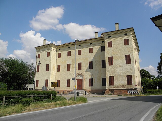
Салара (Salara, Salara)
.svg)
- коммуна Италии
 Hiking in Салара
Salara might not be as widely known as some other hiking destinations, but it offers a unique experience for those seeking tranquility and natural beauty. Located in Italy's Veneto region, near the Po River, Salara is characterized by its picturesque landscapes, rustic charm, and the serene ambiance of the surrounding countryside.
Hiking Opportunities
-
Nature Trails: The area around Salara features various trails that wind through lush landscapes, including fields, forests, and wetlands. These paths can be suitable for both beginners and experienced hikers.
-
Nearby Parks: Consider exploring nearby nature parks like the Po Delta Regional Park, which offers a vast network of trails and an opportunity to observe diverse wildlife, including many bird species.
-
Cultural Walks: Combining hiking with cultural experiences can be rewarding. Look for paths that lead to historical sites, local farms, and traditional villages to get a glimpse of the region's culinary heritage and local traditions.
Tips for Hiking in Salara
-
Best Time to Hike: The ideal seasons for hiking in this area are spring and autumn when temperatures are mild, and nature is at its most vibrant.
-
Gear: Wear sturdy, comfortable hiking shoes and dress in layers to adapt to changing weather conditions. It's also a good idea to have a map or a GPS device.
-
Stay Hydrated: Carry enough water, especially during warmer months, to stay hydrated throughout your hike.
-
Respect Nature: Be mindful of local wildlife and vegetation. Follow the Leave No Trace principles, ensuring that you leave the environment as you found it.
-
Local Guides: If you're unfamiliar with the area, consider hiring a local guide who can provide insight into the flora, fauna, and culture of the region.
By exploring the hiking trails in and around Salara, you can enjoy the stunning scenery and experience the quiet charm of this less-traveled part of Italy.
- Страна:

- Почтовый код: 45030
- Телефонный код: 0425
- Код автомобильного номера: RO
- Координаты: 44° 59' 9" N, 11° 25' 36" E


- GPS треки (wikiloc): [Ссылка]
- Высота над уровнем моря: 7 м m
- Площадь: 14.16 кв.км
- Население: 1148
- Веб сайт: http://www.comune.salara.ro.it
- Википедия русская: wiki(ru)
- Википедия английская: wiki(en)
- Википедия национальная: wiki(it)
- Хранилище Wikidata: Wikidata: Q34585
- Катеория в википедии: [Ссылка]
- код Freebase: [/m/0gk778]
- код GeoNames: Альт: [6538357]
- ID отношения в OpenStreetMap: [43912]
- код ISTAT: 029042
- кадастровый код Италии: H689
Граничит с регионами:
Sermide e Felonica
Hiking in Sermide e Felonica
Sermide e Felonica, located in the province of Mantua in the Lombardy region of Italy, is not as widely known for hiking as some of the more mountainous areas of Italy, but it offers some unique opportunities for outdoor enthusiasts, particularly those who enjoy exploring rural landscapes and riverine environments....
- Страна:
- Код автомобильного номера: MN
- Координаты: 44° 59' 21" N, 11° 19' 6" E
- GPS треки (wikiloc): [Ссылка]
- Площадь: 79.83 кв.км
- Население: 7338
- Веб сайт: [Ссылка]


Баньоло-ди-По
- коммуна Италии
Hiking in Баньоло-ди-По
Bagnolo di Po is a small municipality located in the province of Mantua, in the Lombardy region of northern Italy. While it may not be widely known as a hiking destination like some of Italy's larger national parks or mountains, the surrounding area offers lovely opportunities for outdoor enthusiasts. Here's some information that could enhance your hiking experience in and around Bagnolo di Po:...
- Страна:
- Почтовый код: 45022
- Телефонный код: 0425
- Код автомобильного номера: RO
- Координаты: 45° 1' 0" N, 11° 30' 0" E
- GPS треки (wikiloc): [Ссылка]
- Высота над уровнем моря: 7 м m
- Площадь: 21.36 кв.км
- Население: 1225
- Веб сайт: [Ссылка]


Кальто
- коммуна Италии
Hiking in Кальто
It seems like you might be referring to a specific location called "Calto," but to give you the best information, it would be helpful to clarify which "Calto" you are referring to, as there are multiple possible locations around the world....
- Страна:
- Почтовый код: 45030
- Телефонный код: 0425
- Код автомобильного номера: RO
- Координаты: 45° 0' 0" N, 11° 21' 0" E
- GPS треки (wikiloc): [Ссылка]
- Высота над уровнем моря: 11 м m
- Площадь: 10.85 кв.км
- Население: 726
- Веб сайт: [Ссылка]

Тречента
- коммуна Италии
Hiking in Тречента
Trecenta is a small municipality located in the province of Rovigo in the Veneto region of Italy. While it may not be a well-known hiking destination compared to the more mountainous regions of Italy, there are still opportunities for enjoying nature and walking in the area. Here are some points to consider if you're thinking about hiking around Trecenta:...
- Страна:
- Почтовый код: 45027
- Телефонный код: 0425
- Код автомобильного номера: RO
- Координаты: 45° 2' 0" N, 11° 27' 0" E
- GPS треки (wikiloc): [Ссылка]
- Высота над уровнем моря: 11 м m
- Площадь: 35.08 кв.км
- Население: 2711
- Веб сайт: [Ссылка]


Фикароло
- коммуна Италии
Hiking in Фикароло
Ficarolo is a small municipality in Italy, located in the province of Mantua, Lombardy. While it may not be as widely known as some of Italy’s larger national parks or mountainous regions, it can offer a unique hiking experience, especially for those interested in exploring the countryside and local landscapes....
- Страна:
- Почтовый код: 45036
- Телефонный код: 0425
- Код автомобильного номера: RO
- Координаты: 44° 57' 0" N, 11° 26' 0" E
- GPS треки (wikiloc): [Ссылка]
- Высота над уровнем моря: 10 м m
- Площадь: 18.08 кв.км
- Население: 2407
- Веб сайт: [Ссылка]


Ченезелли
- коммуна Италии
Hiking in Ченезелли
Ceneselli is a small town located in the province of Rovigo in the Veneto region of Italy. While it is not widely known as a prominent hiking destination compared to other regions in Italy, there are still opportunities for outdoor enthusiasts to enjoy some scenic walks and hikes in and around the area....
- Страна:
- Почтовый код: 45030
- Телефонный код: 0425
- Код автомобильного номера: RO
- Координаты: 45° 1' 0" N, 11° 22' 0" E
- GPS треки (wikiloc): [Ссылка]
- Высота над уровнем моря: 13 м m
- Площадь: 28.62 кв.км
- Население: 1636
- Веб сайт: [Ссылка]