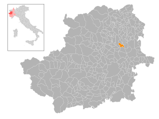
Сан-Бениньо-Канавезе (San Benigno Canavese, San Benigno Canavese)

- коммуна Италии
 Hiking in Сан-Бениньо-Канавезе
San Benigno Canavese is a charming town located in the Piedmont region of northern Italy, not far from Turin. The surrounding areas offer various hiking opportunities, making it a great base for outdoor enthusiasts. Here’s what you should know about hiking in and around San Benigno Canavese:
Trails and Scenery
-
Natural Landscapes: The region is characterized by beautiful landscapes, with rolling hills, vineyards, and agricultural fields. You’ll also find the nearby Canavese mountains providing more challenging hikes.
-
Monte D’Enval: Not too far from San Benigno, this mountain offers several hiking trails with panoramic views of the surrounding valleys and the Alps in the distance.
-
Parco Regionale dei Laghi di Avigliana: A short drive away, this regional park features stunning lakes and well-marked trails, ideal for both casual walkers and more experienced hikers.
-
Sentiero dei Partigiani: This historical trail leads you through areas of significant WWII history. You’ll not only enjoy the hike but also learn about the important historical events that took place in the region.
Best Time to Hike
- The best time for hiking around San Benigno Canavese is in the late spring (May to June) and early autumn (September to October) when the weather is mild and the nature is at its most vibrant.
Recommendations
- Gear Up: Make sure to wear appropriate footwear and carry essentials such as water, snacks, a first aid kit, and a map or GPS device.
- Stay Informed: Before heading out, check local resources for trail conditions, weather updates, and any potential access restrictions.
- Local Guides: If you’re new to the area, consider hiring a local guide for an enriching hiking experience, as they can provide insights not only on the trails but also about the local culture and history.
Accessibility
San Benigno Canavese is easily accessible from Turin, making it an excellent choice for a day hike or a weekend getaway. Public transportation options are available, but having a car can provide more flexibility for reaching trailheads.
In summary, hiking around San Benigno Canavese offers a mix of natural beauty, historical significance, and a variety of trails suitable for all levels. Whether you seek a challenging mountain trail or a leisurely stroll through picturesque landscapes, this region has something to offer every hiker.
- Страна:

- Почтовый код: 10080
- Телефонный код: 011
- Код автомобильного номера: TO
- Координаты: 45° 15' 0" N, 7° 47' 0" E


- GPS треки (wikiloc): [Ссылка]
- Высота над уровнем моря: 194 м m
- Площадь: 22.23 кв.км
- Население: 6044
- Веб сайт: http://www.comune.sanbenignocanavese.to.it
- Википедия русская: wiki(ru)
- Википедия английская: wiki(en)
- Википедия национальная: wiki(it)
- Хранилище Wikidata: Wikidata: Q10256
- Галерея изображений в википедии: [Ссылка]
- Катеория в википедии: [Ссылка]
- код Freebase: [/m/0g8lhv]
- код GeoNames: Альт: [6541797]
- код VIAF: Альт: [152872045]
- ID отношения в OpenStreetMap: [44450]
- код TGN: [1046464]
- UN/LOCODE: [IT7TO]
- код ISTAT: 001236
- кадастровый код Италии: H775
Граничит с регионами:


Вольпьяно
- коммуна в Италии
Hiking in Вольпьяно
Volpiano, located in the Piedmont region of Italy, is a charming area that offers various opportunities for hiking and outdoor activities. Situated just north of Turin, it provides a mix of beautiful natural surroundings and cultural sites. Here are some highlights about hiking in the area:...
- Страна:
- Почтовый код: 10088
- Телефонный код: 011
- Код автомобильного номера: TO
- Координаты: 45° 12' 0" N, 7° 47' 0" E
- GPS треки (wikiloc): [Ссылка]
- Высота над уровнем моря: 219 м m
- Площадь: 32.46 кв.км
- Население: 15459
- Веб сайт: [Ссылка]

Босконеро
- Коммуна Италии
Hiking in Босконеро
Bosconero, located in the Piedmont region of Italy, is a charming area that offers great hiking opportunities, particularly for those who appreciate nature, scenic views, and a bit of local culture. Here are some key points to consider for hiking in Bosconero:...
- Страна:
- Почтовый код: 10080
- Телефонный код: 011
- Код автомобильного номера: TO
- Координаты: 45° 16' 0" N, 7° 46' 0" E
- GPS треки (wikiloc): [Ссылка]
- Высота над уровнем моря: 239 м m
- Площадь: 10.92 кв.км
- Население: 3146
- Веб сайт: [Ссылка]


Кивассо
- коммуна Италии
Hiking in Кивассо
Chivasso, a town located in the Piedmont region of Italy, offers some beautiful landscapes and opportunities for outdoor activities, including hiking. While Chivasso itself is more urban, it serves as a good starting point for exploring the surrounding natural areas, particularly the Po River Park and nearby hills....
- Страна:
- Почтовый код: 10034
- Телефонный код: 011
- Код автомобильного номера: TO
- Координаты: 45° 11' 0" N, 7° 53' 0" E
- GPS треки (wikiloc): [Ссылка]
- Высота над уровнем моря: 183 м m
- Площадь: 51.24 кв.км
- Население: 26976
- Веб сайт: [Ссылка]


Фольиццо
- коммуна Италии
Hiking in Фольиццо
Foglizzo is a town located in the northern Italian region of Piedmont, near Turin. The area surrounding Foglizzo offers beautiful landscapes and opportunities for hiking enthusiasts. Here are some highlights and tips for hiking in and around Foglizzo:...
- Страна:
- Почтовый код: 10090
- Телефонный код: 011
- Код автомобильного номера: TO
- Координаты: 45° 16' 0" N, 7° 49' 0" E
- GPS треки (wikiloc): [Ссылка]
- Высота над уровнем моря: 247 м m
- Площадь: 15.64 кв.км
- Население: 2328
- Веб сайт: [Ссылка]


Ломбардоре
- коммуна Италии
Hiking in Ломбардоре
Lombardore, located in the Piedmont region of Italy, offers a variety of hiking opportunities amidst beautiful natural scenery. The area is characterized by rolling hills, lush forests, and picturesque landscapes. Here are some key points to consider for hiking in Lombardore:...
- Страна:
- Почтовый код: 10040
- Телефонный код: 011
- Код автомобильного номера: TO
- Координаты: 45° 14' 0" N, 7° 44' 0" E
- GPS треки (wikiloc): [Ссылка]
- Высота над уровнем моря: 268 м m
- Площадь: 12.72 кв.км
- Население: 1724
- Веб сайт: [Ссылка]
Монтанаро
- коммуна Италии
Hiking in Монтанаро
Montanaro, located in the Piedmont region of Italy, is a beautiful area known for its scenic landscapes and outdoor activities, including hiking. Although Montanaro itself is a small town, the surrounding region boasts various trails and natural attractions that cater to different skill levels....
- Страна:
- Почтовый код: 10017
- Телефонный код: 011
- Код автомобильного номера: TO
- Координаты: 45° 13' 58" N, 7° 51' 18" E
- GPS треки (wikiloc): [Ссылка]
- Высота над уровнем моря: 209 м m
- Площадь: 20.9 кв.км
- Население: 5262
- Веб сайт: [Ссылка]