Сан-Чезарио-суль-Панаро (San Cesario sul Panaro, San Cesario sul Panaro)
.svg)
- коммуна Италии
 Hiking in Сан-Чезарио-суль-Панаро
San Cesario sul Panaro is a charming town located in the Emilia-Romagna region of Italy, not far from the city of Modena. While it's not as widely known for hiking as some other areas in Italy, it still offers beautiful landscapes and opportunities for outdoor activities, including hiking.
Hiking Opportunities near San Cesario sul Panaro
-
Nature Trails: The area around San Cesario is characterized by rolling hills, vineyards, and agricultural fields. There are various local trails that you can explore, offering a chance to enjoy the natural beauty of the region. Be sure to observe any local trail markers for routes suited to your skill level.
-
Panaro River: The trails along the Panaro River can provide pleasant walks where you can enjoy the scenic views and possibly spot some local wildlife. Look for opportunities to take in the serene beauty while walking or biking.
-
Surrounding Parks: Nearby parks, such as the Parco del Frignano, offer more extensive hiking opportunities with well-marked trails and different degrees of difficulty. These can be great for day hikes, where you can fully appreciate the natural landscapes of the Emilia-Romagna region.
-
Historic Sites: Incorporating historical and cultural aspects into your hikes can enhance your experience. Look for routes that lead to local churches, ancient ruins, and historical sites around San Cesario and in surrounding towns.
Hiking Tips
- Trail Maps: It's always a good idea to have a trail map or download a hiking app that works offline to help you navigate the area easily.
- Weather Considerations: Check the weather before you head out, as conditions can change quickly in the hills.
- Local Advice: Don’t hesitate to ask locals for recommendations on trails and conditions—they can provide valuable insights into the best hikes and hidden gems.
- Safety First: Carry enough water, snacks, and a first aid kit, and let someone know your hiking plans before setting off.
Conclusion
While San Cesario sul Panaro may not be a major hiking destination, it offers a lovely setting for those who enjoy walking and exploring the tranquility of rural Italy. With its scenic views, nearby parks, and opportunities for cultural exploration, hiking in this area can be a rewarding experience.
- Страна:

- Почтовый код: 41018
- Телефонный код: 059
- Код автомобильного номера: MO
- Координаты: 44° 34' 0" N, 11° 2' 0" E


- GPS треки (wikiloc): [Ссылка]
- Высота над уровнем моря: 54 м m
- Площадь: 27.31 кв.км
- Население: 6460
- Веб сайт: http://www.comune.sancesariosulpanaro.mo.it
- Википедия русская: wiki(ru)
- Википедия английская: wiki(en)
- Википедия национальная: wiki(it)
- Хранилище Wikidata: Wikidata: Q100092
- Галерея изображений в википедии: [Ссылка]
- Катеория в википедии: [Ссылка]
- код Freebase: [/m/0gkgrf]
- код GeoNames: Альт: [6538458]
- код VIAF: Альт: [132574790]
- ID отношения в OpenStreetMap: [43265]
- UN/LOCODE: [ITSCS]
- код Цифрового атласа Римской империи: [17212]
- код ISTAT: 036036
- кадастровый код Италии: H794
Граничит с регионами:


Кастельфранко-Эмилия
- коммуна Италии
Hiking in Кастельфранко-Эмилия
Castelfranco Emilia, located in the Emilia-Romagna region of northern Italy, is not only known for its beautiful architecture and history but also for its scenic landscapes and opportunities for hiking. Although it may not be as famous for hiking as some Italian regions, there are still several trails and natural spots nearby that can offer a charming experience for hikers....
- Страна:
- Почтовый код: 41013
- Телефонный код: 059
- Код автомобильного номера: MO
- Координаты: 44° 35' 48" N, 11° 3' 10" E
- GPS треки (wikiloc): [Ссылка]
- Высота над уровнем моря: 42 м m
- Площадь: 102.51 кв.км
- Население: 32894
- Веб сайт: [Ссылка]
Савиньяно-суль-Панаро
- коммуна Италии
Hiking in Савиньяно-суль-Панаро
Savignano sul Panaro is a charming town located in the Emilia-Romagna region of Italy, nestled in a picturesque valley surrounded by hills and nature. Hiking in and around Savignano sul Panaro provides an excellent opportunity to explore the beautiful landscapes, scenic views, and rich history of the area....
- Страна:
- Почтовый код: 41056
- Телефонный код: 059
- Код автомобильного номера: MO
- Координаты: 44° 29' 0" N, 11° 2' 0" E
- GPS треки (wikiloc): [Ссылка]
- Высота над уровнем моря: 202 м m
- Площадь: 25.55 кв.км
- Население: 9142
- Веб сайт: [Ссылка]
Спиламберто
- коммуна Италии
Hiking in Спиламберто
Spilamberto, located in the Emilia-Romagna region of Italy, is a charming town that offers various outdoor activities, including hiking. While Spilamberto itself is known for its historic town center and local cuisine, the surrounding area features beautiful landscapes, vineyards, and hills that are perfect for hiking enthusiasts....
- Страна:
- Почтовый код: 41057
- Телефонный код: 059
- Код автомобильного номера: MO
- Координаты: 44° 32' 0" N, 11° 1' 0" E
- GPS треки (wikiloc): [Ссылка]
- Высота над уровнем моря: 70 м m
- Площадь: 29.79 кв.км
- Население: 12767
- Веб сайт: [Ссылка]
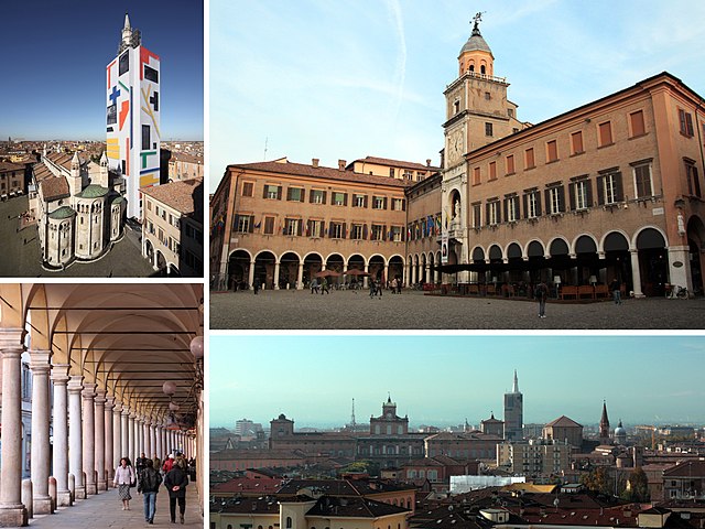

Модена
- город в Италии
Hiking in Модена
Modena, located in the Emilia-Romagna region of Italy, is renowned for its rich cultural heritage, delicious cuisine, and beautiful landscapes, making it a great destination for hiking enthusiasts. While Modena itself is a city, its surrounding areas offer fantastic hiking opportunities, particularly in the Apennine Mountains, which are just a short drive away....
- Страна:
- Почтовый код: 41121–41126
- Телефонный код: 059
- Код автомобильного номера: MO
- Координаты: 44° 38' 45" N, 10° 55' 33" E
- GPS треки (wikiloc): [Ссылка]
- Высота над уровнем моря: 34 м m
- Площадь: 183.19 кв.км
- Население: 184727
- Веб сайт: [Ссылка]
Баццано
- коммуна Италии
Hiking in Баццано
Bazzano, a small town located in the Emilia-Romagna region of Italy, is often appreciated for its picturesque countryside and proximity to the Apennine Mountains. While it may not be as widely known as larger hiking destinations, it offers access to several trails that provide beautiful views and a chance to experience the rich natural environment of the area....
- Страна:
- Почтовый код: 40053
- Телефонный код: 051
- Код автомобильного номера: BO
- Координаты: 44° 30' 11" N, 11° 5' 11" E
- GPS треки (wikiloc): [Ссылка]
- Высота над уровнем моря: 93 м m
- Площадь: 13.99 кв.км
- Веб сайт: [Ссылка]