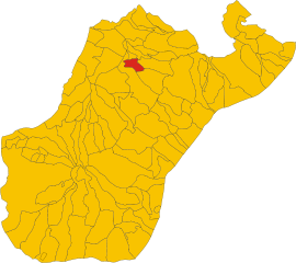
Сан-Джорджо-Морджето (San Giorgio Morgeto, San Giorgio Morgeto)
.svg)
- коммуна Италии
 Hiking in Сан-Джорджо-Морджето
San Giorgio Morgeto, located in the Calabria region of southern Italy, offers a variety of hiking opportunities that showcase the region's stunning natural beauty, rugged terrain, and rich cultural heritage. Here are some key points to consider when hiking in and around San Giorgio Morgeto:
Trail Options:
-
Monte Poro: This area features a network of trails that lead through picturesque landscapes, offering panoramic views of the Tyrrhenian Sea and the surrounding mountains. The paths are suitable for various skill levels, making it an excellent option for families and beginners.
-
Aspromonte National Park: A short distance from San Giorgio Morgeto, this park boasts numerous hiking trails that range from easy walks to challenging hikes. Here, hikers can explore diverse ecosystems, including ancient forests, rivers, and waterfalls, along with an array of wildlife.
-
Canyoning and Nature Walks: In addition to traditional hiking, the region offers opportunities for canyoning and nature walks that allow for a more adventurous exploration of the area's gorges and streams.
Best Times to Hike:
- Spring (March to June): Ideal for hiking as the weather is mild and the landscape is lush and vibrant with flowers.
- Fall (September to November): Another excellent time for hiking, as temperatures are cooler and the fall foliage adds a beautiful backdrop to the trails.
- Summer: While it's possible to hike, be prepared for higher temperatures, and try to plan hikes for early mornings or later in the afternoon to avoid the heat.
Safety Tips:
- Gear Up: Wear sturdy hiking boots and carry appropriate gear, including a map, water, snacks, and a first-aid kit.
- Know Your Limits: Choose trails that match your fitness level and experience. Some routes can be steep or rocky.
- Stay Informed: Check the weather conditions before heading out, as they can change rapidly in mountainous areas.
- Respect Nature: Follow Leave No Trace principles to protect the environment and preserve the beauty of the trails.
Local Culture:
Aside from the natural beauty, San Giorgio Morgeto is also rich in culture and history. Consider exploring local villages, trying traditional Calabrian cuisine, and enjoying the hospitality of the region.
Conclusion:
Hiking in San Giorgio Morgeto is an excellent way to immerse yourself in the natural and cultural wonders of Calabria. Whether you are an experienced hiker or a novice, the area offers something for everyone. Enjoy your adventure!
- Страна:

- Почтовый код: 89017
- Телефонный код: 0966
- Код автомобильного номера: RC
- Координаты: 38° 23' 0" N, 16° 6' 0" E


- GPS треки (wikiloc): [Ссылка]
- Высота над уровнем моря: 512 м m
- Площадь: 35.4 кв.км
- Население: 3047
- Веб сайт: http://www.comune.sangiorgiomorgeto.rc.it
- Википедия русская: wiki(ru)
- Википедия английская: wiki(en)
- Википедия национальная: wiki(it)
- Хранилище Wikidata: Wikidata: Q54647
- Катеория в википедии: [Ссылка]
- код Freebase: [/m/0gnz1_]
- код GeoNames: Альт: [6541317]
- код VIAF: Альт: [235706659]
- ID отношения в OpenStreetMap: [39615]
- код GND: Альт: [7560150-3]
- место в MusicBrainz: [40ff5de8-f663-4981-af7a-3390dce314d3]
- UN/LOCODE: [IT6RS]
- код ISTAT: 080071
- кадастровый код Италии: H889
Граничит с регионами:


Каноло
- коммуна Италии
Hiking in Каноло
Canolo is a picturesque area in Italy, known for its stunning landscapes and hiking opportunities, particularly in the Calabria region. The region features a mix of mountains, dramatic coastlines, and natural parks, making it an ideal destination for hiking enthusiasts....
- Страна:
- Почтовый код: 89040
- Телефонный код: 0964
- Код автомобильного номера: RC
- Координаты: 38° 18' 54" N, 16° 12' 0" E
- GPS треки (wikiloc): [Ссылка]
- Высота над уровнем моря: 432 м m
- Площадь: 28.3 кв.км
- Население: 706
- Веб сайт: [Ссылка]
Чинкуефронди
- коммуна Италии
Hiking in Чинкуефронди
Cinquefrondi is a charming town located in the Calabria region of southern Italy, nestled in the Aspromonte National Park. It is surrounded by rugged mountains, offering a variety of hiking opportunities with stunning views, rich biodiversity, and the chance to explore historic sites. Here are some key points to consider when hiking in the area:...
- Страна:
- Почтовый код: 89021
- Телефонный код: 0966
- Код автомобильного номера: RC
- Координаты: 38° 25' 0" N, 16° 6' 0" E
- GPS треки (wikiloc): [Ссылка]
- Высота над уровнем моря: 257 м m
- Площадь: 29.95 кв.км
- Население: 6480
- Веб сайт: [Ссылка]


Читтанова
- коммуна Италии
Hiking in Читтанова
Cittanova, located in the Calabria region of southern Italy, offers beautiful landscapes and a rich cultural heritage, making it a unique destination for hiking enthusiasts. The area is characterized by its rolling hills, coastal views, and proximity to the Aspromonte National Park, which provides various trails catering to different skill levels....
- Страна:
- Почтовый код: 89022
- Телефонный код: 0966
- Код автомобильного номера: RC
- Координаты: 38° 21' 0" N, 16° 5' 0" E
- GPS треки (wikiloc): [Ссылка]
- Высота над уровнем моря: 390 м m
- Площадь: 61.98 кв.км
- Население: 10284
- Веб сайт: [Ссылка]


Маммола
- коммуна Италии
Hiking in Маммола
Mammola, a charming village located in the Calabria region of southern Italy, is surrounded by stunning natural landscapes, making it an excellent destination for hiking enthusiasts. Here are some key points to consider for hiking in Mammola:...
- Страна:
- Почтовый код: 89045
- Телефонный код: 0964
- Код автомобильного номера: RC
- Координаты: 38° 22' 0" N, 16° 14' 0" E
- GPS треки (wikiloc): [Ссылка]
- Высота над уровнем моря: 240 м m
- Площадь: 81.07 кв.км
- Население: 2732
- Веб сайт: [Ссылка]

Полистена
- коммуна Италии
Hiking in Полистена
Polistena is a town located in the Calabria region of southern Italy. While it might not be as widely known for hiking as some other parts of Calabria, it does offer access to beautiful natural settings and landscapes suitable for hiking enthusiasts....
- Страна:
- Почтовый код: 89024
- Телефонный код: 0966
- Код автомобильного номера: RC
- Координаты: 38° 24' 0" N, 16° 4' 0" E
- GPS треки (wikiloc): [Ссылка]
- Высота над уровнем моря: 254 м m
- Площадь: 11.77 кв.км
- Население: 10373
- Веб сайт: [Ссылка]