Санкт-Файт-ам-Фогау (Sankt Veit am Vogau, Sankt Veit am Vogau)
 Hiking in Санкт-Файт-ам-Фогау
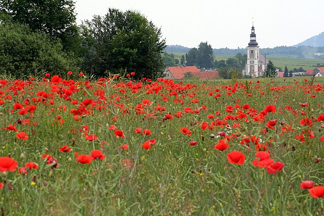
Sankt Veit am Vogau is a charming locale in Austria, located in the Styria region, renowned for its beautiful landscapes and outdoor activities, including hiking. If you're considering hiking in this area, here are some highlights:
Scenic Trails
-
Surrounding Vineyards: The region is dotted with picturesque vineyards, offering gentle trails that meander through rolling hills, perfect for leisurely hikes. The Weinweg (Wine Trail) is particularly popular, allowing hikers to enjoy the local wine culture alongside stunning views.
-
Natural Reserves: The nearby natural reserves provide more challenging terrain for those looking for a vigorous hike. The Käferbach Trail offers routes alongside rivers and through lush forests.
-
Mountain Hikes: While Sankt Veit am Vogau is not as mountainous as some regions in Austria, there are accessible trails leading to nearby hills and viewpoints. The Großer Speikkogel is a rewarding hike, where you can enjoy panoramic views.
Tips for Hiking
- Seasonal Considerations: Spring and autumn are ideal for hiking in this area due to mild temperatures and beautiful foliage. Summer can be warm, while winter may bring snow, which could affect accessibility.
- Gear Up: Wear sturdy hiking boots and bring appropriate clothing for the weather. A good walking stick can also be helpful for uneven terrain.
- Stay Hydrated: Always carry enough water, especially on warmer days. Some trails may be longer and more challenging than they appear.
Local Attractions
- Cultural Sites: When you're not hiking, explore the local culture. The historic town center, churches, and nearby castles can enhance your experience.
- Wine Tasting: Since you're in a wine-producing region, consider pairing your hikes with visits to local wineries for tastings.
Map and Guidance
- It's recommendable to carry a detailed map or a GPS device to stay on track. Local tourist information centers often provide maps of the hiking trails.
Exploring Sankt Veit am Vogau offers a delightful mix of nature, culture, and relaxation. Enjoy your hiking adventures!
- Страна:

- Телефонный код: 03453
- Код автомобильного номера: LB
- Координаты: 46° 44' 52" N, 15° 37' 36" E


- GPS треки (wikiloc): [Ссылка]
- Высота над уровнем моря: 260 м m
- Площадь: 25.9 кв.км
- Википедия русская: wiki(ru)
- Википедия английская: wiki(en)
- Википедия национальная: wiki(de)
- Хранилище Wikidata: Wikidata: Q688126
- Катеория в википедии: [Ссылка]
- код Freebase: [/m/03gwd2r]
- код GeoNames: Альт: [7873472]
- код VIAF: Альт: [128775510]
- идентификатор местоположения ArchINFORM: [9918]
- код LCNAF: Альт: [no2012002083]
- место в MusicBrainz: [acdd760c-ee0a-419d-8b65-5c60b3daa319]
- код австрийского муниципалитета: [61036]
Граничит с регионами:
Габерсдорф
Hiking in Габерсдорф
Gabersdorf, located in the scenic region of Styria in Austria, is an excellent destination for hiking enthusiasts. The area offers a variety of trails that range from easy walking paths suitable for families to more challenging hikes for experienced trekkers. Here are some key points about hiking in Gabersdorf:...
- Страна:
- Почтовый код: 8424
- Телефонный код: 03452
- Код автомобильного номера: LB
- Координаты: 46° 46' 55" N, 15° 35' 13" E
- GPS треки (wikiloc): [Ссылка]
- Высота над уровнем моря: 274 м m
- Площадь: 19.81 кв.км
- Население: 1227
- Веб сайт: [Ссылка]