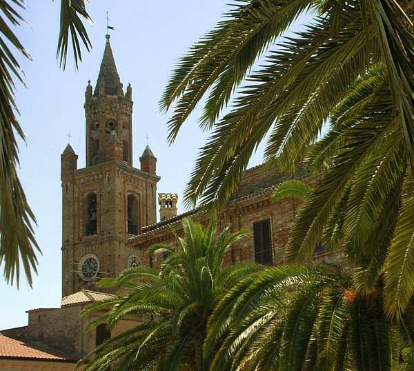
Сант'Омеро (Sant'Omero, Sant'Omero)
.svg)
- коммуна в Италии
 Hiking in Сант'Омеро
Sant'Omero, located in the Abruzzo region of Italy, is a charming town known for its scenic beauty and proximity to the Monti della Laga National Park. Hiking in and around Sant'Omero offers a variety of trails that cater to different skill levels, giving you the opportunity to explore the stunning landscapes, rich biodiversity, and cultural heritage of the area.
Popular Hiking Trails:
-
Monti della Laga National Park:
- The park features numerous trails, with routes ranging from easy walks to more challenging hikes. Some trails lead you through lush forests, while others offer panoramic views of the surrounding mountains and valleys.
-
Cascate della Cimurro:
- This hike takes you to the stunning waterfalls of Cimurro. The trail is moderately challenging and offers beautiful scenery, particularly during spring when the waterfalls are at their fullest.
-
Sentiero del Parco:
- A network of trails within Monti della Laga that allows hikers to explore various aspects of the park's natural beauty. Look for local flora and fauna along the way, including deer, foxes, and a variety of bird species.
-
Historical Hikes:
- Some trails also connect to historical sites, such as ancient churches and ruins, allowing you to combine hiking with cultural exploration.
Tips for Hiking in Sant'Omero:
- Gear: Make sure to wear appropriate hiking attire, including sturdy footwear. A daypack with water, snacks, and a first aid kit is advisable.
- Weather: The weather can change quickly in the mountains, so check the forecast and be prepared for various conditions.
- Maps and Guides: While many trails are well-marked, carrying a detailed map or using a reliable hiking app can enhance your experience.
- Local Advice: Consider connecting with local hiking groups or guides for tips on the best trails and safety information.
Best Time to Hike:
The ideal time for hiking in Sant'Omero typically falls between spring (April to June) and fall (September to October) when temperatures are mild and the natural scenery is particularly beautiful.
Overall, hiking in Sant'Omero presents a wonderful opportunity to immerse yourself in the natural beauty and cultural heritage of this lesser-known part of Italy.
- Страна:

- Почтовый код: 64027
- Телефонный код: 0861
- Код автомобильного номера: TE
- Координаты: 42° 47' 0" N, 13° 48' 0" E


- GPS треки (wikiloc): [Ссылка]
- Высота над уровнем моря: 209 м m
- Площадь: 34.2 кв.км
- Население: 5317
- Веб сайт: http://www.comune.santomero.te.it/
- Википедия русская: wiki(ru)
- Википедия английская: wiki(en)
- Википедия национальная: wiki(it)
- Хранилище Wikidata: Wikidata: Q51465
- Катеория в википедии: [Ссылка]
- код Freebase: [/m/0fs4bn]
- код GeoNames: Альт: [6541211]
- код VIAF: Альт: [155806795]
- ID отношения в OpenStreetMap: [42165]
- UN/LOCODE: [ITZJM]
- dmoz: Альт: [Regional/Europe/Italy/Abruzzo/Localities/Sant'Omero/]
- код ISTAT: 067039
- кадастровый код Италии: I348
Граничит с регионами:

Белланте
- коммуна Италии
Hiking in Белланте
Bellante is a charming municipality located in the Teramo province of the Abruzzo region in Italy. The area boasts beautiful landscapes, rolling hills, and a rich cultural heritage, making it a great destination for hikers....
- Страна:
- Почтовый код: 64020
- Телефонный код: 0861
- Код автомобильного номера: TE
- Координаты: 42° 45' 0" N, 13° 48' 0" E
- GPS треки (wikiloc): [Ссылка]
- Высота над уровнем моря: 354 м m
- Площадь: 50.04 кв.км
- Население: 6997
- Веб сайт: [Ссылка]

Кампли
- коммуна Италии
Hiking in Кампли
Campli, a charming town located in the Abruzzo region of Italy, offers some beautiful hiking opportunities amidst stunning landscapes, historical sites, and natural parks. Here are some key points to consider if you are planning a hiking trip in and around Campli:...
- Страна:
- Почтовый код: 64012
- Телефонный код: 0861
- Код автомобильного номера: TE
- Координаты: 42° 43' 34" N, 13° 41' 10" E
- GPS треки (wikiloc): [Ссылка]
- Высота над уровнем моря: 393 м m
- Площадь: 73.43 кв.км
- Население: 7110
- Веб сайт: [Ссылка]

Чивителла-дель-Тронто
- коммуна Италии
Hiking in Чивителла-дель-Тронто
Civitella del Tronto is a charming hilltop village located in the Abruzzo region of Italy, known for its historical architecture and stunning natural surroundings. Hiking in this area offers a mix of cultural heritage and beautiful landscapes....
- Страна:
- Почтовый код: 64010
- Телефонный код: 0861
- Код автомобильного номера: TE
- Координаты: 42° 46' 19" N, 13° 40' 0" E
- GPS треки (wikiloc): [Ссылка]
- Высота над уровнем моря: 589 м m
- Площадь: 77.74 кв.км
- Население: 4918
- Веб сайт: [Ссылка]
Коррополи
- коммуна Италии
Hiking in Коррополи
Corropoli is a charming town located in the Abruzzo region of Italy, known for its picturesque scenery, rich history, and access to beautiful hiking trails. Hiking in and around Corropoli offers a unique opportunity to explore the stunning landscapes of the Apennines and the coastal areas nearby....
- Страна:
- Почтовый код: 64013
- Телефонный код: 0861
- Код автомобильного номера: TE
- Координаты: 42° 50' 0" N, 13° 50' 0" E
- GPS треки (wikiloc): [Ссылка]
- Высота над уровнем моря: 132 м m
- Площадь: 22.11 кв.км
- Население: 5054
- Веб сайт: [Ссылка]

Мошано-Сант'Анджело
- коммуна Италии
Hiking in Мошано-Сант'Анджело
Mosciano Sant'Angelo is a charming town located in the Abruzzo region of Italy, which features a mix of beautiful landscapes, cultural heritage, and outdoor activities, including hiking. The area around Mosciano Sant'Angelo offers various hiking opportunities that cater to different skill levels and preferences....
- Страна:
- Почтовый код: 64023
- Телефонный код: 085
- Код автомобильного номера: TE
- Координаты: 42° 45' 0" N, 13° 53' 0" E
- GPS треки (wikiloc): [Ссылка]
- Высота над уровнем моря: 227 м m
- Площадь: 48.45 кв.км
- Население: 9316
- Веб сайт: [Ссылка]

Нерето
- коммуна Италии
Hiking in Нерето
Nereto, located in the Abruzzo region of Italy, is not just a picturesque town known for its historical buildings and beautiful landscapes; it also provides access to some wonderful hiking opportunities. The town is surrounded by the splendid Apennine mountains and offers various trails that cater to different skill levels, from casual walkers to experienced hikers....
- Страна:
- Почтовый код: 64015
- Телефонный код: 0861
- Код автомобильного номера: TE
- Координаты: 42° 49' 12" N, 13° 49' 1" E
- GPS треки (wikiloc): [Ссылка]
- Высота над уровнем моря: 163 м m
- Площадь: 7.01 кв.км
- Население: 5342
- Веб сайт: [Ссылка]
Сант'Эджидио-алла-Вибрата
- коммуна Италии
Hiking in Сант'Эджидио-алла-Вибрата
Sant'Egidio alla Vibrata is a quaint town located in the Abruzzo region of Italy, surrounded by picturesque landscapes that make it a great destination for hiking enthusiasts. The area is characterized by its rolling hills, lush valleys, and proximity to the Gran Sasso and Monti della Laga National Park, which offers numerous hiking trails with varying difficulty levels....
- Страна:
- Почтовый код: 64016
- Телефонный код: 0861
- Код автомобильного номера: TE
- Координаты: 42° 50' 0" N, 13° 43' 0" E
- GPS треки (wikiloc): [Ссылка]
- Высота над уровнем моря: 239 м m
- Площадь: 18.36 кв.км
- Население: 9753
- Веб сайт: [Ссылка]

Торано-Нуово
- коммуна Италии
Hiking in Торано-Нуово
Torano Nuovo is a small town located in the Abruzzo region of Italy, known for its scenic landscapes and proximity to the Gran Sasso and Monti della Laga National Park. While it may not be as well-known as some larger hiking destinations, it offers a variety of trails that can cater to both casual walkers and more experienced hikers....
- Страна:
- Почтовый код: 64010
- Телефонный код: 0861
- Код автомобильного номера: TE
- Координаты: 42° 49' 0" N, 13° 47' 0" E
- GPS треки (wikiloc): [Ссылка]
- Высота над уровнем моря: 237 м m
- Площадь: 10.22 кв.км
- Население: 1584
- Веб сайт: [Ссылка]

Торторето
- коммуна Италии
Hiking in Торторето
Tortoreto is a charming coastal town located in the Abruzzo region of Italy, known for its beautiful beaches and scenic landscapes. While it's primarily recognized for its seaside activities, there are also hiking opportunities in the surrounding areas that showcase the stunning natural beauty of the region....
- Страна:
- Почтовый код: 64018
- Телефонный код: 0861
- Код автомобильного номера: TE
- Координаты: 42° 48' 0" N, 13° 55' 0" E
- GPS треки (wikiloc): [Ссылка]
- Высота над уровнем моря: 239 м m
- Площадь: 22.97 кв.км
- Население: 11622
- Веб сайт: [Ссылка]