Сантарканджело-ди-Романья (Santarcangelo di Romagna, Santarcangelo di Romagna)
.svg)
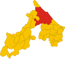
- коммуна Италии
 Hiking in Сантарканджело-ди-Романья
Santarcangelo di Romagna, located in the Emilia-Romagna region of Italy, offers a unique hiking experience with its scenic landscapes and historical charm. The area around Santarcangelo is characterized by rolling hills, vineyards, and quaint villages, making it an attractive destination for hikers.
Hiking Trails
-
Riviera Romagnola Trails: The nearby trails connect the coastal regions with the inland hills, offering varied terrain. You can explore routes that provide stunning views of the Adriatic Sea and the beautiful Romagnolo countryside.
-
Monte San Marino: A short distance from Santarcangelo, Monte San Marino offers trails that lead to the summit, where you can enjoy panoramic views. The ascent is suitable for moderate hikers, and the area is rich in local flora.
-
Historical Pathways: Many paths in the region have historical significance, leading to ancient ruins, castles, and churches. A hike around Santarcangelo can include stops to appreciate the art and culture embedded in the landscape.
Tips for Hiking in Santarcangelo di Romagna
-
Best Time to Hike: The ideal months for hiking are late spring (May to June) and early autumn (September to October) when temperatures are mild and nature is at its best.
-
Gear: Wear comfortable hiking boots and consider weather-appropriate clothing. A hat, sunglasses, and plenty of water are also essential, especially during warmer months.
-
Trail Maps: It's helpful to have a local map or GPS app to navigate the trails, as some paths might not be well-marked.
-
Local Cuisine: After your hike, explore local restaurants for traditional Romagnolo cuisine, such as piadina (flatbread) and fresh pasta dishes.
-
Respect the Environment: Follow Leave No Trace principles to preserve the beauty of the natural landscape. Stick to marked paths and dispose of waste responsibly.
Whether you're looking for a leisurely walk through picturesque villages or a more challenging hike in the hills, Santarcangelo di Romagna offers a wonderful backdrop for outdoor enthusiasts. Happy hiking!
- Страна:

- Почтовый код: 47822
- Телефонный код: 0541
- Код автомобильного номера: RN
- Координаты: 44° 3' 48" N, 12° 26' 48" E


- GPS треки (wikiloc): [Ссылка]
- Высота над уровнем моря: 42 м m
- Площадь: 45.01 кв.км
- Население: 22171
- Веб сайт: http://www.comune.santarcangelo.rn.it/
- Википедия русская: wiki(ru)
- Википедия английская: wiki(en)
- Википедия национальная: wiki(it)
- Хранилище Wikidata: Wikidata: Q111954
- Катеория в википедии: [Ссылка]
- код Freebase: [/m/0dz41f]
- код GeoNames: Альт: [6540301]
- код BNF: [150129450]
- код VIAF: Альт: [130180949]
- ID отношения в OpenStreetMap: [42814]
- код LCNAF: Альт: [n80040566]
- место в MusicBrainz: [36eb1ad3-aae6-4762-bea8-4d7baaae3da3]
- UN/LOCODE: [ITSTN]
- код в Большой каталанской энциклопедии: [0059509]
- код ISTAT: 099018
- кадастровый код Италии: I304
Граничит с регионами:


Веруккьо
- коммуна Италии
Hiking in Веруккьо
Verucchio, located in the Emilia-Romagna region of Italy, is a picturesque village that offers an array of hiking opportunities amidst stunning landscapes and historical landmarks. Here are some highlights about hiking in and around Verucchio:...
- Страна:
- Почтовый код: 47826
- Телефонный код: 0541
- Код автомобильного номера: RN
- Координаты: 43° 59' 0" N, 12° 25' 17" E
- GPS треки (wikiloc): [Ссылка]
- Высота над уровнем моря: 330 м m
- Площадь: 27.3 кв.км
- Население: 10012
- Веб сайт: [Ссылка]

Римини
- коммуна Италии
Hiking in Римини
Rimini, located on the Adriatic coast of Italy, is primarily known for its beaches and vibrant nightlife. However, this area also serves as a great base for exploring the stunning landscapes of the surrounding regions, particularly for those interested in hiking....
- Страна:
- Почтовый код: 47921–47924
- Телефонный код: (+39) 541
- Код автомобильного номера: RN
- Координаты: 44° 3' 34" N, 12° 34' 7" E
- GPS треки (wikiloc): [Ссылка]
- Высота над уровнем моря: 6 м m
- Площадь: 135.71 кв.км
- Население: 148908
- Веб сайт: [Ссылка]


Борги
- коммуна регионе Эмилия-Романья, Италия
Hiking in Борги
Hiking in Borghi, a picturesque village located in Italy, offers a unique blend of beautiful landscapes, rich history, and charming Italian culture. Nestled in the Emilia-Romagna region, Borghi is surrounded by rolling hills, vineyards, and scenic countryside, making it an ideal location for outdoor enthusiasts. Here are some key points to consider if you're planning to hike in this beautiful area:...
- Страна:
- Почтовый код: 47030
- Телефонный код: 0541
- Код автомобильного номера: FC
- Координаты: 44° 1' 56" N, 12° 21' 22" E
- GPS треки (wikiloc): [Ссылка]
- Высота над уровнем моря: 267 м m
- Площадь: 30.23 кв.км
- Население: 2857
- Веб сайт: [Ссылка]


Лонджано
- коммуна Италии
Hiking in Лонджано
Longiano, a charming town in the Emilia-Romagna region of Italy, offers beautiful hiking opportunities thanks to its picturesque landscapes and proximity to both the Adriatic coast and the Apennine mountains. Here are some highlights and tips for hiking in and around Longiano:...
- Страна:
- Почтовый код: 47020
- Телефонный код: 0547
- Код автомобильного номера: FC
- Координаты: 44° 5' 0" N, 12° 20' 0" E
- GPS треки (wikiloc): [Ссылка]
- Высота над уровнем моря: 169 м m
- Площадь: 23.58 кв.км
- Население: 7190
- Веб сайт: [Ссылка]


Сан-Мауро-Пасколи
- коммуна Италии
Hiking in Сан-Мауро-Пасколи
San Mauro Pascoli, located in the Emilia-Romagna region of Italy, offers hikers a unique blend of scenic landscapes, cultural experiences, and a rich literary history. Here are some key points to consider when hiking in this area:...
- Страна:
- Почтовый код: 47030
- Телефонный код: 0541
- Координаты: 44° 6' 0" N, 12° 25' 0" E
- GPS треки (wikiloc): [Ссылка]
- Высота над уровнем моря: 27 м m
- Площадь: 17.29 кв.км
- Население: 11929
- Веб сайт: [Ссылка]


Савиньяно-суль-Рубиконе
- коммуна Италии
Hiking in Савиньяно-суль-Рубиконе
Savignano sul Rubicone is a charming town located in the Emilia-Romagna region of Italy. Nestled near the Rubicon River, it offers a variety of hiking opportunities that allow you to explore both the natural beauty of the surrounding countryside and the historical significance of the area. Here are some key highlights regarding hiking in and around Savignano sul Rubicone:...
- Страна:
- Почтовый код: 47039
- Телефонный код: 0541
- Код автомобильного номера: FC
- Координаты: 44° 5' 17" N, 12° 23' 36" E
- GPS треки (wikiloc): [Ссылка]
- Высота над уровнем моря: 32 м m
- Площадь: 23.3 кв.км
- Население: 17744
- Веб сайт: [Ссылка]