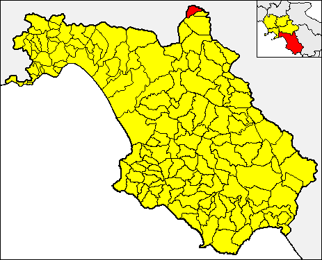
Сантоменна (Santomenna, Santomenna)

- коммуна Италии
 Hiking in Сантоменна
Santomenna, a small and picturesque village located in the province of Salerno in the Campania region of Italy, offers a variety of hiking opportunities for outdoor enthusiasts. Nestled in the beautiful hills of the Cilento and Vallo di Diano National Park, this region is known for its stunning landscapes, diverse flora and fauna, and numerous trails.
Hiking Trails
-
Cilento National Park Trails: The park features several marked trails that vary in difficulty, making it suitable for both beginners and experienced hikers. You can find paths that lead to breathtaking viewpoints, historical ruins, and charming rural landscapes.
-
Sentiero degli Dei (Path of the Gods): Although a bit of a drive from Santomenna, this famous trail is worth it. It connects the towns of Bomerano and Nocelle, providing stunning views of the Amalfi Coast and surrounding hills.
-
Local Trails: Explore lesser-known trails around Santomenna itself, where you can hike through rugged hills, olive groves, and picturesque villages. Be sure to check local maps and ask residents for recommendations on routes that highlight the area's natural beauty and cultural heritage.
What to Expect
- Stunning Scenery: Hikers will be rewarded with panoramic views of the surrounding mountains, valleys, and Mediterranean vegetation.
- Rich Flora and Fauna: The region is home to a variety of plant species and wildlife, making it a great spot for nature lovers and photographers.
- Cultural Experiences: Along the hiking trails, you may encounter small farms, chapels, and ancient ruins, giving you a glimpse into the local culture and history.
Preparation and Tips
- Gear: Wear sturdy hiking boots and bring weather-appropriate clothing, as the weather can change quickly in the mountains.
- Water and Snacks: Keep hydrated and carry snacks, especially on longer hikes.
- Trail Maps: It's advisable to have a map or a GPS device, as some trails may not be well-marked.
- Local Guidance: Consider joining a guided hike if you're unfamiliar with the area, as they can offer insights and ensure a safe experience.
Best Time to Hike
The best times for hiking in Santomenna are typically during the spring (April to June) and fall (September to October) when the weather is mild and the landscapes are lush. Summer can be hot, while winter may bring colder temperatures and rain.
Hiking in Santomenna offers a unique blend of natural beauty, cultural heritage, and the peaceful ambiance of the Italian countryside. Whether you're looking for an easy stroll or a more challenging hike, this charming village and its surroundings have something to offer every adventurer.
- Страна:

- Почтовый код: 84020
- Телефонный код: 0828
- Код автомобильного номера: SA
- Координаты: 40° 48' 0" N, 15° 19' 0" E


- GPS треки (wikiloc): [Ссылка]
- Высота над уровнем моря: 540 м m
- Площадь: 8.92 кв.км
- Население: 441
- Веб сайт: http://www.comune.santomenna.sa.it
- Википедия русская: wiki(ru)
- Википедия английская: wiki(en)
- Википедия национальная: wiki(it)
- Хранилище Wikidata: Wikidata: Q81633
- Катеория в википедии: [Ссылка]
- код GeoNames: Альт: [6541193]
- код VIAF: Альт: [246326647]
- ID отношения в OpenStreetMap: [40792]
- код ISTAT: 065131
- кадастровый код Италии: I260
Граничит с регионами:
Пескопагано
- коммуна Италии
Hiking in Пескопагано
Pescopagano, a charming village in the Basilicata region of southern Italy, offers fantastic opportunities for hiking and enjoying the natural beauty of the area. Here are some key points to consider for hiking in and around Pescopagano:...
- Страна:
- Почтовый код: 85020
- Телефонный код: 0976
- Код автомобильного номера: PZ
- Координаты: 40° 50' 6" N, 15° 23' 58" E
- GPS треки (wikiloc): [Ссылка]
- Высота над уровнем моря: 954 м m
- Площадь: 69.84 кв.км
- Население: 1851
- Веб сайт: [Ссылка]

Кастельнуово-ди-Конца
- коммуна Италии
Hiking in Кастельнуово-ди-Конца
Castelnuovo di Conza, located in the Campania region of Italy, offers a unique hiking experience thanks to its picturesque landscapes, historical significance, and varied terrain. Here are some key points to consider if you're planning to hike in this area:...
- Страна:
- Почтовый код: 84020
- Телефонный код: 0828
- Код автомобильного номера: SA
- Координаты: 40° 49' 0" N, 15° 19' 0" E
- GPS треки (wikiloc): [Ссылка]
- Высота над уровнем моря: 650 м m
- Площадь: 14.06 кв.км
- Население: 598
- Веб сайт: [Ссылка]
Лавьяно
- коммуна Италии
Hiking in Лавьяно
Laviano is a charming town located in the province of Avellino, in the Campania region of Italy. Surrounded by the scenic beauty of the Apennine Mountains, Laviano offers a range of hiking opportunities for outdoor enthusiasts, with various trails that showcase its lush landscapes, rich flora, and stunning views....
- Страна:
- Почтовый код: 84020
- Телефонный код: 0828
- Код автомобильного номера: SA
- Координаты: 40° 47' 10" N, 15° 18' 28" E
- GPS треки (wikiloc): [Ссылка]
- Высота над уровнем моря: 475 м m
- Площадь: 55.68 кв.км
- Население: 1373
- Веб сайт: [Ссылка]