Зассенбург (Sassenburg, Sassenburg)

 Hiking in Зассенбург
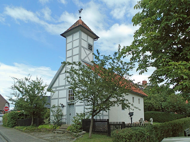
Sassenburg, located in Lower Saxony, Germany, is surrounded by natural beauty and offers various opportunities for hiking enthusiasts. While not as widely known as some other hiking regions, it has its own charm and scenic landscapes.
Hiking Trails:
-
Local Pathways: Sassenburg has several local trails that allow hikers to explore the beautiful countryside, including forests, fields, and waterways. The paths are often well-marked and range from easy strolls to more challenging walks.
-
Nature Reserves: The area surrounding Sassenburg may include nature reserves that provide even more varied terrain and a chance to see local wildlife. Visiting these areas can provide a serene hiking experience.
-
Nearby Forests: The region features several forests, offering shaded trails and the chance to connect with nature. Look for routes in the nearby forests that are ideal for both leisure hikes and more vigorous trekking.
Preparation for Hiking:
-
Maps and Guides: It's advisable to get a local hiking map or guide, which can provide insights into the trails and points of interest. Local tourist information can be very helpful.
-
Weather Considerations: Check the weather before you head out, as conditions can change quickly. Dress appropriately in layers and bring waterproof gear if necessary.
-
Safety Tips: Always inform someone of your hiking plans, especially if you are venturing into less populated areas. Carry a first-aid kit, sufficient water, snacks, and a fully charged mobile phone.
Best Time to Hike:
The best times for hiking in the Sassenburg area are usually in late spring (May to June) and early autumn (September to October) when the weather is mild, and the scenery is particularly beautiful.
Local Attractions:
After a day of hiking, consider exploring local attractions such as small towns, historical sites, or enjoying local cuisine at nearby eateries.
Enjoy your hiking adventure in Sassenburg! Remember to respect the natural environment and follow all local regulations regarding trail usage.
- Страна:

- Почтовый код: 38524
- Телефонный код: 05379; 05378; 05371
- Код автомобильного номера: GF
- Координаты: 52° 31' 0" N, 10° 38' 0" E


- GPS треки (wikiloc): [Ссылка]
- Высота над уровнем моря: 68 м m
- Площадь: 88.4 кв.км
- Население: 12460
- Веб сайт: http://www.sassenburg.de
- Википедия русская: wiki(ru)
- Википедия английская: wiki(en)
- Википедия национальная: wiki(de)
- Хранилище Wikidata: Wikidata: Q475659
- Катеория в википедии: [Ссылка]
- код Freebase: [/m/0c66wg]
- код Freebase: [/m/0c66wg]
- код GeoNames: Альт: [3208618]
- код GeoNames: Альт: [3208618]
- код VIAF: Альт: [248262628]
- код VIAF: Альт: [248262628]
- ID отношения в OpenStreetMap: [1392805]
- ID отношения в OpenStreetMap: [1392805]
- код GND: Альт: [4439951-0]
- код GND: Альт: [4439951-0]
- место в MusicBrainz: [e8030f62-3a86-48f1-891c-3b0097ad3c34]
- место в MusicBrainz: [e8030f62-3a86-48f1-891c-3b0097ad3c34]
- WOEID: [12630304]
- WOEID: [12630304]
- код TGN: [7078152]
- код TGN: [7078152]
- код Historical Gazetteer: [SASURGJO52IM]
- код Historical Gazetteer: [SASURGJO52IM]
- идентификатор муниципалитетов в Германии: 03151025
- идентификатор муниципалитетов в Германии: 03151025
- код GNS: 23165
- код GNS: 23165
Граничит с регионами:

Гифхорн
- город в земле Нижняя Саксония (Германия)
Hiking in Гифхорн
Gifhorn is a charming town in Lower Saxony, Germany, surrounded by natural beauty and offers a range of hiking opportunities. Here are some highlights about hiking in and around Gifhorn:...
- Страна:
- Почтовый код: 38518
- Телефонный код: 05371
- Код автомобильного номера: GF
- Координаты: 52° 29' 19" N, 10° 32' 47" E
- GPS треки (wikiloc): [Ссылка]
- Высота над уровнем моря: 53 м m
- Площадь: 104.86 кв.км
- Население: 42019
- Веб сайт: [Ссылка]
Бокенсдорф
- коммуна в Германии
Hiking in Бокенсдорф
Bokensdorf, located in Germany, offers a tranquil escape for hiking enthusiasts. Though it's a small village, the surrounding area boasts beautiful natural landscapes ideal for outdoor activities. When hiking in and around Bokensdorf, consider these aspects:...
- Страна:
- Почтовый код: 38556
- Телефонный код: 05366
- Код автомобильного номера: GF
- Координаты: 52° 29' 52" N, 10° 42' 52" E
- GPS треки (wikiloc): [Ссылка]
- Высота над уровнем моря: 76 м m
- Площадь: 14.49 кв.км
- Население: 1283

Барведель
Hiking in Барведель
Barwedel is a quaint village located in Lower Saxony, Germany. While it may not be renowned for dramatic mountain scenery, it offers a charming rural landscape perfect for leisurely hikes. Here are some key aspects to consider when hiking in and around Barwedel:...
- Страна:
- Почтовый код: 38476
- Телефонный код: 05366
- Код автомобильного номера: GF
- Координаты: 52° 31' 0" N, 10° 47' 0" E
- GPS треки (wikiloc): [Ссылка]
- Высота над уровнем моря: 70 м m
- Площадь: 19.8 кв.км
- Население: 996
- Веб сайт: [Ссылка]
Кальберла
Hiking in Кальберла
Calberlah is a small village located in Lower Saxony, Germany, close to the larger city of Wolfsburg. The region offers a tranquil environment, although it's not as well-known for hiking compared to Germany's famous national parks and mountains. However, there are still some opportunities for outdoor activities, including hiking, that you can explore in and around Calberlah....
- Страна:
- Почтовый код: 38547
- Телефонный код: 05374
- Код автомобильного номера: GF
- Координаты: 52° 25' 29" N, 10° 36' 59" E
- GPS треки (wikiloc): [Ссылка]
- Высота над уровнем моря: 67 м m
- Площадь: 27.65 кв.км
- Население: 4996

Йембке
Hiking in Йембке
Jembke is a small village located in Lower Saxony, Germany, and while it may not be the first place that comes to mind when considering hiking destinations, it can serve as a starting point for exploring the surrounding natural areas....
- Страна:
- Почтовый код: 38477
- Телефонный код: 05366
- Код автомобильного номера: GF
- Координаты: 52° 29' 50" N, 10° 45' 36" E
- GPS треки (wikiloc): [Ссылка]
- Высота над уровнем моря: 63 м m
- Площадь: 14.57 кв.км
- Население: 2005

Ослос
Hiking in Ослос
Hiking in Oslo offers a fantastic blend of nature, culture, and accessible trails. The region is surrounded by beautiful forests, hills, and lakes, making it a great destination for outdoor enthusiasts. Here are some key points for hiking in and around Oslo:...
- Страна:
- Почтовый код: 38557
- Телефонный код: 05362
- Код автомобильного номера: GF
- Координаты: 52° 28' 9" N, 10° 40' 48" E
- GPS треки (wikiloc): [Ссылка]
- Высота над уровнем моря: 52 м m
- Площадь: 7.64 кв.км
- Население: 1913

Варенхольц
Hiking in Варенхольц
Wahrenholz is a small town located in Lower Saxony, Germany, surrounded by beautiful countryside and natural landscapes, making it a pleasant option for hiking enthusiasts. While Wahrenholz itself may not have extensive hiking trails specifically within the town, you can explore the surrounding areas that offer various hiking opportunities. Here are some key points to consider when hiking in and around Wahrenholz:...
- Страна:
- Почтовый код: 29399
- Телефонный код: 05835
- Код автомобильного номера: GF
- Координаты: 52° 37' 0" N, 10° 36' 0" E
- GPS треки (wikiloc): [Ссылка]
- Высота над уровнем моря: 55 м m
- Площадь: 58 кв.км
- Население: 3596

Эра-Лессин
Hiking in Эра-Лессин
Ehra-Lessien is a small municipality located in Lower Saxony, Germany. While it may not be as well-known for hiking as some of the larger national parks or mountainous regions in Germany, there are still opportunities for outdoor activities in and around the area....
- Страна:
- Почтовый код: 38468
- Телефонный код: 05377
- Код автомобильного номера: GF
- Координаты: 52° 35' 49" N, 10° 47' 46" E
- GPS треки (wikiloc): [Ссылка]
- Высота над уровнем моря: 63 м m
- Площадь: 56.08 кв.км
- Население: 1931
- Веб сайт: [Ссылка]