Шрёккен (Schröcken, Schröcken)

 Hiking in Шрёккен
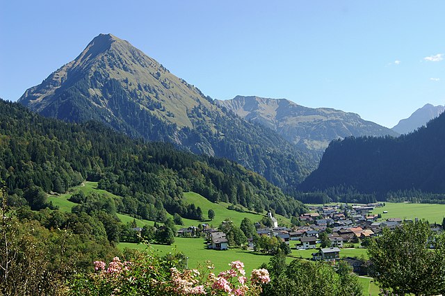
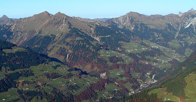
Schröcken is a charming village located in the Bregenzerwald region of Austria, and it is a fantastic destination for hiking enthusiasts. Nestled within the scenic Alps, Schröcken offers a variety of trails that cater to all skill levels, from beginners to experienced hikers.
Hiking Trails
-
Schwarzenberg Trail: A moderate hike that leads through lush forests and meadows, offering stunning views of the surrounding mountains. This trail is well-marked and ideal for families.
-
Bärengrat Path: This is a more challenging trail that rewards hikers with breathtaking panoramic views from the summit. The path follows a ridge and is perfect for those looking for a bit of adventure.
-
Auenfeld Trail: A relatively easy trail suitable for all ages. It winds through beautiful landscapes dotted with wildflowers in the summer. It’s a great option for those looking to enjoy a leisurely hike.
-
Mountain Lakes Hike: This trail takes you to nearby mountain lakes, where you can relax, swim, or have a picnic. The accessibility can vary, so make sure to check the trail conditions.
Best Time to Hike
The best time for hiking in Schröcken is from late spring through early autumn (May to October). During this period, the weather is generally mild, and the trails are well-maintained. However, always check local weather reports before heading out, as conditions can change rapidly in the mountains.
Guided Hikes
For those unfamiliar with the area, guided hikes are available, offering insights into the local flora and fauna as well as the region's history. This is especially beneficial if you’re hiking with a group or family.
Preparation Tips
- Footwear: Wear sturdy hiking boots with good grip.
- Layering: Dress in layers as mountain weather can change quickly. An extra layer and a waterproof jacket are advisable.
- Hydration: Carry plenty of water and snacks to keep your energy levels up.
- Map & Navigation: Always carry a map or a GPS device, especially if you're venturing onto less-traveled paths.
Other Activities
In addition to hiking, Schröcken offers opportunities for mountain biking, paragliding, and skiing in the winter months, making it a year-round destination for outdoor enthusiasts.
Whether you're looking to tackle serious trails or simply enjoy the stunning alpine scenery, Schröcken provides a great backdrop for your hiking adventures. Always remember to respect nature, stay on marked paths, and practice Leave No Trace principles. Happy hiking!
- Страна:

- Почтовый код: 6888
- Телефонный код: 05519
- Код автомобильного номера: B
- Координаты: 47° 15' 0" N, 10° 5' 0" E


- GPS треки (wikiloc): [Ссылка]
- Высота над уровнем моря: 1269 м m
- Площадь: 23.43 кв.км
- Население: 224
- Веб сайт: http://www.warth-schroecken.at/
- Википедия русская: wiki(ru)
- Википедия английская: wiki(en)
- Википедия национальная: wiki(de)
- Хранилище Wikidata: Wikidata: Q535102
- Галерея изображений в википедии: [Ссылка]
- Катеория в википедии: [Ссылка]
- код Freebase: [/m/03gty8d]
- код GeoNames: Альт: [7667386]
- код VIAF: Альт: [244730729]
- код GND: Альт: [4527861-1]
- идентификатор местоположения ArchINFORM: [10542]
- код австрийского муниципалитета: [80234]
Граничит с регионами:

Шоппернау
Hiking in Шоппернау
Schoppernau is a picturesque village located in the Vorarlberg region of Austria, surrounded by the stunning landscapes of the Bregenzerwald mountains. It is a fantastic destination for hiking enthusiasts, offering a variety of trails suitable for different skill levels....
- Страна:
- Почтовый код: 6886
- Телефонный код: 05515
- Код автомобильного номера: B
- Координаты: 47° 18' 48" N, 10° 1' 3" E
- GPS треки (wikiloc): [Ссылка]
- Высота над уровнем моря: 852 м m
- Площадь: 47.64 кв.км
- Население: 950
- Веб сайт: [Ссылка]


Лех-на-Арльберге
Hiking in Лех-на-Арльберге
Lech, located in the Vorarlberg region of Austria, is a popular destination for hiking enthusiasts, particularly in the summer months. The breathtaking alpine scenery, idyllic landscapes, and well-maintained trails make it an ideal spot for hikers of all skill levels....
- Страна:
- Почтовый код: 6764
- Телефонный код: 05583
- Код автомобильного номера: BZ
- Координаты: 47° 12' 36" N, 10° 8' 34" E
- GPS треки (wikiloc): [Ссылка]
- Высота над уровнем моря: 1444 м m
- Площадь: 90 кв.км
- Население: 1568
- Веб сайт: [Ссылка]


Миттельберг
Hiking in Миттельберг
Mittelberg, situated in the Kleinwalsertal region of Austria, offers a variety of hiking opportunities set against stunning alpine scenery. Known for its picturesque landscapes and diverse terrain, Mittelberg is a fantastic destination for both beginners and experienced hikers....
- Страна:
- Телефонный код: 05517
- Код автомобильного номера: B
- Координаты: 47° 19' 22" N, 10° 9' 20" E
- GPS треки (wikiloc): [Ссылка]
- Высота над уровнем моря: 1200 м m
- Площадь: 96.82 кв.км
- Население: 4962
- Веб сайт: [Ссылка]


Варт
Hiking in Варт
Warth, a charming village located in the Bregenzerwald region of Vorarlberg, Austria, is an excellent destination for hiking enthusiasts. Nestled within the stunning backdrop of the Alps, it offers a range of trails that cater to different skill levels and preferences....
- Страна:
- Почтовый код: 6767
- Телефонный код: 05583
- Код автомобильного номера: B
- Координаты: 47° 15' 32" N, 10° 10' 55" E
- GPS треки (wikiloc): [Ссылка]
- Высота над уровнем моря: 1495 м m
- Площадь: 19.34 кв.км
- Население: 170
- Веб сайт: [Ссылка]

Зоннтаг
Hiking in Зоннтаг
Sonntag is a charming village located in the Montafon valley in the Austrian state of Vorarlberg. It is a fantastic base for hiking enthusiasts, offering a range of trails that cater to various levels of hikers, from beginners to experienced trekkers....
- Страна:
- Почтовый код: 6731
- Телефонный код: 05554
- Код автомобильного номера: BZ
- Координаты: 47° 14' 21" N, 9° 54' 5" E
- GPS треки (wikiloc): [Ссылка]
- Высота над уровнем моря: 888 м m
- Площадь: 81.58 кв.км
- Население: 671
- Веб сайт: [Ссылка]