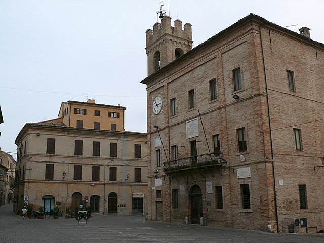
Сироло (Sirolo, Sirolo)
.svg)
- коммуна Италии
 Hiking in Сироло
Sirolo, a picturesque village on the Adriatic Coast in Italy, is part of the Monte Conero Regional Park. This area is renowned for its stunning landscapes, diverse flora and fauna, and breathtaking views of the sea. Here’s an overview of hiking in Sirolo:
Trails and Routes
-
Sentiero del Conero: This is one of the main hiking trails in the park, a coastal route that offers panoramic views of the Adriatic Sea and takes you through dense Mediterranean vegetation. It connects Sirolo to Numana and offers several viewpoints along the way.
-
Monte Conero Summit: For a more challenging hike, head towards the summit of Monte Conero. The trail might get steep at times, but the views from the top are worth the effort, offering a spectacular vantage point over the coastline and surrounding areas.
-
Scoglio del Trave: This trail leads to one of the most iconic rock formations along the coast. The hike is moderately challenging and includes some rocky paths, rewards you with stunning coastal views.
-
Portonovo Bay: A more relaxed hiking option, this trail takes you down to Portonovo Bay, where you can enjoy a refreshing swim or picnic on the beach after your hike.
Things to Consider
- Preparation: Make sure to wear appropriate hiking footwear, bring enough water, and consider using sunscreen, especially in summer.
- Maps and Guides: It can be useful to have a map or a hiking app since some trails may not be well-marked.
- Wildlife Viewing: The area is home to diverse wildlife, including various bird species and unique plants, so keep an eye out for nature enthusiasts.
- Local Regulations: Always follow local regulations and guidelines to protect the natural environment.
Best Time to Hike
The best time for hiking in Sirolo is during the spring (April to June) and early autumn (September to October) when the weather is mild and the landscapes are vibrant. Summer can be quite hot, so early morning hikes are advisable if you choose to hike during this season.
Conclusion
Hiking in Sirolo is a fantastic way to explore the stunning natural beauty of the Monte Conero Regional Park. With its diverse trails ranging from easy walks to more demanding hikes, there's something for everyone. Enjoy the breathtaking views and the rich biodiversity that this beautiful area has to offer!
- Страна:

- Почтовый код: 60020
- Телефонный код: 071
- Код автомобильного номера: AN
- Координаты: 43° 31' 34" N, 13° 36' 58" E


- GPS треки (wikiloc): [Ссылка]
- Высота над уровнем моря: 125 м m
- Площадь: 16.68 кв.км
- Население: 4078
- Веб сайт: http://www.provincia.ancona.it/comuni/sirolo/
- Википедия русская: wiki(ru)
- Википедия английская: wiki(en)
- Википедия национальная: wiki(it)
- Хранилище Wikidata: Wikidata: Q124999
- Галерея изображений в википедии: [Ссылка]
- Катеория в википедии: [Ссылка]
- код Freebase: [/m/0f5cgr]
- код GeoNames: Альт: [6540451]
- код VIAF: Альт: [139384940]
- ID отношения в OpenStreetMap: [42474]
- код TGN: [1046923]
- код ISTAT: 042048
- кадастровый код Италии: I758
Граничит с регионами:


Камерано
- коммуна Италии
Hiking in Камерано
Camerano is a charming town in the Marche region of Italy, known for its beautiful landscapes, rich history, and proximity to the stunning Conero Riviera. Hiking around Camerano offers a variety of trails that cater to different skill levels while providing breathtaking views of the surrounding countryside and the Adriatic Sea....
- Страна:
- Почтовый код: 60021
- Телефонный код: 071
- Код автомобильного номера: AN
- Координаты: 43° 31' 40" N, 13° 33' 9" E
- GPS треки (wikiloc): [Ссылка]
- Высота над уровнем моря: 231 м m
- Площадь: 20 кв.км
- Население: 7218
- Веб сайт: [Ссылка]

Кастельфидардо
- коммуна Италии
Hiking in Кастельфидардо
Castelfidardo is a charming town located in the Marche region of Italy, known for its scenic landscapes and rich cultural heritage. Hiking in Castelfidardo offers a wonderful experience as it combines the beauty of nature with historical sites and stunning views of the surrounding countryside, including the nearby Adriatic Sea....
- Страна:
- Почтовый код: 60022
- Телефонный код: 071
- Код автомобильного номера: AN
- Координаты: 43° 27' 51" N, 13° 32' 46" E
- GPS треки (wikiloc): [Ссылка]
- Высота над уровнем моря: 215 м m
- Площадь: 33.39 кв.км
- Население: 18601
- Веб сайт: [Ссылка]


Нумана
- коммуна Италии
Hiking in Нумана
Numana, located on the Adriatic coast in the Marche region of Italy, offers a unique combination of scenic coastal trails and lush inland hikes. Here are some highlights and tips for hiking in and around Numana:...
- Страна:
- Почтовый код: 60026
- Телефонный код: 071
- Код автомобильного номера: AN
- Координаты: 43° 30' 49" N, 13° 37' 18" E
- GPS треки (wikiloc): [Ссылка]
- Высота над уровнем моря: 96 м m
- Площадь: 10.94 кв.км
- Население: 3763
- Веб сайт: [Ссылка]


Анкона
- коммуна Италии
Hiking in Анкона
Ancona, located on the Adriatic coast of Italy, is a beautiful destination for hiking, offering a mix of coastal trails, scenic landscapes, and historical sites. Here are some highlights for hiking in and around Ancona:...
- Страна:
- Почтовый код: 60121–60131; 60100
- Телефонный код: 071
- Код автомобильного номера: AN
- Координаты: 43° 37' 0" N, 13° 31' 0" E
- GPS треки (wikiloc): [Ссылка]
- Высота над уровнем моря: 16 м m
- Площадь: 124.84 кв.км
- Население: 100721
- Веб сайт: [Ссылка]