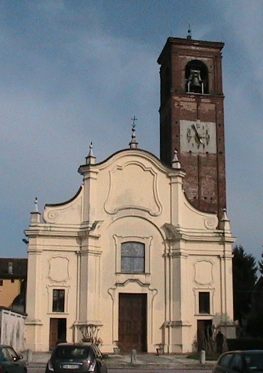
Соспиро (Sospiro, Sospiro)
.svg)
- коммуна Италии
 Hiking in Соспиро
Sospiro is a small municipality located in the province of Cremona, northern Italy. While it might not be a well-known hiking destination compared to more mountainous regions, the surrounding areas offer some opportunities for scenic walks and hikes.
Local Environment
Sospiro is situated in the flat plains of the Po Valley, characterized by agricultural landscapes, rivers, and canals. Hiking in this region provides a unique opportunity to explore the tranquil countryside, with routes that may include tree-lined paths, fields of crops, and small, picturesque villages.
Hiking Opportunities
-
Riverside Walks: The area around Sospiro features rivers such as the Po River and its tributaries, which provide peaceful walking routes where you can enjoy nature, birdwatching, and the soothing sounds of flowing water.
-
Agricultural Trails: You can hike through surrounding agricultural lands and appreciate the rural lifestyle, including charming farmhouses and local produce markets.
-
Cremona Province Trails: If you're willing to venture a bit further, you can explore designated hiking trails in the nearby areas of the province of Cremona. The Parco Regionale dell’Oglio Sud, for instance, is a lovely natural park that offers various hiking paths suitable for all levels.
Tips for Hiking in Sospiro
-
Be Prepared: Since the terrain is generally flat, good walking shoes are still recommended. Carry plenty of water, especially during warm months, and be mindful of the weather.
-
Explore Local Culture: Take time to enjoy local attractions and cuisine in Sospiro and the surrounding areas, including visiting nearby historic towns like Cremona known for its rich history and artistry.
-
Respect the Environment: As always, practice Leave No Trace principles by staying on marked paths and respecting wildlife.
Conclusion
While you may not find traditional mountain hiking in Sospiro, there are still beautiful landscapes and a chance to experience the serene countryside of Italy. Combine your hikes with a taste of the local culture and history for a well-rounded experience!
- Страна:

- Почтовый код: 26048
- Телефонный код: 0372
- Код автомобильного номера: CR
- Координаты: 45° 6' 0" N, 10° 9' 0" E


- GPS треки (wikiloc): [Ссылка]
- Высота над уровнем моря: 36 м m
- Площадь: 18.96 кв.км
- Население: 3103
- Веб сайт: http://www.comune.sospiro.cr.it
- Википедия русская: wiki(ru)
- Википедия английская: wiki(en)
- Википедия национальная: wiki(it)
- Хранилище Wikidata: Wikidata: Q166875
- Катеория в википедии: [Ссылка]
- код Freebase: [/m/0gj_2r]
- код GeoNames: Альт: [6540644]
- код VIAF: Альт: [249237738]
- ID отношения в OpenStreetMap: [44155]
- код GND: Альт: [7700879-0]
- UN/LOCODE: [ITSPO]
- код места в Facebook: [110616325626176]
- код ISTAT: 019099
- кадастровый код Италии: I865
Граничит с регионами:
Маланьино
- коммуна Италии
Hiking in Маланьино
Malagnino is a small town located in the province of Cremona, Lombardy, Italy. While it may not be as well-known as some other hiking destinations in Italy, it does offer opportunities for outdoor exploration and enjoying the natural surroundings....
- Страна:
- Почтовый код: 26030
- Телефонный код: 0372
- Код автомобильного номера: CR
- Координаты: 45° 8' 0" N, 10° 7' 0" E
- GPS треки (wikiloc): [Ссылка]
- Высота над уровнем моря: 43 м m
- Площадь: 10.82 кв.км
- Население: 1728
- Веб сайт: [Ссылка]
Пьеве-д'Ольми
- коммуна Италии
Hiking in Пьеве-д'Ольми
Pieve d'Olmi is a small village located in the province of Cremona, Lombardy, Italy. While it may not be as well-known as some of the more prominent hiking destinations in Italy, the surrounding countryside offers some beautiful opportunities for hiking and experiencing the natural beauty of the region....
- Страна:
- Почтовый код: 26040
- Телефонный код: 0372
- Код автомобильного номера: CR
- Координаты: 45° 5' 0" N, 10° 7' 0" E
- GPS треки (wikiloc): [Ссылка]
- Высота над уровнем моря: 36 м m
- Площадь: 19.44 кв.км
- Население: 1291
- Веб сайт: [Ссылка]


Челла-Дати
- коммуна Италии
Hiking in Челла-Дати
Cella Dati is a small town in Italy, located in the Lombardy region. While it may not be as renowned for hiking as some of Italy's more famous mountainous areas, such as the Dolomites or the Apennines, there are still opportunities for outdoor activities and hiking in the surrounding areas....
- Страна:
- Почтовый код: 26040
- Телефонный код: 0372
- Код автомобильного номера: CR
- Координаты: 45° 6' 0" N, 10° 13' 0" E
- GPS треки (wikiloc): [Ссылка]
- Высота над уровнем моря: 34 м m
- Площадь: 18.92 кв.км
- Население: 511
- Веб сайт: [Ссылка]

Пьеве-Сан-Джакомо
- коммуна Италии
Hiking in Пьеве-Сан-Джакомо
Pieve San Giacomo is a small hamlet located in the province of Brescia, Italy. It's nestled in the beautiful landscape of the Lombardy region, making it an excellent destination for hiking enthusiasts. Here’s what you can expect when hiking in and around Pieve San Giacomo:...
- Страна:
- Почтовый код: 26035
- Телефонный код: 0372
- Код автомобильного номера: CR
- Координаты: 45° 8' 0" N, 10° 11' 0" E
- GPS треки (wikiloc): [Ссылка]
- Высота над уровнем моря: 39 м m
- Площадь: 14.85 кв.км
- Население: 1586
- Веб сайт: [Ссылка]


Сан-Даниеле-По
- коммуна Италии
Hiking in Сан-Даниеле-По
San Daniele Po is a charming commune located in the province of Cremona in northern Italy. While it’s not primarily known for extensive hiking trails like some of Italy's more mountainous regions, there are still opportunities for pleasant walks and outdoor activities in the surrounding countryside and natural areas....
- Страна:
- Почтовый код: 26046
- Телефонный код: 0372
- Код автомобильного номера: CR
- Координаты: 45° 4' 0" N, 10° 11' 0" E
- GPS треки (wikiloc): [Ссылка]
- Высота над уровнем моря: 33 м m
- Площадь: 22.69 кв.км
- Население: 1374
- Веб сайт: [Ссылка]


Весковато
- коммуна Италии
Hiking in Весковато
Vescovato, a charming village in Lombardy, Italy, is surrounded by the stunning landscapes of the Italian countryside, making it a wonderful destination for hiking enthusiasts. Here’s what you can expect while hiking in and around Vescovato:...
- Страна:
- Почтовый код: 26039
- Телефонный код: 0372
- Код автомобильного номера: CR
- Координаты: 45° 10' 0" N, 10° 10' 0" E
- GPS треки (wikiloc): [Ссылка]
- Высота над уровнем моря: 46 м m
- Площадь: 17.44 кв.км
- Население: 3895
- Веб сайт: [Ссылка]