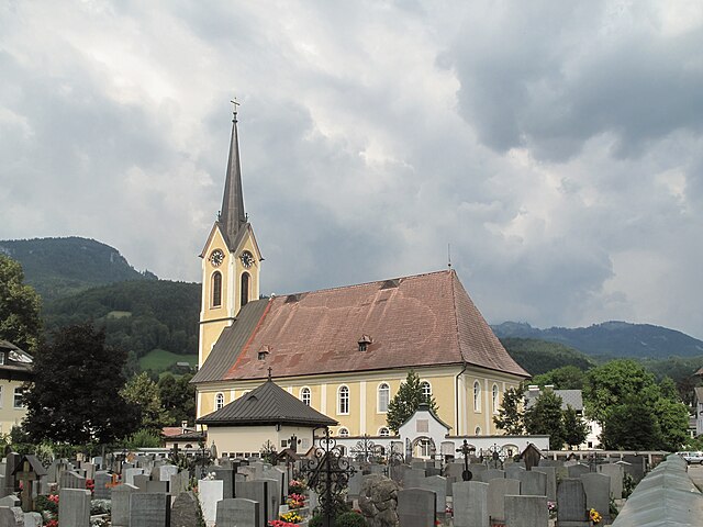
Штробль-ам-Вольфгангзе (Strobl, Strobl)
 Hiking in Штробль-ам-Вольфгангзе
Strobl is a charming village located at the edge of the Salzkammergut region in Austria, framed by the picturesque Wolfgangsee lake. It offers a variety of hiking opportunities for all levels, from leisurely walks along the lake to more challenging mountain trails.
Hiking Trails in Strobl:
-
Lake Wolfgangsee Trail:
- Description: A scenic and easy walking trail along the shores of Wolfgangsee. This trail is perfect for families and offers stunning views of the lake and surrounding mountains.
- Duration: Approximately 2-3 hours.
-
Schafberg Mountain:
- Description: For those looking for a challenge, hiking up Schafberg (1783 m) is a fulfilling experience. You can hike the trail from Strobl or take the Schafbergbahn cog railway and walk the remaining distance. The summit offers breathtaking panoramic views of the Salzkammergut lakes.
- Duration: 5-6 hours from Strobl, shorter if taking the cog railway.
-
Strobl to Abersee:
- Description: This moderately easy hike takes you along the lakeside path to Abersee, a quaint village with more beach access and serene views.
- Duration: Approximately 1.5-2 hours one way.
-
Pötschen Pass Trail:
- Description: A more demanding route, this trail provides a rich natural experience as it leads through forested areas and offers great vistas along the way.
- Duration: Around 4-5 hours.
Tips for Hiking in Strobl:
- Best Time to Hike: The hiking season generally runs from late spring to early autumn (May to October), with July and August being the warmest months. It's advisable to check the weather before heading out.
- Trail Maps: It's beneficial to carry a map or download GPS routes for your chosen trails. Local tourist information centers can provide you with the latest trails and conditions.
- Essential Gear: Wear appropriate hiking footwear, bring water, snacks, and a first-aid kit. Sunscreen and a hat are also recommended, especially in summer.
- Wildlife and Nature: Respect the natural environment, and remember that some areas may have local wildlife. Keep a safe distance and avoid feeding animals.
Strobl combines the beauty of nature with the charm of a small Austrian village, making it a delightful destination for hiking enthusiasts! If you have specific trails or experiences you’d like to know more about, feel free to ask!
- Страна:

- Почтовый код: 5350
- Телефонный код: 06137
- Код автомобильного номера: SL
- Координаты: 47° 43' 0" N, 13° 28' 0" E


- GPS треки (wikiloc): [Ссылка]
- Высота над уровнем моря: 542 м m
- Площадь: 93.89 кв.км
- Население: 3645
- Веб сайт: http://www.strobl.salzburg.at/
- Википедия русская: wiki(ru)
- Википедия английская: wiki(en)
- Википедия национальная: wiki(de)
- Хранилище Wikidata: Wikidata: Q667278
- Катеория в википедии: [Ссылка]
- код Freebase: [/m/05ftgl]
- код GeoNames: Альт: [2764121]
- код VIAF: Альт: [124970969]
- код GND: Альт: [4118859-7]
- идентификатор местоположения ArchINFORM: [10607]
- код LCNAF: Альт: [n85206344]
- код австрийского муниципалитета: [50336]
Граничит с регионами:
Бад-Гойзерн
- коммуна в Федеральной земле Верхняя Австрия
Hiking in Бад-Гойзерн
Bad Goisern am Hallstättersee is a picturesque village located in Upper Austria, near the stunning Hallstättersee (Lake Hallstatt). It is an excellent starting point for a variety of hiking trails that showcase the region's natural beauty, including mountains, lakes, and lush forests. Here are some highlights and useful information about hiking in the area:...
- Страна:
- Почтовый код: 4822
- Телефонный код: 06135
- Код автомобильного номера: GM
- Координаты: 47° 38' 30" N, 13° 37' 0" E
- GPS треки (wikiloc): [Ссылка]
- Высота над уровнем моря: 500 м m
- Площадь: 112.5 кв.км
- Население: 7450
- Веб сайт: [Ссылка]

Санкт-Вольфганг-им-Зальцкаммергут
Hiking in Санкт-Вольфганг-им-Зальцкаммергут
St. Wolfgang im Salzkammergut is a beautiful destination for hiking enthusiasts, located in the stunning Austrian Salzkammergut region. The area is renowned for its picturesque lakes, rolling hills, and mountainous landscapes. Here are some highlights and tips for hiking in this incredible locale:...
- Страна:
- Почтовый код: 5360
- Телефонный код: 06138
- Код автомобильного номера: GM
- Координаты: 47° 44' 18" N, 13° 26' 53" E
- GPS треки (wikiloc): [Ссылка]
- Высота над уровнем моря: 548 м m
- Площадь: 56.6 кв.км
- Население: 2820
- Веб сайт: [Ссылка]