
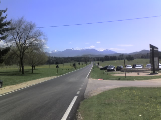
Субьяко (Subiaco, Subiaco)
.svg)
- коммуна Италии
 Hiking in Субьяко
Subiaco, located in the Lazio region of Italy, is known for its stunning natural landscapes, rich history, and numerous hiking opportunities. It is situated in the Aniene Valley, surrounded by the Simbruini Mountains, making it a great base for hiking enthusiasts. Here’s what you should know about hiking in Subiaco:
1. :
- Simbruini Mountains: The park features various trails with varying difficulty levels, catering to both beginners and experienced hikers. Popular trails lead through lush forests, rocky outcrops, and offer breathtaking views of the valleys below.
- Monastery Trails: Some trails connect historical sites like the ancient monasteries of St. Benedict and Santa Scolastica. These trails not only provide physical challenges but also a dose of cultural history.
2. :
- Cascate di Trevi: A picturesque waterfall close to Subiaco, accessible via a scenic hike. The trail to the waterfall offers beautiful views and is a great spot for a picnic.
- Lago di Pertuso: A serene lake ideal for a relaxed hike. The area around the lake is also great for birdwatching and enjoying nature's tranquility.
3. :
- The Simbruini Mountains are home to diverse wildlife, including deer, wild boar, and various bird species. The flora is equally rich, with many native plants and flowers, particularly impressive in spring.
4. :
- The best time for hiking in Subiaco is during the spring (April to June) and fall (September to October). The weather is generally mild, and the landscapes are particularly beautiful during these seasons.
5. :
- It’s important to wear appropriate footwear, carry sufficient water, and be prepared for changing weather conditions. A map or a GPS device can be helpful, especially for longer hikes.
6. :
- Subiaco is relatively easy to reach from Rome, making it a perfect day trip for those looking to escape the city for a day of hiking.
7. :
- Consider hiring a local guide for an enriched experience. They can provide insights into the ecology, geology, and history of the region, as well as ensure a safe and enjoyable hike.
Whether you’re looking for a leisurely walk through nature or a challenging hike in the mountains, Subiaco offers a variety of options to explore its majestic landscapes. Always check trail conditions and local regulations before heading out, and enjoy the beauty of this remarkable area!
- Страна:

- Почтовый код: 00028
- Телефонный код: 0774
- Код автомобильного номера: RM
- Координаты: 41° 56' 0" N, 13° 6' 0" E


- GPS треки (wikiloc): [Ссылка]
- Высота над уровнем моря: 408 м m
- Площадь: 63.23 кв.км
- Население: 8916
- Веб сайт: http://www.comune.subiaco.rm.it
- Википедия русская: wiki(ru)
- Википедия английская: wiki(en)
- Википедия национальная: wiki(it)
- Хранилище Wikidata: Wikidata: Q243467
- Галерея изображений в википедии: [Ссылка]
- Катеория в википедии: [Ссылка]
- код Freebase: [/m/060h77]
- код GeoNames: Альт: [6540526]
- код BNF: [119463406]
- код VIAF: Альт: [146590011]
- ID отношения в OpenStreetMap: [41625]
- код GND: Альт: [4118868-8]
- код LCNAF: Альт: [n81066658]
- код в энциклопедии «Британника онлайн»: [place/Subiaco-Italy]
- код Цифрового атласа Римской империи: [22204]
- код ISTAT: 058103
- кадастровый код Италии: I992
Граничит с регионами:


Аффиле
- коммуна Италии
Hiking in Аффиле
Affile is a charming village located in the province of Rome, Italy, nestled in the beautiful landscape of the Monti Simbruini Regional Park. This region offers diverse hiking opportunities due to its varied terrain, rich biodiversity, and stunning vistas....
- Страна:
- Почтовый код: 00021
- Телефонный код: 0774
- Код автомобильного номера: RM
- Координаты: 41° 53' 6" N, 13° 5' 46" E
- GPS треки (wikiloc): [Ссылка]
- Высота над уровнем моря: 684 м m
- Площадь: 15.11 кв.км
- Население: 1502
- Веб сайт: [Ссылка]


Агоста
- коммуна Италии
Hiking in Агоста
Agosta, a charming town located in the Lazio region of Italy, is nestled in the Aniene Valley and offers beautiful landscapes and outdoor activities, making it a great destination for hiking enthusiasts. Here are some key points to consider when hiking in and around Agosta:...
- Страна:
- Почтовый код: 00020
- Телефонный код: 0774
- Код автомобильного номера: ROMA
- Координаты: 41° 58' 57" N, 13° 2' 1" E
- GPS треки (wikiloc): [Ссылка]
- Высота над уровнем моря: 392 м m
- Площадь: 9.5 кв.км
- Население: 1742
- Веб сайт: [Ссылка]

Арчинаццо-Романо
- коммуна Италии
Hiking in Арчинаццо-Романо
Arcinazzo Romano is a charming village located in the province of Frosinone, in the Lazio region of Italy. It’s surrounded by stunning natural landscapes, making it a great destination for hiking enthusiasts. Here’s a guide to hiking in this beautiful area:...
- Страна:
- Почтовый код: 00020
- Телефонный код: 0774
- Код автомобильного номера: RM
- Координаты: 41° 53' 0" N, 13° 7' 0" E
- GPS треки (wikiloc): [Ссылка]
- Высота над уровнем моря: 831 м m
- Площадь: 28.31 кв.км
- Население: 1344
- Веб сайт: [Ссылка]
Камерата-Нуова
- коммуна Италии
Hiking in Камерата-Нуова
Camerata Nuova is a charming village located in the province of Rome, Italy, nestled within the beautiful landscape of the Apennine Mountains. This area is known for its natural beauty, making it a fantastic destination for hiking enthusiasts....
- Страна:
- Почтовый код: 00020
- Телефонный код: 0774
- Код автомобильного номера: RM
- Координаты: 42° 1' 0" N, 13° 6' 0" E
- GPS треки (wikiloc): [Ссылка]
- Высота над уровнем моря: 810 м m
- Площадь: 40.5 кв.км
- Население: 445
- Веб сайт: [Ссылка]


Кантерано
- коммуна Италии
Hiking in Кантерано
Canterano is a small town located in the Lazio region of Italy, surrounded by beautiful natural landscapes, making it an appealing destination for hiking enthusiasts. Situated in the Sabine Hills, Canterano offers a variety of trails that cater to different skill levels, from gentle walks to more challenging hikes....
- Страна:
- Почтовый код: 00020
- Телефонный код: 0774
- Код автомобильного номера: ROMA
- Координаты: 41° 57' 0" N, 13° 2' 0" E
- GPS треки (wikiloc): [Ссылка]
- Высота над уровнем моря: 602 м m
- Площадь: 7.37 кв.км
- Население: 325
- Веб сайт: [Ссылка]


Червара-ди-Рома
- коммуна Италии
Hiking in Червара-ди-Рома
Cervara di Roma is a charming mountain village located in the Apennines, known for its stunning landscapes, rich history, and excellent hiking opportunities. Here are some highlights about hiking in and around Cervara di Roma:...
- Страна:
- Почтовый код: 00020
- Телефонный код: 0774
- Код автомобильного номера: RM
- Координаты: 41° 59' 17" N, 13° 4' 2" E
- GPS треки (wikiloc): [Ссылка]
- Высота над уровнем моря: 1053 м m
- Площадь: 31.75 кв.км
- Население: 438
- Веб сайт: [Ссылка]


Енне
- коммуна Италии
Hiking in Енне
Jenne, a charming town located in the Lazio region of Italy, is a hidden gem for hikers and outdoor enthusiasts. Nestled in the Simbruini Mountains, it offers a variety of trails that range from easy walks to more challenging hikes, allowing for exploration of the stunning landscapes, rich biodiversity, and historical sites....
- Страна:
- Почтовый код: 00020
- Телефонный код: 0774
- Код автомобильного номера: RM
- Координаты: 41° 53' 0" N, 13° 10' 0" E
- GPS треки (wikiloc): [Ссылка]
- Высота над уровнем моря: 834 м m
- Площадь: 31.52 кв.км
- Население: 347
- Веб сайт: [Ссылка]
Рокка-Санто-Стефано
- коммуна Италии
Hiking in Рокка-Санто-Стефано
Rocca Santo Stefano is a picturesque destination located in the province of Rome, Italy, renowned for its natural beauty and rich history. The area is characterized by rugged terrain, rolling hills, and scenic vistas, making it a great spot for hiking enthusiasts....
- Страна:
- Почтовый код: 00030
- Телефонный код: 06
- Код автомобильного номера: ROMA
- Координаты: 41° 54' 38" N, 13° 1' 26" E
- GPS треки (wikiloc): [Ссылка]
- Высота над уровнем моря: 664 м m
- Площадь: 9.57 кв.км
- Население: 967
- Веб сайт: [Ссылка]


Валлепьетра
- коммуна Италии
Hiking in Валлепьетра
Vallepietra, located in the Lazio region of Italy, is known for its beautiful landscapes and its setting within the Simbruini Mountains. The area is an excellent choice for hiking enthusiasts due to its varied terrain, rich wildlife, and historical sites....
- Страна:
- Почтовый код: 00020
- Телефонный код: 0774
- Код автомобильного номера: RM
- Координаты: 41° 56' 0" N, 13° 14' 0" E
- GPS треки (wikiloc): [Ссылка]
- Высота над уровнем моря: 825 м m
- Площадь: 52.94 кв.км
- Население: 268
- Веб сайт: [Ссылка]