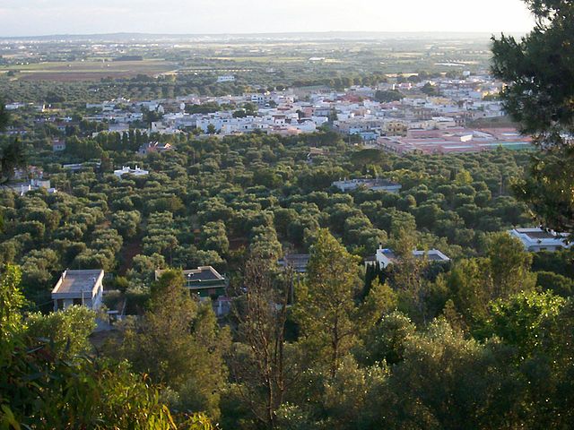
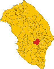
Суперсано (Supersano, Supersano)
.svg)
- коммуна Италии
 Hiking in Суперсано
Supersano, located in the Apulia region of Italy, offers a unique blend of cultural and natural experiences, making it a great destination for hiking enthusiasts. Here are some highlights and tips for hiking in and around Supersano:
Trails and Natural Features
-
Surrounding Countryside: The area surrounding Supersano is characterized by picturesque olive groves, vineyards, and gently rolling hills. These landscapes provide a serene backdrop for hiking, with various paths that can be explored.
-
Salento Region: Supersano is part of the Salento peninsula, which features a beautiful coastline along the Adriatic and Ionian Seas, as well as inland trails that connect traditional towns and stunning countryside.
-
Nature Reserves: Nearby natural parks, such as the Regional Park of Porto Selvaggio and Palude del Capitano, offer marked trails that take you through diverse ecosystems, including pine forests, rocky cliffs, and sandy beaches.
Hiking Tips
-
Best Time to Hike: The best times for hiking in Supersano are during the spring (April to June) and fall (September to October) when the weather is pleasant. Summers can be hot, making hiking in the afternoon less comfortable.
-
Difficulty Levels: Trails vary in difficulty from easy walks suitable for families to more challenging hikes. Always choose a trail that matches your fitness level and experience.
-
Local Guides: Consider hiring a local guide who can offer insights into the area's history, flora, and fauna, enhancing your hiking experience.
-
Pack Essentials: Make sure to bring plenty of water, snacks, sunscreen, and appropriate gear, including sturdy hiking shoes. A map or GPS device can also be useful for navigating trails.
-
Stay Informed: Always check the weather forecast before heading out, and inform someone about your hiking plans.
Cultural Experience
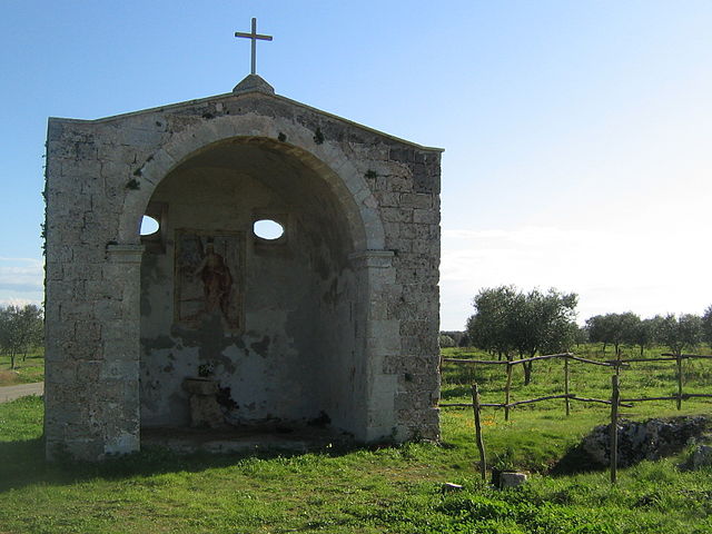
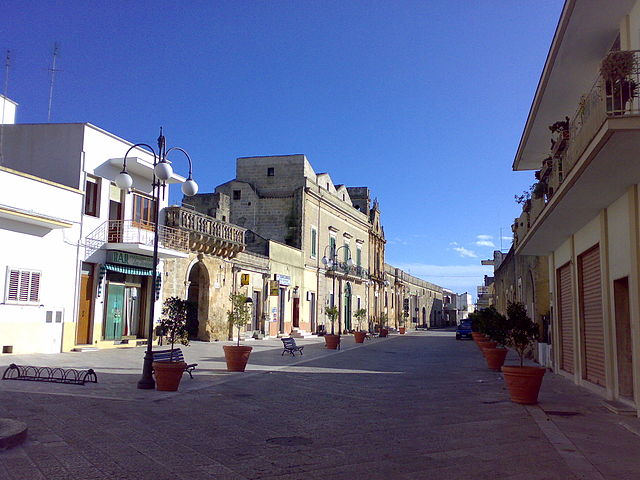
Hiking in Supersano not only offers the chance to enjoy nature but also the opportunity to explore local culture. You can visit traditional farms, taste local cuisine, and see historical sites, providing a well-rounded experience beyond just the trails.
Overall, hiking in Supersano provides a fantastic way to connect with the natural beauty of Italy while enjoying the rich cultural heritage of the Salento region.
- Страна:

- Почтовый код: 73040
- Телефонный код: 0833
- Код автомобильного номера: LE
- Координаты: 40° 1' 0" N, 18° 15' 0" E


- GPS треки (wikiloc): [Ссылка]
- Высота над уровнем моря: 105 м m
- Площадь: 36.41 кв.км
- Население: 4398
- Веб сайт: http://www.comune.supersano.le.it/
- Википедия русская: wiki(ru)
- Википедия английская: wiki(en)
- Википедия национальная: wiki(it)
- Хранилище Wikidata: Wikidata: Q52202
- Катеория в википедии: [Ссылка]
- код Freebase: [/m/0f_9pk]
- код GeoNames: Альт: [6538987]
- код VIAF: Альт: [240563083]
- ID отношения в OpenStreetMap: [40199]
- WOEID: [724641]
- код ISTAT: 075081
- кадастровый код Италии: L008
Граничит с регионами:


Ботруньо
- коммуна Италии
Hiking in Ботруньо
Botrugno is a small town located in the province of Lecce in the Apulia region of Italy. While it may not be a widely recognized hiking destination compared to larger national parks or well-known trails, there are opportunities for walking and exploring the surrounding countryside....
- Страна:
- Почтовый код: 73020
- Телефонный код: 0836
- Код автомобильного номера: LE
- Координаты: 40° 4' 0" N, 18° 19' 0" E
- GPS треки (wikiloc): [Ссылка]
- Высота над уровнем моря: 92 м m
- Площадь: 9.75 кв.км
- Население: 2745
- Веб сайт: [Ссылка]

Казарано
- коммуна Италии
Hiking in Казарано
Casarano is a charming town located in the Apulia region of southern Italy, known for its picturesque landscapes, historical sites, and beautiful agricultural scenery. When considering hiking in and around Casarano, there are several aspects to keep in mind:...
- Страна:
- Почтовый код: 73042
- Телефонный код: 0833
- Код автомобильного номера: LE
- Координаты: 40° 1' 0" N, 18° 10' 0" E
- GPS треки (wikiloc): [Ссылка]
- Высота над уровнем моря: 109 м m
- Площадь: 38.73 кв.км
- Население: 20070
- Веб сайт: [Ссылка]

Коллепассо
- коммуна Италии
Hiking in Коллепассо
Collepasso is a charming town located in the Apulia region of Italy, characterized by its picturesque landscapes, rich history, and a warm Mediterranean climate. While it might not be as famous for hiking as some of Italy's more renowned regions, there are still opportunities to explore the natural beauty surrounding the town....
- Страна:
- Почтовый код: 73040
- Телефонный код: 0833
- Код автомобильного номера: LE
- Координаты: 40° 4' 0" N, 18° 10' 0" E
- GPS треки (wikiloc): [Ссылка]
- Высота над уровнем моря: 120 м m
- Площадь: 12.79 кв.км
- Население: 5979
- Веб сайт: [Ссылка]

Кутрофьяно
- коммуна Италии
Hiking in Кутрофьяно
Cutrofiano is a charming town located in the Apulia region of Italy, known for its beautiful landscapes, historic architecture, and rich cultural heritage. While it may not be as famous for hiking as some other regions of Italy, there are still opportunities for outdoor enthusiasts to explore the countryside and enjoy nature....
- Страна:
- Почтовый код: 73020
- Телефонный код: 0836
- Код автомобильного номера: LE
- Координаты: 40° 8' 0" N, 18° 12' 0" E
- GPS треки (wikiloc): [Ссылка]
- Высота над уровнем моря: 81 м m
- Площадь: 56.81 кв.км
- Население: 8992
- Веб сайт: [Ссылка]

Монтезано-Салентино
- коммуна Италии
Hiking in Монтезано-Салентино
Montesano Salentino is a picturesque town located in the Apulia region of southern Italy, and it offers beautiful hiking opportunities for outdoor enthusiasts. Nestled in the Salento area, the region is characterized by its stunning landscapes, rich history, and diverse flora and fauna. Here are some key points to consider when hiking in Montesano Salentino:...
- Страна:
- Почтовый код: 73030
- Телефонный код: 0833
- Код автомобильного номера: LE
- Координаты: 39° 58' 33" N, 18° 19' 21" E
- GPS треки (wikiloc): [Ссылка]
- Высота над уровнем моря: 106 м m
- Площадь: 8.53 кв.км
- Население: 2687
- Веб сайт: [Ссылка]


Ночилья
- коммуна Италии
Hiking in Ночилья
Nociglia, located in the Apulia region of southern Italy, offers a charming and scenic backdrop for hiking enthusiasts. While it may not be as well-known as some of the larger national parks, Nociglia and its surroundings provide a range of hiking opportunities, characterized by beautiful landscapes, traditional Apulian architecture, and rich local culture....
- Страна:
- Почтовый код: 73020
- Телефонный код: 0836
- Код автомобильного номера: LE
- Координаты: 40° 2' 0" N, 18° 20' 0" E
- GPS треки (wikiloc): [Ссылка]
- Высота над уровнем моря: 102 м m
- Площадь: 11.13 кв.км
- Население: 2289
- Веб сайт: [Ссылка]


Руффано
- коммуна Италии
Hiking in Руффано
Ruffano is a charming town located in the Apulia region of Italy, known for its beautiful countryside, historical architecture, and warm climate. While Ruffano itself is not a major hiking destination, it is surrounded by stunning natural landscapes offering various hiking opportunities....
- Страна:
- Почтовый код: 73049
- Телефонный код: 0833
- Код автомобильного номера: LE
- Координаты: 39° 59' 0" N, 18° 15' 0" E
- GPS треки (wikiloc): [Ссылка]
- Высота над уровнем моря: 127 м m
- Площадь: 39.73 кв.км
- Население: 9741
- Веб сайт: [Ссылка]

Сан-Кассиано
- коммуна Италии
Hiking in Сан-Кассиано
San Cassiano, located in the stunning Dolomites region of Italy, is a fantastic destination for hiking enthusiasts. This picturesque village offers breathtaking views, diverse landscapes, and well-marked trails suitable for various skill levels. Here are some key highlights about hiking in San Cassiano:...
- Страна:
- Почтовый код: 73020
- Телефонный код: 0836
- Код автомобильного номера: LE
- Координаты: 40° 3' 23" N, 18° 20' 2" E
- GPS треки (wikiloc): [Ссылка]
- Высота над уровнем моря: 89 м m
- Площадь: 8.77 кв.км
- Население: 2037
- Веб сайт: [Ссылка]

Скоррано
- коммуна Италии
Hiking in Скоррано
Scorrano is a charming town located in the Province of Lecce in the Apulia region of Italy. While it is best known for its historical architecture and beautiful baroque buildings, it also offers some delightful hiking opportunities in the surrounding areas....
- Страна:
- Почтовый код: 73020
- Телефонный код: 0836
- Код автомобильного номера: LE
- Координаты: 40° 5' 25" N, 18° 18' 0" E
- GPS треки (wikiloc): [Ссылка]
- Высота над уровнем моря: 95 м m
- Площадь: 35.33 кв.км
- Население: 6974
- Веб сайт: [Ссылка]