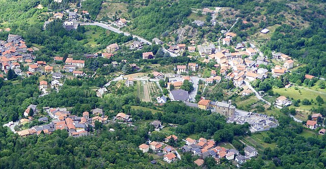
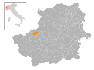
Суза (Susa, Susa)

- коммуна в Италии
 Hiking in Суза
Susa, located in the Piedmont region of Italy, is a charming town nestled in the Susa Valley, surrounded by the stunning Alps. The area is known for its spectacular natural landscapes, historical sites, and a variety of hiking opportunities that cater to different skill levels.
Hiking Trails and Areas
-
Monte Cenisio: This mountain offers scenic views of the Susa Valley and the surrounding peaks. The ascent is moderate and provides a great opportunity to experience the local flora and fauna.
-
The Susa Valley Trail: This is a long-distance trail that stretches through the entire valley, offering diverse landscapes and vistas. It passes through picturesque villages and offers options for shorter segments.
-
Sentiero degli Alpini: This trail is dedicated to the Italian Alpine troops and provides a historical experience alongside beautiful natural scenery. It winds through alpine meadows and forests, making it beautiful during the wildflower season.
-
Col de Fenestrelle: This hike leads to the historic Fenestrelle Fort, which is a 19th-century military fortification. The trail offers an interesting mix of history and breathtaking views of the surrounding mountains.
-
Val di Susa Natural Park: This park offers numerous marked trails, ranging from easy walks to challenging hikes. It’s an excellent place for nature lovers, with opportunities to spot wildlife and enjoy the peaceful surroundings.
Best Time to Hike
The best time to hike in Susa is typically from late spring to early autumn (May to September), as the weather is milder and trails are more accessible. However, be aware that some trails may have snow cover well into summer, especially at higher elevations.
Tips for Hiking in Susa
- Footwear: Good hiking boots with ankle support are recommended, as trails can be rocky and uneven.
- Maps and Markings: While many trails are marked, it’s advisable to carry a trail map or GPS device to ensure you stay on course.
- Hydration and Snacks: Always carry enough water and some high-energy snacks, especially on longer hikes.
- Weather Preparedness: Be prepared for changing weather conditions, especially in mountainous areas. Layered clothing is ideal.
- Local Regulations: Familiarize yourself with park regulations, especially if you encounter wildlife or plan to camp overnight.
Transportation
Susa is accessible by train and bus from Turin and other nearby cities, making it relatively easy to reach the hiking areas. Having a vehicle can provide more flexibility in exploring different trails.
Accommodation
There are various accommodation options in and around Susa, including hotels, guesthouses, and campsites. If you plan to hike multiple days, you might also consider staying in mountain huts.
Conclusion
Hiking in Susa, Piedmont, offers an exciting blend of natural beauty, outdoor adventure, and a glimpse into the rich history of the region. Whether you are an experienced hiker or a beginner, the area has trails that will suit your interests and skill level. Enjoy the fresh alpine air and the spectacular scenery!
- Страна:

- Почтовый код: 10059
- Телефонный код: 0122
- Код автомобильного номера: TO
- Координаты: 45° 8' 0" N, 7° 3' 0" E


- GPS треки (wikiloc): [Ссылка]
- Высота над уровнем моря: 503 м m
- Площадь: 10.99 кв.км
- Население: 6340
- Веб сайт: http://www.cittadisusa.it
- Википедия русская: wiki(ru)
- Википедия английская: wiki(en)
- Википедия национальная: wiki(it)
- Хранилище Wikidata: Wikidata: Q10311
- Галерея изображений в википедии: [Ссылка]
- Катеория в википедии: [Ссылка]
- код Freebase: [/m/04dksc]
- код GeoNames: Альт: [6540101]
- код BNF: [11952963r]
- ID отношения в OpenStreetMap: [44287]
- код GND: Альт: [5168349-0]
- код LCNAF: Альт: [n94089566]
- код тезауруса PACTOLS: [pcrtTeYF7QUx8N]
- место в MusicBrainz: [23f7bcf2-b389-4ec9-b2b6-31adee60c79e]
- UN/LOCODE: [ITSUA]
- код Цифрового атласа Римской империи: [1868]
- код Pleiades: [167919]
- код ISTAT: 001270
- кадастровый код Италии: L013
Граничит с регионами:


Буссолено
- коммуна Италии
Hiking in Буссолено
Bussoleno is a charming town located in the Susa Valley in the Piedmont region of Italy, nestled in the foothills of the Alps. It offers a variety of hiking opportunities, making it an appealing destination for outdoor enthusiasts. Here are some highlights and tips for hiking in Bussoleno:...
- Страна:
- Почтовый код: 10053
- Телефонный код: 0122
- Код автомобильного номера: TO
- Координаты: 45° 8' 28" N, 7° 8' 51" E
- GPS треки (wikiloc): [Ссылка]
- Высота над уровнем моря: 440 м m
- Площадь: 37.07 кв.км
- Население: 5981
- Веб сайт: [Ссылка]


Джальоне
- коммуна Италии
Hiking in Джальоне
Giaglione is a picturesque village located in the Susa Valley of the Piedmont region in northwest Italy. It’s an ideal location for hiking enthusiasts, offering stunning views of the surrounding alpine landscape and numerous trails suitable for various skill levels....
- Страна:
- Почтовый код: 10050
- Телефонный код: 0122
- Код автомобильного номера: TO
- Координаты: 45° 8' 23" N, 7° 0' 51" E
- GPS треки (wikiloc): [Ссылка]
- Высота над уровнем моря: 774 м m
- Площадь: 33.38 кв.км
- Население: 619
- Веб сайт: [Ссылка]


Гравере
- коммуна Италии
Hiking in Гравере
Gravere is a small municipality located in the Susa Valley in the Piedmont region of northern Italy. It's known for its stunning natural scenery, which makes it a great spot for outdoor activities, including hiking. Here are some key points to consider if you’re planning to hike in Gravere:...
- Страна:
- Почтовый код: 10050
- Телефонный код: 0122
- Код автомобильного номера: TO
- Координаты: 45° 8' 0" N, 7° 1' 0" E
- GPS треки (wikiloc): [Ссылка]
- Площадь: 18.99 кв.км
- Население: 671
- Веб сайт: [Ссылка]
Маттие
- коммуна Италии
Hiking in Маттие
Hiking in Mattie, Piedmont, offers a beautiful blend of scenic views and the tranquility of nature. The region is known for its stunning landscapes, including rolling hills, dense forests, and potentially some water bodies like rivers or lakes, depending on the exact area....
- Страна:
- Почтовый код: 10050
- Телефонный код: 0122
- Код автомобильного номера: TO
- Координаты: 45° 7' 0" N, 7° 7' 0" E
- GPS треки (wikiloc): [Ссылка]
- Высота над уровнем моря: 730 м m
- Площадь: 28.69 кв.км
- Население: 662
- Веб сайт: [Ссылка]

Меана-ди-Суза
- коммуна Италии
Hiking in Меана-ди-Суза
Meana di Susa is a picturesque village located in the Susa Valley, nestled in the Italian Alps near Turin. It offers a variety of hiking options for both beginners and experienced hikers, making it an appealing destination for outdoor enthusiasts. Here's what you should know about hiking in Meana di Susa:...
- Страна:
- Почтовый код: 10050
- Телефонный код: 0122
- Код автомобильного номера: TO
- Координаты: 45° 7' 26" N, 7° 3' 40" E
- GPS треки (wikiloc): [Ссылка]
- Высота над уровнем моря: 730 м m
- Площадь: 16.54 кв.км
- Население: 814
- Веб сайт: [Ссылка]
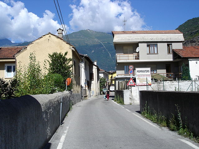
Момпантеро
- коммуна Италии
Hiking in Момпантеро
Mompantero, located in the province of Turin in the Piedmont region of Italy, is a charming destination for hikers looking to explore beautiful landscapes and enjoy outdoor activities. Nestled in the Susa Valley, this area is characterized by its stunning mountainous terrain, rich biodiversity, and picturesque views of the surrounding Alps....
- Страна:
- Почтовый код: 10059
- Телефонный код: 0122
- Код автомобильного номера: TO
- Координаты: 45° 9' 0" N, 7° 4' 0" E
- GPS треки (wikiloc): [Ссылка]
- Высота над уровнем моря: 531 м m
- Площадь: 30.33 кв.км
- Население: 646
- Веб сайт: [Ссылка]