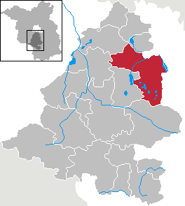
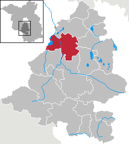
Тельтов-Флеминг (Teltow-Fläming District, Landkreis Teltow-Fläming)


 Hiking in Тельтов-Флеминг
Teltow-Fläming is a picturesque region in Germany, located just south of Berlin. Known for its diverse landscapes, charming villages, and rich history, it offers a range of hiking opportunities suitable for varying skill levels. Here are some key aspects to consider when hiking in Teltow-Fläming:
Trails and Nature
-
Scenic Routes: The area features numerous well-marked hiking trails. Notable routes include parts of the "Fläming Hiking Trail" (Flämingweg), which runs through beautiful woodlands, meadows, and agricultural land, providing a variety of ecosystems to explore.
-
Lakes and Rivers: The region is home to several lakes, such as the Großer Langen See and numerous small ponds, which can provide serene stops during your hike. The Zauche region is particularly appealing for its natural beauty.
-
Biosphere Reserve: Portions of Teltow-Fläming fall within the UNESCO Biosphere Reserve, which protects natural habitats and flora and fauna. This area is ideal for those interested in nature observation.
Points of Interest
-
Historic Sites: While hiking, you can encounter various historical sites, including traditional village structures, mill ruins, and ancient churches. Notable towns like Jüterbog and Luckenwalde each have unique cultural offerings.
-
Open-Air Museums: Teltow-Fläming has several open-air museums that showcase regional history and agriculture, offering a unique dimension to your hiking experience.
-
Culinary Stops: Many local farms and small eateries provide regional cuisine, giving you a chance to refuel and enjoy the local flavors.
Hiking Tips
-
Trail Maps: Always carry a map or download a hiking app that offers offline maps before heading out. The trails are generally well-marked, but it's good to be prepared.
-
Weather: Check the weather conditions ahead of your hike, as they can change quickly. Dress in layers, and be prepared for varying temperatures and conditions.
-
Respect Nature: Stick to marked trails to preserve the local ecosystem and wildlife. Take any trash with you and minimize your impact on the environment.
-
Safety: Carry enough water, snacks, and a basic first-aid kit. Inform someone of your hiking plan, especially if venturing into less traveled areas.
Accessibility
The region is easily accessible by public transport from Berlin, making it a perfect day trip for both local and visiting hikers. There are various start points for different trails, often with convenient public transportation options.
In summary, Teltow-Fläming offers a delightful hiking experience with a mix of natural beauty, cultural heritage, and recreational opportunities. Whether you’re embarking on a short stroll or a longer trek, you’ll find plenty to explore in this charming part of Germany.
- Страна:

- Столица: Луккенвальде
- Код автомобильного номера: TF
- Координаты: 52° 5' 0" N, 13° 18' 0" E


- GPS треки (wikiloc): [Ссылка]
- Население: 160448
- Веб сайт: http://www.teltow-flaeming.de/
- Википедия русская: wiki(ru)
- Википедия английская: wiki(en)
- Википедия национальная: wiki(de)
- Хранилище Wikidata: Wikidata: Q6146
- Катеория в википедии: [Ссылка]
- Карты в википедии: [Ссылка]
- код Freebase: [/m/016936]
- код GeoNames: Альт: [3249090]
- код VIAF: Альт: [305232702]
- ID отношения в OpenStreetMap: [62364]
- код GND: Альт: [4332142-2]
- идентификатор местоположения ArchINFORM: [2503]
- код LCNAF: Альт: [no2006075619]
- код TGN: [7076934]
- код ISNI: Альт: [0000 0004 4910 461X]
- код NUTS: [DE40H]
- код района Германии: 12072
Включает регионы:

Цоссен
Hiking in Цоссен
Zossen, located in the Brandenburg region of Germany, offers a variety of hiking opportunities surrounded by natural beauty and serene landscapes. Situated near the larger city of Berlin, it provides a perfect escape for both locals and visitors looking to experience nature....
- Страна:
- Почтовый код: 15806
- Телефонный код: 03377; 033769; 033731; 033702
- Код автомобильного номера: TF
- Координаты: 52° 13' 0" N, 13° 26' 59" E
- GPS треки (wikiloc): [Ссылка]
- Высота над уровнем моря: 38 м m
- Площадь: 180.39 кв.км
- Население: 18915
- Веб сайт: [Ссылка]

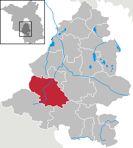
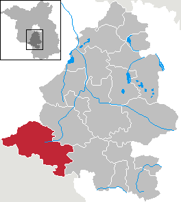
Барут
Hiking in Барут
Baruth/Mark is a small town located in the Brandenburg region of Germany, known for its natural beauty and access to various outdoor activities, including hiking. Here are some highlights and tips for hiking in and around Baruth/Mark:...
- Страна:
- Почтовый код: 15837
- Телефонный код: 033745; 033704
- Координаты: 52° 3' 0" N, 13° 30' 0" E
- GPS треки (wikiloc): [Ссылка]
- Высота над уровнем моря: 58 м m
- Площадь: 233.62 кв.км
- Население: 4137
- Веб сайт: [Ссылка]

Ам-Меллензе
Hiking in Ам-Меллензе
Am Mellensee is a beautiful area located in Brandenburg, Germany, and it's known for its scenic landscapes, lakes, and outdoor recreational opportunities, making it a great destination for hiking enthusiasts....
- Страна:
- Почтовый код: 15838
- Телефонный код: 03377; 033703
- Координаты: 52° 8' 59" N, 13° 22' 0" E
- GPS треки (wikiloc): [Ссылка]
- Высота над уровнем моря: 60 м m
- Площадь: 104.72 кв.км
- Население: 6628
- Веб сайт: [Ссылка]
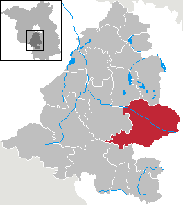
амт Даме/Марк
Hiking in амт Даме/Марк
Dahme-Mark is a picturesque region in Brandenburg, Germany, known for its serene landscapes and outdoor recreational opportunities. Here are some aspects to consider when hiking in Dahme-Mark:...
- Страна:
- Почтовый код: 15936
- Координаты: 52° 7' 0" N, 13° 25' 0" E
- GPS треки (wikiloc): [Ссылка]
- Население: 6495
- Веб сайт: [Ссылка]

Йютербог
- город в Германии
Hiking in Йютербог
Jüterbog, a historic town located in Brandenburg, Germany, offers some great opportunities for hiking and enjoying nature. The region is known for its scenic landscapes, rich history, and diverse trails, making it an attractive destination for outdoor enthusiasts....
- Страна:
- Почтовый код: 14913
- Телефонный код: 03372
- Координаты: 51° 59' 36" N, 13° 4' 22" E
- GPS треки (wikiloc): [Ссылка]
- Высота над уровнем моря: 71 м m
- Площадь: 176.48 кв.км
- Население: 12393
- Веб сайт: [Ссылка]

Треббин
Hiking in Треббин
Trebbin is a small town located in the Brandenburg region of Germany, not far from Berlin. While it may not be a major hiking destination compared to larger national parks, it does offer some beautiful landscapes and opportunities for nature walks. Here are some highlights about hiking around Trebbin:...
- Страна:
- Почтовый код: 14959
- Телефонный код: 033731
- Код автомобильного номера: TF
- Координаты: 52° 13' 0" N, 13° 11' 59" E
- GPS треки (wikiloc): [Ссылка]
- Высота над уровнем моря: 39 м m
- Площадь: 125.66 кв.км
- Население: 9433
- Веб сайт: [Ссылка]
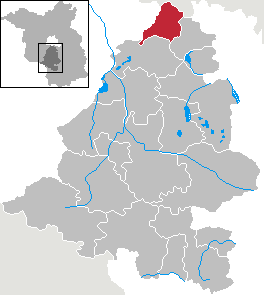
Бланкенфельде-Малов
Hiking in Бланкенфельде-Малов
Blankenfelde-Mahlow, located in Brandenburg, Germany, offers a variety of hiking opportunities for outdoor enthusiasts. The area is characterized by picturesque landscapes, including forests, meadows, and small lakes, which make for enjoyable hiking experiences. Here are some highlights and tips for hiking in this region:...
- Страна:
- Почтовый код: 15831; 15827
- Телефонный код: 033708; 03379
- Код автомобильного номера: TF
- Координаты: 52° 21' 0" N, 13° 24' 0" E
- GPS треки (wikiloc): [Ссылка]
- Высота над уровнем моря: 43 м m
- Площадь: 54.89 кв.км
- Население: 27378
- Веб сайт: [Ссылка]


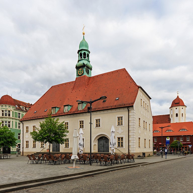
Луккенвальде
Hiking in Луккенвальде
Luckenwalde, located in Brandenburg, Germany, is a great destination for hiking enthusiasts. The area features a mix of scenic landscapes, including forests, fields, and small lakes, making it suitable for various hiking experiences....
- Страна:
- Почтовый код: 14943
- Телефонный код: 03371
- Координаты: 52° 4' 59" N, 13° 10' 0" E
- GPS треки (wikiloc): [Ссылка]
- Высота над уровнем моря: 48 м m
- Площадь: 46.75 кв.км
- Население: 20674
- Веб сайт: [Ссылка]
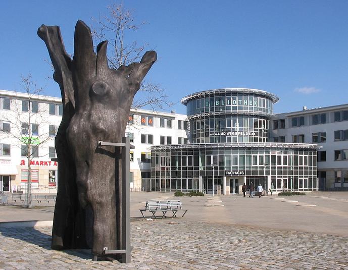

Людвигсфельде
- община Германии
Hiking in Людвигсфельде
Ludwigsfelde, located in the state of Brandenburg, Germany, offers a range of hiking opportunities for those looking to explore the natural beauty of the area. Here are some key points to consider when planning a hiking trip in and around Ludwigsfelde:...
- Страна:
- Почтовый код: 14974
- Телефонный код: 03378
- Код автомобильного номера: TF
- Координаты: 52° 17' 59" N, 13° 16' 0" E
- GPS треки (wikiloc): [Ссылка]
- Высота над уровнем моря: 43 м m
- Площадь: 109.30 кв.км
- Население: 25665
- Веб сайт: [Ссылка]


Нидерер-Флеминг
Hiking in Нидерер-Флеминг
Niederer Fläming is a beautiful region located in the state of Brandenburg, Germany, known for its scenic landscapes, rolling hills, and rich biodiversity. It's an excellent destination for hiking enthusiasts of all skill levels, offering a variety of trails and routes that showcase the enchanting natural beauty of the area....
- Страна:
- Почтовый код: 14913
- Телефонный код: 033746
- Координаты: 51° 54' 0" N, 13° 12' 0" E
- GPS треки (wikiloc): [Ссылка]
- Высота над уровнем моря: 103 м m
- Площадь: 185.36 кв.км
- Население: 3086
- Веб сайт: [Ссылка]

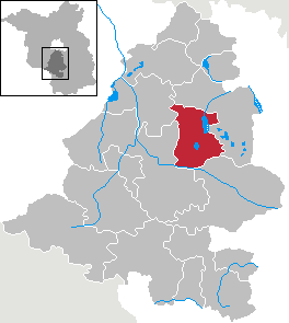
Нуте-Урштромталь
Hiking in Нуте-Урштромталь
Nuthe-Urstromtal is a scenic region located in Brandenburg, Germany, known for its beautiful landscapes, rich biodiversity, and recreational opportunities, including hiking. Here’s a guide to hiking in the Nuthe-Urstromtal area:...
- Страна:
- Почтовый код: 14947
- Телефонный код: 033732; 03371
- Координаты: 52° 7' 0" N, 13° 11' 59" E
- GPS треки (wikiloc): [Ссылка]
- Высота над уровнем моря: 42 м m
- Площадь: 337.84 кв.км
- Население: 6513
- Веб сайт: [Ссылка]

Рангсдорф
Hiking in Рангсдорф
Rangsdorf, located just south of Berlin, Germany, offers a variety of hiking opportunities amidst beautiful natural landscapes. The area is ideal for both leisurely walks and more adventurous hikes, making it a popular destination for locals and visitors alike....
- Страна:
- Почтовый код: 15834
- Телефонный код: 033708
- Код автомобильного номера: TF
- Координаты: 52° 16' 59" N, 13° 25' 59" E
- GPS треки (wikiloc): [Ссылка]
- Высота над уровнем моря: 41 м m
- Площадь: 33.72 кв.км
- Население: 11279
- Веб сайт: [Ссылка]

Гросберен
Hiking in Гросберен
Großbeeren is a small town located just south of Berlin, Germany. While it might not be as renowned for hiking as larger natural reserves or national parks, there are still opportunities for outdoor activities and explorations in the surrounding areas. Here are some aspects to consider for hiking in and around Großbeeren:...
- Страна:
- Почтовый код: 15831; 14979
- Телефонный код: 033701
- Код автомобильного номера: TF
- Координаты: 52° 21' 16" N, 13° 18' 22" E
- GPS треки (wikiloc): [Ссылка]
- Высота над уровнем моря: 42 м m
- Площадь: 51.89 кв.км
- Население: 8393
- Веб сайт: [Ссылка]

Нидергёрсдорф
Hiking in Нидергёрсдорф
Niedergörsdorf is a charming village located in the Brandenburg region of Germany, surrounded by scenic landscapes that offer great opportunities for hiking enthusiasts. When planning a hiking trip to Niedergörsdorf, here are some highlights and tips to consider:...
- Страна:
- Почтовый код: 14913
- Телефонный код: 033742; 033741
- Координаты: 51° 58' 45" N, 13° 0' 0" E
- GPS треки (wikiloc): [Ссылка]
- Высота над уровнем моря: 84 м m
- Площадь: 204.67 кв.км
- Население: 6123
- Веб сайт: [Ссылка]
Граничит с регионами:
Виттенберг
Hiking in Виттенберг
Wittenberg, located in the state of Saxony-Anhalt, Germany, is not just known for its historical significance but also for its beautiful landscapes and opportunities for hiking. The region is rich in natural beauty, with a mix of woodlands, rivers, and rolling hills, making it an excellent destination for outdoor enthusiasts....
- Страна:
- Код автомобильного номера: WB; JE; GHC
- Координаты: 51° 48' 0" N, 12° 41' 0" E
- GPS треки (wikiloc): [Ссылка]
- Высота над уровнем моря: 66 м m
- Площадь: 1929.96 кв.км
- Население: 130699
- Веб сайт: [Ссылка]


Потсдам-Миттельмарк
Hiking in Потсдам-Миттельмарк
Potsdam-Mittelmark, located in the state of Brandenburg, Germany, offers a rich variety of hiking opportunities amidst picturesque landscapes and historical sites. Here are some key points to consider when hiking in this beautiful region:...
- Страна:
- Столица: Бад-Бельциг
- Почтовый код: 14806
- Код автомобильного номера: PM
- Координаты: 52° 13' 10" N, 12° 40' 30" E
- GPS треки (wikiloc): [Ссылка]
- Высота над уровнем моря: 40 м m
- Население: 204388
- Веб сайт: [Ссылка]

Эльба-Эльстер
Hiking in Эльба-Эльстер
Elbe-Elster is a picturesque district located in the state of Brandenburg, Germany, known for its beautiful landscapes, rivers, and a variety of outdoor activities, including hiking. The region offers a mix of natural scenery, cultural attractions, and well-maintained hiking trails....
- Страна:
- Код автомобильного номера: LIB; FI; EE
- Координаты: 51° 36' 0" N, 13° 26' 0" E
- GPS треки (wikiloc): [Ссылка]
- Высота над уровнем моря: 120 м m
- Площадь: 1889.34 кв.км
- Население: 107649
- Веб сайт: [Ссылка]
Даме-Шпревальд
- район в Бранденбурге, Германия
Hiking in Даме-Шпревальд
Dahme-Spreewald, located in Brandenburg, Germany, offers stunning landscapes, rich biodiversity, and a variety of hiking trails that cater to both casual walkers and experienced hikers. Here are some key points to consider when hiking in this beautiful region:...
- Страна:
- Код автомобильного номера: LDS
- Координаты: 52° 2' 0" N, 13° 54' 0" E
- GPS треки (wikiloc): [Ссылка]
- Высота над уровнем моря: 46 м m
- Площадь: 2.26 кв.км
- Население: 160314
- Веб сайт: [Ссылка]


Берлин
- столица и одна из федеральных земель Германии
Hiking in Берлин
Hiking in and around Berlin offers a unique blend of urban exploration and access to nature. While Berlin itself is a bustling metropolis, there are various parks, forested areas, and nearby trails that provide excellent opportunities for hiking. Here are some highlights:...
- Страна:
- Почтовый код: 10115–14199
- Телефонный код: 030
- Код автомобильного номера: B; I
- Координаты: 52° 31' 0" N, 13° 23' 0" E
- GPS треки (wikiloc): [Ссылка]
- Высота над уровнем моря: 34 м m
- Площадь: 891.12 кв.км
- Население: 3611222
- Веб сайт: [Ссылка]