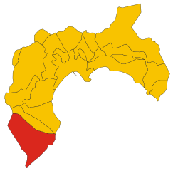
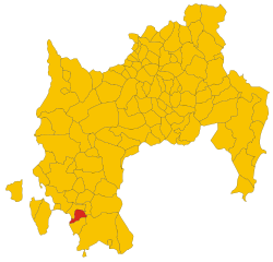
Теулада (Teulada, Sardinia, Teulada)
- коммуна Италии
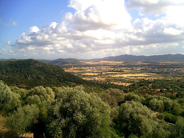
Teulada, located on the southern coast of Sardinia, Italy, is an excellent destination for hiking enthusiasts due to its stunning natural landscapes, diverse ecosystems, and rich cultural heritage. Here are some key points about hiking in the Teulada area:
Trails and Routes
-
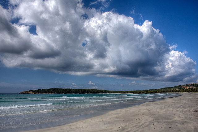
Coastal Trails: The coastline near Teulada features beautiful cliffs, sandy beaches, and hidden coves. Hiking along the coastal paths provides breathtaking views of the Mediterranean Sea, especially around popular spots like Cala de La Murta and Cala Agricola.
-
Natural Parks: The nearby Sulcis Regional Park offers a variety of trails that traverse different terrains, including forests, hills, and coastal scenery. The park is home to unique flora and fauna, making it great for nature lovers.
-
Mountain Trails: The nearby Monte Nieddu and Monte Aidu present more challenging hikes that reward with spectacular panoramic views of the surrounding region, including the Gulf of Teulada and the nearby hills.
-
Historical Routes: Some trails lead to archaeological sites, where you can explore ancient ruins and structures, adding a cultural aspect to your hiking experience.
Flora and Fauna
- The region is rich in biodiversity, with Mediterranean macchia, oak forests, and various endemic species. Keep an eye out for local wildlife, including birds, reptiles, and small mammals.
Tips for Hiking in Teulada
- Best Time to Hike: The ideal seasons for hiking are spring (April to June) and autumn (September to October) when temperatures are mild and the landscapes are vibrant.
- Preparation: Always check the weather forecast, wear appropriate hiking gear, and bring sufficient water and snacks. Some trails can be remote, so it's wise to have a map or GPS device on hand.
- Respect Nature: Follow Leave No Trace principles to preserve the natural beauty of the area. Stay on marked trails and avoid disturbing wildlife.
Local Amenities
- Teulada has basic amenities, including accommodations, restaurants, and shops. It can serve as a good base for accessing various hiking trails and exploring the surrounding areas.
Hiking in Teulada offers a fantastic opportunity to enjoy Sardinia's natural beauty, making it a rewarding experience for outdoor enthusiasts. Whether you are a beginner or an experienced hiker, there are options available to suit your skill level. Enjoy your hike!
- Страна:

- Почтовый код: 09019
- Телефонный код: 070
- Код автомобильного номера: SU
- Координаты: 38° 58' 5" N, 8° 46' 20" E


- GPS треки (wikiloc): [Ссылка]
- Высота над уровнем моря: 50 м m
- Площадь: 246.19 кв.км
- Население: 3559
- Веб сайт: http://www.comune.teulada.ca.it
- Википедия русская: wiki(ru)
- Википедия английская: wiki(en)
- Википедия национальная: wiki(it)
- Хранилище Wikidata: Wikidata: Q285414
- Галерея изображений в википедии: [Ссылка]
- Катеория в википедии: [Ссылка]
- код Freebase: [/m/0gqygk]
- код Freebase: [/m/0gqygk]
- код GeoNames: Альт: [6539311]
- код GeoNames: Альт: [6539311]
- код VIAF: Альт: [125470833]
- код VIAF: Альт: [125470833]
- ID отношения в OpenStreetMap: [39736]
- ID отношения в OpenStreetMap: [39736]
- код GND: Альт: [4683500-3]
- код GND: Альт: [4683500-3]
- код LCNAF: Альт: [n78060060]
- код LCNAF: Альт: [n78060060]
- код ISTAT: 111089
- код ISTAT: 111089
- кадастровый код Италии: L154
- кадастровый код Италии: L154
Граничит с регионами:


Домус-де-Мария
- коммуна Италии
Domus de Maria, located in the southern part of Sardinia, Italy, is a stunning area known for its beautiful landscapes, pristine beaches, and rich cultural history. It offers a variety of hiking opportunities that cater to different skill levels, making it a great destination for nature lovers and outdoor enthusiasts....
- Страна:

- Почтовый код: 09010
- Телефонный код: 070
- Код автомобильного номера: SU
- Координаты: 38° 56' 37" N, 8° 51' 46" E


- GPS треки (wikiloc): [Ссылка]
- Высота над уровнем моря: 66 м m
- Площадь: 97.14 кв.км
- Население: 1663
- Веб сайт: [Ссылка]


Пула
- коммуна Италии
Pula, located on the southwestern coast of Sardinia, is a beautiful destination for hiking enthusiasts. The area is known for its stunning coastal landscapes, crystal-clear waters, and rich history. Here are some highlights and tips for hiking in and around Pula:...
- Страна:

- Почтовый код: 09010
- Телефонный код: 070
- Код автомобильного номера: CA
- Координаты: 39° 0' 34" N, 9° 0' 2" E


- GPS треки (wikiloc): [Ссылка]
- Высота над уровнем моря: 10 м m
- Площадь: 138.92 кв.км
- Население: 7338
- Веб сайт: [Ссылка]


Мазайнас
- коммуна Италии
Masainas is a small town located in the Sardinia region of Italy. While it's not as widely known as some other hiking destinations in Italy, it is situated near beautiful coastal areas and natural parks, making it a lovely place for hiking enthusiasts looking for less crowded trails....
- Страна:

- Почтовый код: 09010
- Телефонный код: 0781
- Код автомобильного номера: SU
- Координаты: 39° 2' 47" N, 8° 37' 53" E


- GPS треки (wikiloc): [Ссылка]
- Высота над уровнем моря: 57 м m
- Площадь: 23.69 кв.км
- Население: 1288
- Веб сайт: [Ссылка]


Пишинас
- коммуна Италии
Hiking in Piscinas, located in the beautiful region of Sardinia, Italy, offers a unique blend of breathtaking landscapes, rich history, and diverse wildlife. The area is renowned for its stunning natural beauty, particularly its mountainous terrain, green hills, and picturesque beaches....
- Страна:

- Почтовый код: 09010
- Телефонный код: 0781
- Код автомобильного номера: SU
- Координаты: 39° 4' 28" N, 8° 39' 58" E


- GPS треки (wikiloc): [Ссылка]
- Высота над уровнем моря: 66 м m
- Площадь: 16.89 кв.км
- Население: 860
- Веб сайт: [Ссылка]


Сантади
- коммуна Италии
Santadi is a charming town located in Sardinia, Italy, known for its stunning landscapes and proximity to various hiking trails. The area around Santadi features a mix of natural beauty, historical sites, and cultural experiences, making it an excellent location for hiking enthusiasts....
- Страна:

- Почтовый код: 09010
- Телефонный код: 0781
- Код автомобильного номера: SU
- Координаты: 39° 5' 37" N, 8° 42' 54" E


- GPS треки (wikiloc): [Ссылка]
- Высота над уровнем моря: 135 м m
- Площадь: 116.49 кв.км
- Население: 3385
- Веб сайт: [Ссылка]


Сант'Анна-Аррези
- коммуна Италии
Sant'Anna Arresi is a charming village located in Sardinia, Italy, known for its picturesque landscapes, Mediterranean climate, and a mix of coastal and mountainous terrain. Hiking in and around Sant'Anna Arresi offers opportunities to explore stunning natural beauty, cultural heritage, and diverse ecosystems....
- Страна:

- Почтовый код: 09010
- Телефонный код: 0781
- Код автомобильного номера: SU
- Координаты: 39° 0' 14" N, 8° 38' 37" E


- GPS треки (wikiloc): [Ссылка]
- Высота над уровнем моря: 77 м m
- Площадь: 36.68 кв.км
- Население: 2739
- Веб сайт: [Ссылка]

