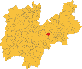
Торченьйо (Torcegno, Torcegno)
%202018.svg)
- коммуна Италии
 Hiking in Торченьйо
Torcegno is a charming village located in the Trentino region of northern Italy, nestled in the heart of the Italian Alps. The region is known for its stunning natural landscapes, lush forests, and scenic mountain trails that are perfect for hiking enthusiasts.
Hiking Trails
-
Sentiero dei Bisiac: This trail is a favorite among hikers for its combination of natural beauty and cultural history. It offers views of the surrounding valleys and a chance to learn about local flora and fauna.
-
Cima di Campo: A more challenging hike that rewards adventurers with panoramic views of the surrounding mountains. This trail is suitable for experienced hikers and typically takes a few hours to complete.
-
The Monte Avena Circuit: This trail offers a mix of forest paths and open meadows, making it a great option for families and casual hikers. The trail provides beautiful views of the surrounding alpine landscape.
Best Time to Hike
The best time to hike in Torcegno is during late spring to early autumn (May to October) when the weather is mild, and the trails are usually dry and accessible. Summer months may bring more hikers, while early autumn offers stunning fall foliage.
Important Tips
- Equipment: Make sure to wear sturdy hiking boots and bring a good backpack with water, snacks, and a first aid kit.
- Navigation: It's advisable to carry a map or GPS device, as some trails may not be well-marked.
- Weather: Check the weather forecast before your hike, as conditions can change rapidly in the mountains.
- Respect Nature: Stay on marked trails, pack out what you pack in, and be mindful of wildlife.
Local Culture
Hiking in Torcegno also offers an opportunity to experience the local culture. Consider visiting traditional alpine huts (rifugi) along the way, where you can enjoy local Trentino cuisine and hospitality.
Whether you're seeking a leisurely nature walk or a challenging mountain ascent, Torcegno provides a beautiful backdrop for outdoor adventures.
- Страна:

- Почтовый код: 38050
- Телефонный код: 0461
- Код автомобильного номера: TN
- Координаты: 46° 4' 0" N, 11° 27' 0" E


- GPS треки (wikiloc): [Ссылка]
- Высота над уровнем моря: 769 м m
- Площадь: 15.19 кв.км
- Население: 691
- Веб сайт: http://www.comune.torcegno.tn.it
- Википедия русская: wiki(ru)
- Википедия английская: wiki(en)
- Википедия национальная: wiki(it)
- Хранилище Wikidata: Wikidata: Q327341
- Катеория в википедии: [Ссылка]
- код Freebase: [/m/0gb14m]
- код GeoNames: Альт: [6542694]
- код VIAF: Альт: [248281050]
- ID отношения в OpenStreetMap: [46818]
- код ISTAT: 022202
- кадастровый код Италии: L211
Граничит с регионами:


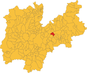
Борго-Вальсугана
- коммуна Италии
Hiking in Борго-Вальсугана
Borgo Valsugana, located in the Trentino region of northern Italy, is a picturesque area known for its stunning landscapes, rich history, and outdoor activities, making it a fantastic destination for hiking enthusiasts. The region features a mix of valleys, rivers, and mountains, providing a diverse range of trails suitable for all levels of hikers....
- Страна:
- Почтовый код: 38051
- Телефонный код: 0461
- Код автомобильного номера: TN
- Координаты: 46° 3' 0" N, 11° 27' 0" E
- GPS треки (wikiloc): [Ссылка]
- Высота над уровнем моря: 386 м m
- Площадь: 52.37 кв.км
- Население: 6949
- Веб сайт: [Ссылка]

Фиероццо
- коммуна Италии
Hiking in Фиероццо
Fierozzo is a picturesque village located in the Trentino-Alto Adige region of northern Italy, known for its beautiful landscapes and outdoor activities, including hiking. Nestled in the foothills of the Alps, Fierozzo provides access to numerous trails that vary in difficulty, catering to both beginners and experienced hikers....
- Страна:
- Почтовый код: 38050
- Телефонный код: 0461
- Код автомобильного номера: TN
- Координаты: 46° 7' 0" N, 11° 19' 0" E
- GPS треки (wikiloc): [Ссылка]
- Высота над уровнем моря: 1127 м m
- Площадь: 17.94 кв.км
- Население: 478
- Веб сайт: [Ссылка]

Палу-дель-Ферсина
- коммуна в регионе Трентино — Альто-Адидже, Италия
Hiking in Палу-дель-Ферсина
Palù del Fersina, located in the Trentino region of northern Italy, is a beautiful area known for its stunning natural landscapes, rich biodiversity, and charming mountain villages. Here are some highlights and tips for hiking in this area:...
- Страна:
- Почтовый код: 38050
- Телефонный код: 0461
- Код автомобильного номера: TN
- Координаты: 46° 8' 0" N, 11° 21' 0" E
- GPS треки (wikiloc): [Ссылка]
- Высота над уровнем моря: 1360 м m
- Площадь: 16.65 кв.км
- Население: 168
- Веб сайт: [Ссылка]


Ронченьо-Терме
- коммуна Италии
Hiking in Ронченьо-Терме
Roncegno Terme, located in the Trentino region of northern Italy, is a beautiful destination for hiking enthusiasts. Nestled in the scenic Valsugana valley, the area boasts stunning landscapes, rich biodiversity, and a mild climate, making it an appealing spot for outdoor activities year-round....
- Страна:
- Почтовый код: 38050
- Телефонный код: 0461
- Код автомобильного номера: TN
- Координаты: 46° 3' 3" N, 11° 24' 36" E
- GPS треки (wikiloc): [Ссылка]
- Высота над уровнем моря: 535 м m
- Площадь: 38.08 кв.км
- Население: 2906
- Веб сайт: [Ссылка]
Ронки-Вальсугана
- коммуна Италии
Hiking in Ронки-Вальсугана
Ronchi Valsugana, located in the Trentino region of northern Italy, is a beautiful area that offers a variety of hiking trails amidst stunning natural landscapes. The region is characterized by its picturesque valleys, rolling hills, and the backdrop of the Dolomite mountains. Here’s what you need to know for hiking in Ronchi Valsugana:...
- Страна:
- Почтовый код: 38051
- Телефонный код: 0461
- Код автомобильного номера: TN
- Координаты: 46° 4' 0" N, 11° 26' 0" E
- GPS треки (wikiloc): [Ссылка]
- Высота над уровнем моря: 776 м m
- Площадь: 10 кв.км
- Население: 434
- Веб сайт: [Ссылка]
Тельве-ди-Сопра
- коммуна Италии
Hiking in Тельве-ди-Сопра
Telve di Sopra is a charming village located in the Trentino region of northern Italy, surrounded by the picturesque landscape of the Italian Alps. Hiking in this area offers stunning views, diverse trails, and opportunities to explore the natural beauty and local culture....
- Страна:
- Почтовый код: 38050
- Телефонный код: 0461
- Код автомобильного номера: TN
- Координаты: 46° 4' 0" N, 11° 28' 0" E
- GPS треки (wikiloc): [Ссылка]
- Высота над уровнем моря: 650 м m
- Площадь: 17.72 кв.км
- Население: 595
- Веб сайт: [Ссылка]