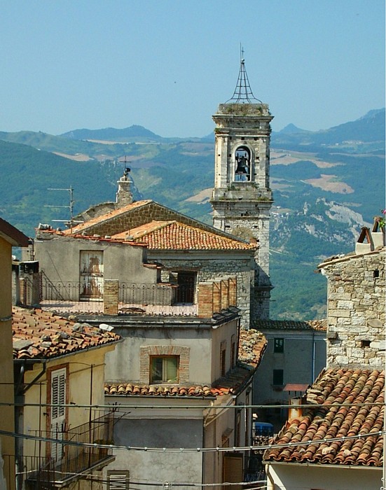
Торнареччо (Tornareccio, Tornareccio)
.svg)
- коммуна Италии
 Hiking in Торнареччо
Tornareccio, a charming village located in the Abruzzo region of Italy, is surrounded by stunning natural landscapes that are perfect for hiking enthusiasts. The area is characterized by rolling hills, scenic valleys, and rugged mountain terrain, making it an excellent destination for both casual walkers and more experienced hikers.
Hiking Trails in Tornareccio
-
Monte Amaro and Majella National Park: Just a short distance from Tornareccio, the Majella National Park offers numerous trails with varying levels of difficulty. The hike to Monte Amaro, the second highest peak in the Apennines, is particularly popular, offering breathtaking views of the surrounding mountains and valleys.
-
Valle della Tirino: This beautiful valley features trails that wind alongside the Tirino River, known for its crystal clear waters. The area is rich in biodiversity and provides a relaxing hiking experience. Look out for opportunities for birdwatching and enjoying local flora.
-
Gole di Sahara: A short drive from Tornareccio will lead you to this impressive gorge. The trails here offer a mix of easy walks and more challenging paths, with stunning rock formations and unique landscapes.
-
Civitalupia Trail: A moderate hike that takes you through the countryside, offering excellent views of the surrounding hills and access to local historical sites along the way.
Tips for Hiking in Tornareccio
-
Best Time to Hike: Spring (April to June) and fall (September to October) are ideal due to mild weather and blooming nature. Summer months can be hot, while winter may bring snow to higher elevations.
-
Preparation: Always check the weather before heading out, dress in layers, wear sturdy hiking boots, and bring enough water and snacks. A map or GPS device can be very helpful.
-
Local Guides: If you're unfamiliar with the area or prefer structured hikes, consider hiring a local guide. They can provide insights into the local flora and fauna, as well as historical context.
-
Respect Nature: Follow Leave No Trace principles. Stick to marked trails, pack out what you pack in, and respect wildlife and local regulations.
Additional Activities
Beyond hiking, Tornareccio offers cultural experiences and the chance to enjoy local cuisine. Don’t miss trying local dishes and exploring the village, famous for its tasty traditional foods, especially that of cured meats.
Overall, Tornareccio is a fantastic hiking destination that combines natural beauty with cultural richness, making it suitable for both outdoor adventurers and those interested in Italian heritage.
- Страна:

- Почтовый код: 66046
- Телефонный код: 0872
- Код автомобильного номера: CH
- Координаты: 42° 2' 0" N, 14° 25' 0" E


- GPS треки (wikiloc): [Ссылка]
- Высота над уровнем моря: 630 м m
- Площадь: 27.53 кв.км
- Население: 1784
- Веб сайт: http://www.comuneditornareccio.it/
- Википедия русская: wiki(ru)
- Википедия английская: wiki(en)
- Википедия национальная: wiki(it)
- Хранилище Wikidata: Wikidata: Q51302
- Катеория в википедии: [Ссылка]
- код Freebase: [/m/0fg3v1]
- код GeoNames: Альт: [6541235]
- ID отношения в OpenStreetMap: [41723]
- UN/LOCODE: [ITTC4]
- код ISTAT: 069092
- кадастровый код Италии: L224
Граничит с регионами:


Арки
- коммуна Италии
Hiking in Арки
Archi is a charming small village located in the province of L'Aquila in the Abruzzo region of Italy. The area around Archi is known for its stunning natural scenery, making it a great destination for hiking enthusiasts....
- Страна:
- Почтовый код: 66044
- Телефонный код: 0872
- Код автомобильного номера: CH
- Координаты: 42° 5' 0" N, 14° 23' 0" E
- GPS треки (wikiloc): [Ссылка]
- Высота над уровнем моря: 492 м m
- Площадь: 28.54 кв.км
- Население: 2136
- Веб сайт: [Ссылка]


Атесса
- коммуна Италии
Hiking in Атесса
Atessa, located in the Abruzzo region of Italy, offers a range of hiking opportunities that showcase the area's beautiful landscapes, rich history, and cultural heritage. Here are some key points about hiking in Atessa:...
- Страна:
- Почтовый код: 66041
- Телефонный код: 0872
- Код автомобильного номера: CH
- Координаты: 42° 4' 0" N, 14° 27' 0" E
- GPS треки (wikiloc): [Ссылка]
- Высота над уровнем моря: 435 м m
- Площадь: 110.98 кв.км
- Население: 10580
- Веб сайт: [Ссылка]

Бомба
- коммуна Италии
Hiking in Бомба
Bomba is a charming small town located in the province of Chieti in the Abruzzo region of Italy. Nestled within the foothills of the Appennine mountains and surrounded by stunning natural landscapes, it offers a variety of hiking opportunities for both beginners and experienced hikers....
- Страна:
- Почтовый код: 66042
- Телефонный код: 0872
- Код автомобильного номера: CH
- Координаты: 42° 2' 0" N, 14° 22' 0" E
- GPS треки (wikiloc): [Ссылка]
- Высота над уровнем моря: 424 м m
- Площадь: 17.26 кв.км
- Население: 785
- Веб сайт: [Ссылка]


Карпинето-Синелло
- коммуна Италии
Hiking in Карпинето-Синелло
Carpineto Sinello, located in the Abruzzo region of Italy, is a charming destination for hiking enthusiasts, offering a mix of scenic views, rich natural landscapes, and cultural heritage. Here are some details about what you can expect when hiking in this area:...
- Страна:
- Почтовый код: 66030
- Телефонный код: 0872
- Код автомобильного номера: CH
- Координаты: 42° 1' 0" N, 14° 30' 0" E
- GPS треки (wikiloc): [Ссылка]
- Высота над уровнем моря: 381 м m
- Площадь: 29.85 кв.км
- Население: 574
- Веб сайт: [Ссылка]