Tourmont (Tourmont)

- коммуна во Франции
 Hiking in Tourmont
Tourmont, located in the southeastern part of France, is a picturesque area that offers a variety of hiking opportunities. Depending on the specific region you are interested in—rural landscapes, mountainous terrain, or coastal views—there are several trails to explore.
Highlights of Hiking in Tourmont:
-
Scenic Trails: Tourmont features diverse landscapes, including rolling hills, dense forests, and stunning views of nearby mountains or water bodies. Many trails are marked and well-maintained, providing an enjoyable hiking experience for all skill levels.
-
Wildlife and Flora: The region is home to a variety of wildlife, including birds, deer, and other animals. Hikers often report seeing beautiful wildflowers and unique plant species, especially during spring and early summer.
-
Access and Facilities: Most popular hiking areas in Tourmont offer facilities such as parking, rest areas, and information boards. Be sure to check local maps and guides for specific route details and trail conditions.
-
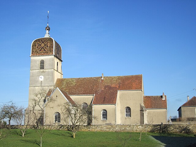
Cultural Sites: Along some trails, you may encounter historical landmarks, churches, or ruins that reflect the area's rich cultural heritage. This can add an interesting layer to your hiking experience.
-
Local Tips:
- Best Time to Hike: The best time for hiking is usually in the spring and fall, as the weather is mild and the scenery is at its most beautiful.
- Gear and Preparation: Wear sturdy hiking boots, carry plenty of water, and be prepared for changing weather conditions. Consider bringing a map or downloading a hiking app for navigation.
- Guided Tours: If you're unfamiliar with the area, consider joining a guided hike to learn more about the local ecology and history.
-
Safety: Always inform someone about your hiking plans, particularly if you're going on a less-traveled path. Carry a first-aid kit and know the basics of trail safety.
If you're considering hiking in Tourmont, it’s advisable to check local resources for up-to-date information on trail conditions, closures, and any area-specific regulations. Happy hiking!
- Страна:

- Почтовый код: 39800
- Координаты: 46° 51' 38" N, 5° 40' 56" E


- GPS треки (wikiloc): [Ссылка]
- Площадь: 9.73 кв.км
- Население: 472
- Википедия английская: wiki(en)
- Википедия национальная: wiki(fr)
- Хранилище Wikidata: Wikidata: Q1166655
- Катеория в википедии: [Ссылка]
- код Freebase: [/m/03nvvgw]
- код Freebase: [/m/03nvvgw]
- код GeoNames: Альт: [6433779]
- код GeoNames: Альт: [6433779]
- номер SIREN: [213905359]
- номер SIREN: [213905359]
- код BNF: [15258894j]
- код BNF: [15258894j]
- код тезауруса PACTOLS: [pcrt3Z4P8Ef63O]
- код тезауруса PACTOLS: [pcrt3Z4P8Ef63O]
- код муниципалитета INSEE: 39535
- код муниципалитета INSEE: 39535
Граничит с регионами:

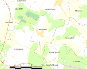
Brainans
- коммуна во Франции
Hiking in Brainans
Hiking in Brainans, a destination that is often associated with scenic landscapes and varied terrain, offers an inviting experience for outdoor enthusiasts. While it may not be as widely recognized as some other hiking destinations, the area's natural beauty can provide a rewarding hiking experience....
- Страна:
- Почтовый код: 39800
- Координаты: 46° 52' 14" N, 5° 37' 25" E
- GPS треки (wikiloc): [Ссылка]
- Площадь: 7.07 кв.км
- Население: 165


Saint-Lothain
- коммуна во Франции
Hiking in Saint-Lothain
Saint-Lothain is a small commune located in the Jura department of France, known for its beautiful landscapes, picturesque vineyards, and proximity to the Jura Mountains. It offers a range of outdoor activities, including hiking, that will appeal to nature enthusiasts and those looking to explore the local environment....
- Страна:
- Почтовый код: 39230
- Координаты: 46° 49' 32" N, 5° 38' 40" E
- GPS треки (wikiloc): [Ссылка]
- Площадь: 12.33 кв.км
- Население: 473


Villerserine
- коммуна во Франции
Hiking in Villerserine
Villerserine, located in the Jura mountains of France, is a less well-known but beautiful area for hiking. The Jura region is characterized by its stunning landscapes, rolling hills, lush forests, and panoramic views, making it a great destination for outdoor enthusiasts....
- Страна:
- Почтовый код: 39800
- Координаты: 46° 51' 28" N, 5° 38' 32" E
- GPS треки (wikiloc): [Ссылка]
- Площадь: 2.85 кв.км
- Население: 54

Montholier
- коммуна во Франции
Hiking in Montholier
Montholier is a charming destination that offers a variety of hiking options surrounded by its picturesque landscapes. The region is known for its natural beauty, with trails that cater to different skill levels, from easy walks to more challenging hikes....
- Страна:
- Почтовый код: 39800
- Координаты: 46° 53' 52" N, 5° 38' 51" E
- GPS треки (wikiloc): [Ссылка]
- Площадь: 7.99 кв.км
- Население: 348


Полиньи
Hiking in Полиньи
Poligny, located in the Jura region of France, is a charming town surrounded by beautiful natural landscapes which make it a fantastic destination for hiking enthusiasts. Here are some key points to know about hiking in this area:...
- Страна:
- Почтовый код: 39800
- Координаты: 46° 50' 10" N, 5° 42' 28" E
- GPS треки (wikiloc): [Ссылка]
- Площадь: 50.22 кв.км
- Население: 4104
- Веб сайт: [Ссылка]


Grozon
- коммуна во Франции
Hiking in Grozon
It seems you may be referring to "Grosmont" or perhaps a similar-sounding location as "Grozon" may not be widely recognized as a hiking destination. If you're thinking of Grosmont, which is a village in North Yorkshire, England, I can provide information on that or other well-known hiking spots....
- Страна:
- Почтовый код: 39800
- Координаты: 46° 53' 23" N, 5° 42' 3" E
- GPS треки (wikiloc): [Ссылка]
- Площадь: 14.25 кв.км
- Население: 436