
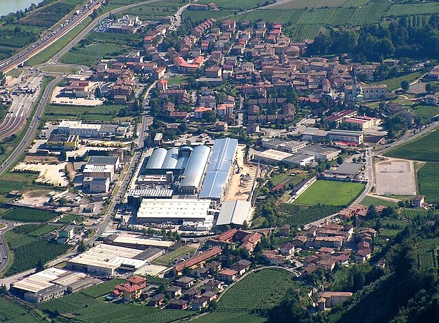
Тренто (Trento, Trento)

%202018.svg)
- коммуна Италии
 Hiking in Тренто
Hiking in Trento, a picturesque city in northern Italy, offers a remarkable blend of natural beauty, historical sites, and diverse trails suitable for all experience levels. Nestled in the Adige Valley and surrounded by the stunning Dolomites, Trento is an excellent base for both leisurely walks and more challenging hikes. Here are some highlights and popular hiking options in and around Trento:
1.
- Trail Types: Various trails ranging from easy to difficult.
- Overview: Just a short distance from Trento, Monte Bondone features numerous well-marked trails through lush forests and alpine meadows. The views from the summit are breathtaking, with panoramic vistas of the surrounding mountains and valleys. Popular routes include the “Sentiero della Vela” and trails leading to the peak.
2.
- Trail Types: Easy to moderate.
- Overview: This area is known for its beautiful lakes and scenic views. There’s a lovely circular walk around the lakes, allowing hikers to enjoy the serene environment. It is an excellent spot for families and those looking for a relaxing hike with picnic opportunities.
3.
- Trail Types: Various options available.
- Overview: Located nearby, this valley offers several hiking opportunities through stunning landscapes, with trails that range from easy walks to more strenuous routes. The valley is also steeped in history and features charming villages worth exploring.
4.
- Trail Types: Moderate.
- Overview: An interesting hike that takes you through a gorge with fascinating rock formations and waterfalls. This trail offers a unique natural experience, with opportunities to see local wildlife and plants.
5.
- Trail Types: Moderate to hard.
- Overview: A bit further afield, but easily accessible, Paganella offers challenging hikes with rewarding views. The area is part of the Brenta Dolomites and provides various routes, including some that lead to the summit of Paganella itself.
Tips for Hiking in Trento:
- Season: The best time for hiking is typically late spring through early autumn (May to October). However, specific trails may be accessible in winter for snowshoeing or winter hiking.
- Equipment: Wear sturdy hiking boots and dress in layers. Always bring a map, water, snacks, and a first-aid kit.
- Local Regulations: Respect nature and local regulations, especially in protected areas.
- Guided Hikes: If you prefer a guided experience, consider joining a local hiking group or hiring a local guide who can provide insights into the flora, fauna, and cultural heritage of the region.
Trento’s hiking trails offer a perfect blend of natural beauty and cultural experiences, making it a fantastic destination for hikers of all levels. Enjoy your hikes and take in the breathtaking scenery of this Alpine region!
- Страна:

- Почтовый код: 38123; 38122; 38121
- Телефонный код: 0461
- Код автомобильного номера: TN
- Координаты: 46° 4' 0" N, 11° 7' 0" E


- GPS треки (wikiloc): [Ссылка]
- Высота над уровнем моря: 190 м m
- Площадь: 157.88 кв.км
- Население: 117185
- Веб сайт: http://www.comune.trento.it
- Википедия русская: wiki(ru)
- Википедия английская: wiki(en)
- Википедия национальная: wiki(it)
- Хранилище Wikidata: Wikidata: Q3376
- Галерея изображений в википедии: [Ссылка]
- Катеория в википедии: [Ссылка]
- код Freebase: [/m/0cfrs]
- код GeoNames: Альт: [6541469]
- код BNF: [11957722t]
- код VIAF: Альт: [140709218]
- ID отношения в OpenStreetMap: [46663]
- код GND: Альт: [4078405-8]
- идентификатор местоположения ArchINFORM: [7793]
- код LCNAF: Альт: [n79100752]
- код тезауруса PACTOLS: [pcrt5SLvyZ1ti5]
- место в MusicBrainz: [b3111efb-088f-40a1-8885-179114cfb4f0]
- WOEID: [12676608]
- код темы Quora: [Trento-Italy]
- UN/LOCODE: [ITTRT]
- код в энциклопедии «Британника онлайн»: [place/Trento-Italy]
- EMLO location ID: [7c42293a-790e-4a88-9888-2654e4163fa0]
- код места в Facebook: [110085715688081]
- код NLI: [000976646]
- код в Итальянской энциклопедии онлайн: [trento]
- код ISTAT: 022205
- кадастровый код Италии: L378
- код US National Archives: 10044696
Граничит с регионами:
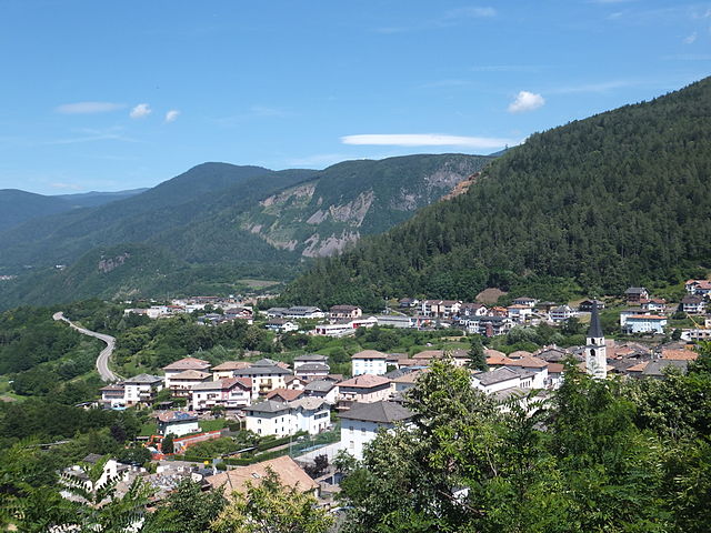

Альбьяно
- коммуна Италии
Hiking in Альбьяно
Albiano is a charming area located in the province of Trento, in the northern part of Italy. Surrounded by beautiful landscapes, it offers various hiking trails suitable for different skill levels. Here are some aspects of hiking in Albiano:...
- Страна:
- Почтовый код: 38041
- Телефонный код: 0461
- Код автомобильного номера: TN
- Координаты: 46° 8' 40" N, 11° 11' 41" E
- GPS треки (wikiloc): [Ссылка]
- Высота над уровнем моря: 644 м m
- Площадь: 9.96 кв.км
- Население: 1473
- Веб сайт: [Ссылка]
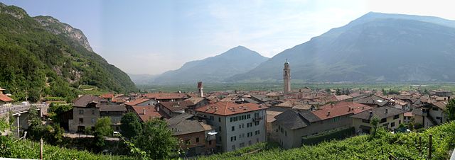

Альдено
- коммуна Италии
Hiking in Альдено
Aldeno is a charming village located in the Trentino region of northern Italy, nestled near the foothills of the Alps. It offers a variety of hiking options suitable for different skill levels, with beautiful landscapes, historical sites, and natural beauty....
- Страна:
- Почтовый код: 38060
- Телефонный код: 0461
- Код автомобильного номера: TN
- Координаты: 45° 59' 0" N, 11° 5' 0" E
- GPS треки (wikiloc): [Ссылка]
- Высота над уровнем моря: 200 м m
- Площадь: 8.97 кв.км
- Население: 3133
- Веб сайт: [Ссылка]


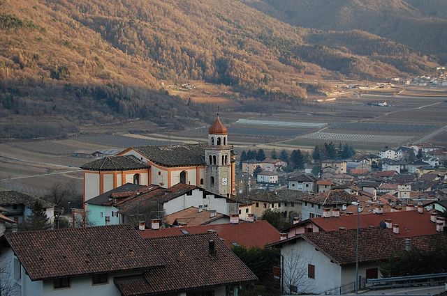
Безенелло
- коммуна Италии
Hiking in Безенелло
Besenello is a picturesque village located in the Trentino region of northern Italy, surrounded by beautiful landscapes and offering various hiking opportunities for outdoor enthusiasts. Here are some aspects to consider when planning a hiking experience in Besenello:...
- Страна:
- Почтовый код: 38060
- Телефонный код: 0464
- Код автомобильного номера: TN
- Координаты: 45° 56' 31" N, 11° 6' 31" E
- GPS треки (wikiloc): [Ссылка]
- Высота над уровнем моря: 218 м m
- Площадь: 25.94 кв.км
- Население: 2663
- Веб сайт: [Ссылка]

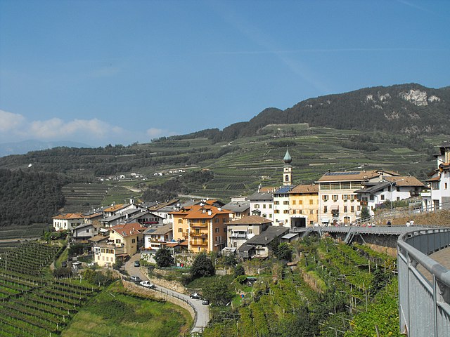
Каведине
- коммуна Италии
Hiking in Каведине
Cavedine, located in Trentino, Italy, is a picturesque area that offers a unique blend of natural beauty and outdoor activities, making it a great destination for hiking enthusiasts. Here are some key highlights about hiking in the Cavedine region:...
- Страна:
- Почтовый код: 38073
- Телефонный код: 0461
- Код автомобильного номера: TN
- Координаты: 46° 0' 0" N, 10° 58' 0" E
- GPS треки (wikiloc): [Ссылка]
- Высота над уровнем моря: 504 м m
- Площадь: 38.23 кв.км
- Население: 2952
- Веб сайт: [Ссылка]
Чимоне
- коммуна Италии
Hiking in Чимоне
Cimone, officially known as Monte Cimone, is the highest peak in the Northern Apennines of Italy, standing at 2,165 meters (7,103 feet). It is located in the Emilia-Romagna region, near the town of Sestola, and offers a variety of hiking opportunities that cater to different skill levels....
- Страна:
- Почтовый код: 38060
- Телефонный код: 0461
- Код автомобильного номера: TN
- Координаты: 45° 59' 3" N, 11° 4' 18" E
- GPS треки (wikiloc): [Ссылка]
- Высота над уровнем моря: 540 м m
- Площадь: 9.81 кв.км
- Население: 700
- Веб сайт: [Ссылка]


Чивеццано
- коммуна Италии
Hiking in Чивеццано
Civezzano is a picturesque village located in the Trentino region of northern Italy, surrounded by the stunning landscapes of the Alps. Hiking in and around Civezzano offers a range of trails suitable for various skill levels, allowing you to immerse yourself in the natural beauty of the area. Here are some highlights and tips for hiking in Civezzano:...
- Страна:
- Почтовый код: 38045
- Телефонный код: 0461
- Код автомобильного номера: TN
- Координаты: 46° 5' 0" N, 11° 10' 0" E
- GPS треки (wikiloc): [Ссылка]
- Высота над уровнем моря: 469 м m
- Площадь: 15.67 кв.км
- Население: 4025
- Веб сайт: [Ссылка]
Гарнига-Терме
- коммуна Италии
Hiking in Гарнига-Терме
Garniga Terme is a small village located in the Trentino-Alto Adige/Südtirol region of northern Italy, known for its natural beauty and thermal springs. Hiking in this area can be a rewarding experience, offering beautiful landscapes, lush forests, and serene mountain views. Here are some highlights and suggestions for hiking in and around Garniga Terme:...
- Страна:
- Почтовый код: 38060
- Телефонный код: 0461
- Код автомобильного номера: TN
- Координаты: 46° 0' 50" N, 11° 5' 1" E
- GPS треки (wikiloc): [Ссылка]
- Высота над уровнем моря: 810 м m
- Площадь: 13.13 кв.км
- Население: 375
- Веб сайт: [Ссылка]

Джово
- коммуна Италии
Hiking in Джово
Giovo, located in the Trentino region of northern Italy, offers a variety of hiking opportunities that showcase the stunning natural beauty of the area. The terrain is characterized by picturesque landscapes, including rolling hills, lush forests, and views of the surrounding mountains, making it an appealing destination for both novice and experienced hikers....
- Страна:
- Почтовый код: 38030
- Телефонный код: 0461
- Код автомобильного номера: TN
- Координаты: 46° 9' 21" N, 11° 9' 10" E
- GPS треки (wikiloc): [Ссылка]
- Высота над уровнем моря: 495 м m
- Площадь: 20.81 кв.км
- Население: 2521
- Веб сайт: [Ссылка]
Лавис
- коммуна Италии
Hiking in Лавис
Lavis is located in the Trentino-Alto Adige region of northern Italy, surrounded by stunning landscapes, including the impressive Dolomites. Hiking in Lavis offers a fantastic mix of serene nature, rich history, and beautiful views....
- Страна:
- Почтовый код: 38015
- Телефонный код: 0461
- Код автомобильного номера: TN
- Координаты: 46° 8' 0" N, 11° 7' 0" E
- GPS треки (wikiloc): [Ссылка]
- Высота над уровнем моря: 235 м m
- Площадь: 12.18 кв.км
- Население: 8969
- Веб сайт: [Ссылка]


Перджине-Вальсугана
- коммуна Италии
Hiking in Перджине-Вальсугана
Pergine Valsugana, located in the Trentino region of northern Italy, is a fantastic destination for hiking enthusiasts. Nestled between the beautiful mountains and the serene lakes, the area offers a variety of trails that cater to all skill levels—from leisurely walks to challenging hikes....
- Страна:
- Почтовый код: 38057
- Телефонный код: 0461
- Код автомобильного номера: TN
- Координаты: 46° 4' 0" N, 11° 14' 0" E
- GPS треки (wikiloc): [Ссылка]
- Высота над уровнем моря: 490 м m
- Площадь: 54.33 кв.км
- Население: 21384
- Веб сайт: [Ссылка]

Вилла-Лагарина
- коммуна Италии
Hiking in Вилла-Лагарина
Villa Lagarina is a charming village located in the Trentino region of northern Italy. Nestled at the edge of the Adige Valley and surrounded by stunning mountain landscapes, it offers a variety of hiking opportunities for all skill levels....
- Страна:
- Почтовый код: 38060
- Телефонный код: 0464
- Код автомобильного номера: TN
- Координаты: 45° 55' 0" N, 11° 2' 0" E
- GPS треки (wikiloc): [Ссылка]
- Высота над уровнем моря: 410 м m
- Площадь: 24.13 кв.км
- Население: 3823
- Веб сайт: [Ссылка]