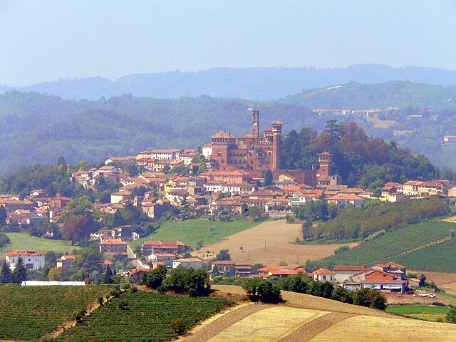
Тревилле (Treville, Treville)
- коммуна в регионе Пьемонт, Италия
 Hiking in Тревилле
Treville, while not as widely known as some other hiking destinations, offers scenic trails that showcase beautiful landscapes and local natural features. Here are some key points that can help you enjoy your hiking experience in Treville:
Trail Options
- Local Trails: Look for well-marked local trails that vary in difficulty. Easy trails are great for beginners or families, while challenging routes cater to more experienced hikers.
- Nature Paths: Many paths may lead through diverse ecosystems, allowing hikers to experience local flora and fauna. Keep an eye out for wildlife and unique plant species.
Best Season for Hiking
- Spring and Fall: These seasons generally offer the most pleasant weather for hiking, with mild temperatures and beautiful landscapes.
- Summer: Expect warmer temperatures; plan hikes for early morning or later in the evening to avoid the heat.
- Winter: If trails are open and accessible, winter hiking can be magical with snow-covered landscapes, but ensure proper gear and safety measures.
Preparation Tips
- Gear: Wear appropriate hiking boots and dress in layers to adjust to changing temperatures.
- Hydration: Always carry enough water, particularly during warmer months.
- Navigation: Bring a map or GPS device, especially if you’re exploring less-marked trails.
- Emergency Kit: It's wise to carry a basic first-aid kit and a whistle in case of emergencies.
Leave No Trace
- Practice responsible hiking by following Leave No Trace principles: pack out what you pack in, stay on designated trails, and respect wildlife.
Local Regulations
- Always check for any permits or regulations specific to the area you are hiking in, as some trails may have specific guidelines to follow.
If you can provide more specific details about Treville, such as its geographical location or particular trails you are interested in, I’d be happy to offer more tailored information! Happy hiking!
- Страна:

- Почтовый код: 15030
- Телефонный код: 0142
- Код автомобильного номера: AL
- Координаты: 45° 5' 52" N, 8° 21' 38" E


- GPS треки (wikiloc): [Ссылка]
- Высота над уровнем моря: 300 м m
- Площадь: 4.6 кв.км
- Население: 287
- Веб сайт: http://www.comune.treville.al.it/
- Википедия русская: wiki(ru)
- Википедия английская: wiki(en)
- Википедия национальная: wiki(it)
- Хранилище Wikidata: Wikidata: Q17687
- Катеория в википедии: [Ссылка]
- код Freebase: [/m/0gbp9_]
- код GeoNames: Альт: [6542891]
- код VIAF: Альт: [304915885]
- ID отношения в OpenStreetMap: [44187]
- UN/LOCODE: [ITTYA]
- код ISTAT: 006175
- кадастровый код Италии: L403
Граничит с регионами:
Черезето
- коммуна в регионе Пьемонт, Италия
Hiking in Черезето
Cereseto is a small, picturesque village located in the province of Asti in the Piedmont region of Italy. The area is known for its beautiful landscapes, vineyards, and rolling hills, making it an excellent destination for hiking enthusiasts. Here are some key points to consider if you’re planning to hike in and around Cereseto:...
- Страна:
- Почтовый код: 15020
- Телефонный код: 0142
- Код автомобильного номера: AL
- Координаты: 45° 5' 13" N, 8° 19' 5" E
- GPS треки (wikiloc): [Ссылка]
- Высота над уровнем моря: 280 м m
- Площадь: 10.44 кв.км
- Население: 411
- Веб сайт: [Ссылка]

Оццано-Монферрато
- коммуна в регионе Пьемонт, Италия
Hiking in Оццано-Монферрато
Ozzano Monferrato is a charming village located in the Monferrato area of Italy’s Piedmont region. Known for its rolling hills, vineyards, and rich history, it offers various hiking opportunities that cater to different skill levels....
- Страна:
- Почтовый код: 15039
- Телефонный код: 0142
- Код автомобильного номера: AL
- Координаты: 45° 6' 33" N, 8° 22' 23" E
- GPS треки (wikiloc): [Ссылка]
- Высота над уровнем моря: 246 м m
- Площадь: 15.18 кв.км
- Население: 1419
- Веб сайт: [Ссылка]

Сала-Монферрато
- коммуна в регионе Пьемонт, Италия
Hiking in Сала-Монферрато
Sala Monferrato is a charming town located in the Monferrato region of Piedmont, Italy. It offers a beautiful landscape with rolling hills, vineyards, and scenic views, making it a great destination for hiking enthusiasts. Here are some highlights and tips for hiking in the area:...
- Страна:
- Почтовый код: 15030
- Телефонный код: 0142
- Код автомобильного номера: AL
- Координаты: 45° 4' 34" N, 8° 21' 35" E
- GPS треки (wikiloc): [Ссылка]
- Высота над уровнем моря: 264 м m
- Площадь: 7.58 кв.км
- Население: 341
- Веб сайт: [Ссылка]